
Temps are already dropping- Yesterday was in the low eighties, right now its reaching the thirties and there's the possibility of snow around 2I was interested to see that as well. I wonder if it'll be the temperature differential driving that? Some places are supposed to drop ~40 degrees between Sunday and Monday, so the cold front has to be pretty aggressive. I guess similar to the Indiana event, any cell that gets out ahead and locks in the warm sector could get up to something?
Navigation
Install the app
How to install the app on iOS
Follow along with the video below to see how to install our site as a web app on your home screen.
Note: This feature may not be available in some browsers.
More options
-
Welcome to TalkWeather! We see you lurking around TalkWeather! Take the extra step and join us today to view attachments, see less ads and maybe even join the discussion. CLICK TO JOIN TALKWEATHER
You are using an out of date browser. It may not display this or other websites correctly.
You should upgrade or use an alternative browser.
You should upgrade or use an alternative browser.
Severe Weather 3/15 - 3/16
- Thread starter CheeselandSkies
- Start date
bckhd2
Member
With that type of trough it won't take a lot of moisture to start causing problems, and I feel like models always underestimate the amount of moisture coming off the Gulf, even in early spring setups.
tennessee storm chaser
Member
- Messages
- 1,877
- Reaction score
- 4,288
- Location
- jackson tennessee
- Special Affiliations
- SKYWARN® Volunteer
Yeah. That trough has big time trouble written allWith that type of trough it won't take a lot of moisture to start causing problems, and I feel like models always underestimate the amount of moisture coming off the Gulf, even in early spring setups.
Over .if moisture is slightly even underdone . This setup could produce even violent tornadoes ️ fear
Kds86z
Member
SPC doesn’t mention supercells Sunday, too early? Just said hail/wind.
WeathermanLeprechaun
Member
Too uncertain atm but the synoptic picture says plenty for this system. It may be trouble or the limits of March will hold it back.SPC doesn’t mention supercells Sunday, too early? Just said hail/wind.
tennessee storm chaser
Member
- Messages
- 1,877
- Reaction score
- 4,288
- Location
- jackson tennessee
- Special Affiliations
- SKYWARN® Volunteer
Things hold together even close to what’s gotSPC doesn’t mention supercells Sunday, too early? Just said hail/wind.
Model 6z. SPC going step it up big time wording
For anyone wondering how to get "Effective Layer STP" back on their Dupage soundings, just change weather type from Winter to Severe and then click "Generate New Sounding."

Also CIPs has uptrended again, but in a totally different area. And the SCP has made a noticeable uptick on the 12z GFS run

Also CIPs has uptrended again, but in a totally different area. And the SCP has made a noticeable uptick on the 12z GFS run
bckhd2
Member
Yeah, hail/wind right now. They did mention an uncertain conditional risk of supercells in the warm sector on Monday, but it read like they're still expecting a primarily QLCS threat oriented along the cold front there too.SPC doesn’t mention supercells Sunday, too early? Just said hail/wind.
Kds86z
Member
Well color me surprised, didn't know another event was coming down the pipeline lol.
Just checked the 500mb and I'll say wowzers lol. I see why this could be a big threat.
Yeah. SPC is gonna have to up wording going forward looking at the latest model guidance. Wouldn't be surprised to see them go Enhanced in tomorrow's Day 3 Outlook.
tennessee storm chaser
Member
- Messages
- 1,877
- Reaction score
- 4,288
- Location
- jackson tennessee
- Special Affiliations
- SKYWARN® Volunteer
Well spoke. . Fixing say thatYeah. SPC is gonna have to up wording going forward looking at the latest model guidance. Wouldn't be surprised to see them go Enhanced in tomorrow's Day 3 Outlook.
Agree. Synoptics are definitely on the higher end. I've seen them go D3 ENH for much less.Yeah. SPC is gonna have to up wording going forward looking at the latest model guidance. Wouldn't be surprised to see them go Enhanced in tomorrow's Day 3 Outlook.
tennessee storm chaser
Member
- Messages
- 1,877
- Reaction score
- 4,288
- Location
- jackson tennessee
- Special Affiliations
- SKYWARN® Volunteer
Reed trimmer early thinking he going start from Little Rock ton Memphis. Then go from there
- Thread starter
- #36
CheeselandSkies
Member
Ask him where he’s been lol.. no outlooks by him. Jk though
Personally I haven't minded the break. I still find his forecasts, especially the longer-range ones, to be somewhat overwrought. Again, I'm not saying he's bad at his job, just a difference of philosophies.
Jason Mills
Member
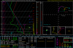
(Disclaimer: I'm looking at this from an Alabama/Mississippi perspective). A potential fly in the ointment I'm seeing from the 12z GFS is a pretty substantial warm nose/EML in the 800-600mb layer. By the time that layer cools through lifting, the LLJ is starting to eject northward and hodographs become significantly straighter. That warm layer is going to make it hard to sustain intense updrafts, at least in the afternoon/early evening hours while you have stronger diurnal heating.
The 06z Euro doesn't have as prominent of a warm layer and it depicts a prefrontal trough out ahead of the main cold front. That could spell trouble.
The 06z Euro doesn't have as prominent of a warm layer and it depicts a prefrontal trough out ahead of the main cold front. That could spell trouble.
Attachments
tennessee storm chaser
Member
- Messages
- 1,877
- Reaction score
- 4,288
- Location
- jackson tennessee
- Special Affiliations
- SKYWARN® Volunteer
Think the gfs is doing gfs things when it gets 4(Disclaimer: I'm looking at this from an Alabama/Mississippi perspective). A potential fly in the ointment I'm seeing from the 12z GFS is a pretty substantial warm nose/EML in the 800-600mb layer. By the time that layer cools through lifting, the LLJ is starting to eject northward and hodographs become significantly straighter. That warm layer is going to make it hard to sustain intense updrafts, at least in the afternoon/early evening hours while you have stronger diurnal heating.
The 06z Euro doesn't have as prominent of a warm layer and it depicts a prefrontal trough out ahead of the main cold front. That could spell trouble.
Days out …. Euro usually does better this timeframe unfortunately
Kds86z
Member
Well i understand. It was nice to get a tornado mod with multiple intense tornadoes mentioned and it not being him. No offensePersonally I haven't minded the break. I still find his forecasts, especially the longer-range ones, to be somewhat overwrought. Again, I'm not saying he's bad at his job, just a difference of philosophies.
- Thread starter
- #40
CheeselandSkies
Member
Notable, that GFS ensemble image in there appears to have slightly higher dewpoints than any individual op run I've seen over the last 24 hours or so. That's...ominous.