This early round isn't it but stuff should reinvorgate later on for the main tor threat. Orographic influence will play a big part I'm thinking and let's tag our fellow expert on that
@N0mz. Curious on your thoughts should any storms stretch these mountains?
I do see a possibly more favorable air mass with much warmer temperatures was shunted off to the SE.
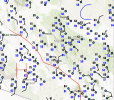
Possibly, this was caused by terrain not allowing a typical southeasterly mass response, allowing cooler air to remain over the risk area. This terrain effect is why you see the gap in violent tornadoes from SE KY through WV and W VA up to Maryland, as the Appalachians typically prevent any southeasterly mass response from improving surface conditions. Meanwhile, the opposite occurs around OH and W PA, where historically there have been a few more violent tornadoes (although many are from a single outbreak) because the very flat terrain in OH, N KY, and IN allows for improved Gulf moisture fetch, even though this area is a bit further north than WV.
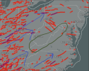
A couple of caveats: I am late to the party, so, as much as I try to avoid it, I am hindcasting a bit. Also, while there were warmer temperatures to the south, they had much larger t-d spreads, so they could have hurt more than they helped. There also wasn't a super consistent surface SE flow, although it may have been a little more evident at 925, as seen here.
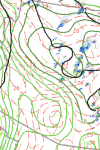
Finally, I'm not super knowledgeable about hailers in general, especially with terrain effects. Orographically stretching the meso might hurt hailers as it forces the meso out of its "natural" and probably most stable state, although I'm really just guessing.


