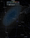
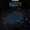
Uhhh what???
Someone is spoofing tornado reports, this ain't real. Have seen other erroneous reports from the same guy.
Follow along with the video below to see how to install our site as a web app on your home screen.
Note: This feature may not be available in some browsers.
Uhhh what???


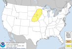
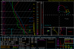

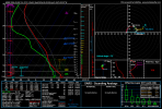
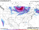
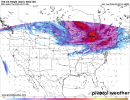
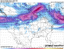
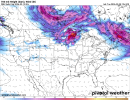

Thanks for the heads up! Today was totally not even on my radar! (Hehe)Yesterday verified superb in ND for photogenic tor potential as I had mentioned.
Today, a 2% is outlined around the Des Moines vicinity @Grand Poo Bah and while it's a low end setup, something can't be fully ruled out. 500mb flow is rather meager but a subtle 700mb shortwave should help to fire stuff in C IA today.
View attachment 54883View attachment 54884
A lot of dry air may cause more outflowy production and potentially damaging winds but heads up anyways!
TOMORROW
I know I've been up and down but I don't fully think that areas are out of the gun with a tornado risk tomorrow. W NY catches my eye. While instability will be paltry due to warmer mid levels as we've discussed but just enough instability combined with shear in excess of 300+ SRH could help any line segments strongly forced by the intense mid level jet. View attachment 54885View attachment 54886
The 11th was outlined as mentioned above by @ThatGuy;P. It seems that localized intense bout of shear evolves from this localized 50+ kt 700mb jet max that hits the cluster of sorts in this environment. The 500mb jet also hits this area bang on. While intense shear does exist, uncertainties about storm mode in this environment exist. All down south is a damaging wind/hail risk that may be more discrete in nature. View attachment 54887
Notice the lack of flow the further you go. Height falls are also generally poor too except for up in NE MN. this area catches my eye plenty. View attachment 54888
That 60+ kt peak may be convective influence but regardless, it's a interesting synoptic picture that favors one area in particular. Tornado risk absolutely exists, to what extent or how high is unknown atm.
storms in des moines area appear to be rapidly gaining strength.

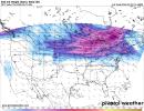 Well, another day, another discussion.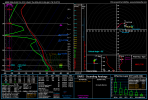
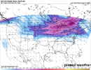
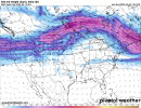
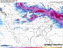
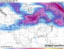

Just on the 14th:View attachment 54896Well, another day, another discussion.
TODAY
Nothing has really changed. Paltry thermodynamic profiles but low level shear should be enough for a tornado risk in E OH/NW PA/W NY. Our jet has changed quite a bit, not as intense anymore but seems to be sporadic bursts of forcing in the area, and as mentioned yesterday, 50+ kt 700s will help with that.
View attachment 54895
View attachment 54897
FRIDAY
Yeah. See that potential? It's kinda gone now. Shear profiles are nowhere as robust and moisture is a big issue. The difference is that you don't have any robust 500mb nose of sorts and that means no 700mb jet either. I mean it's there but it's not as strong not as correlated as yesterday'e runs. View attachment 54898
View attachment 54899
Take a look at yesterday's runs I posted and you'll see the difference.
The 14th
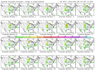
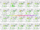
This is sorta out there as a signal but model guidance has been prominent on some troughing in IA/WI. View attachment 54900
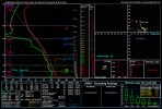
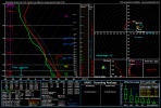
It's more akin to a strong shortwave but model guidance has suggested a good 700/850 mb overlap which increases rather intense shear profiles later on in the evening. Here's a sounding to demonstrate what we could be looking at but do not call for anything significant just yet. I know the shear is eyecatching but I need to see genuinely solid, thermos that would support a actual surface based supercell. Regardless, potential is there for a setup next week. StormNet has also had the most robust signal it's had in a good month or two for this one. Will watch this one.
For reference, I may only do these discussions for higher end/sigtor day potential. Unfortunately, I just don't feel like I'm consistent enough to do write ups for every single low end, watch out type day. So don't expect a lot from me but if I do post a discussion, you know what that means.
View attachment 54901
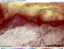
Yep, this is my general AOI for now. E to W boundaries are very finicky storm mode wise though. You need stuff to kinda fire near the front but not on the front so it can remain discrete for a bit. 5/6 and 3/10 are examples of days featuring this sort of boundary and they worked. Just need a discrete cell to fire right. Also the displaced 500/850 overlap is a instant fail mode to me. Broyles has spoke to me about a standard he likes when analysing for jets and you usually need around 40+ kt overlap at 850 combined with that same level at 500 if you want good lift and shear. Awaiting the 18Z GFS now.Just on the 14th:
One thing that jumps out to me is the E-W oriented boundary across Iowa. Although displaced from the best ingredients, which seem to be in N IL (surprise), if moisture improves (like on the euro perhaps), IA could be the area to watch. It is much closer to the somewhat displaced 500mb jet, as well as the 850mb jet earlier in the day, which does shift off towards Illinois into the evening. Lapse rates are also better in IA.
View attachment 54902