
- Moderator
- #3,081
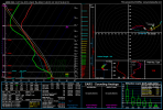
...MS/AL...
Widely scattered to scattered thunderstorms are expected to develop
near the cold front overnight -- most likely after 06Z -- with
marginal potential for a tornado, isolated damaging winds or severe
hail.
Despite the veered (southwesterly) surface flow ahead of the front,
a 40-50-kt west-southwesterly LLJ should contribute to long low-
level hodographs with some curvature. That will foster 200-300 J/kg
effective and 0-1-km SRH values (locally higher), amidst 45-55-kt
effective-shear magnitudes and a narrow, front-parallel plume of
500-1000 J/kg MLCAPE. However, with the veering prefrontal flow,
lift along the front will be compromised to some extent, causing
uncertainty on storm coverage. Also, weak boundary-layer lapse
rates -- characteristic of this time of day in marginal-moisture
scenarios -- may yield long time windows for convective deepening,
potentially limiting storm strength at maturity if activity merges
with other precip or moves into weaker instability, as progged.
Given these concerns, the threat continues to appear limited but
nonzero in nature, and has been removed from previous northwestern
areas where it now appears frontal passage will precede substantial
deep development.


.png")