Navigation
Install the app
How to install the app on iOS
Follow along with the video below to see how to install our site as a web app on your home screen.
Note: This feature may not be available in some browsers.
More options
-
Welcome to TalkWeather! We see you lurking around TalkWeather! Take the extra step and join us today to view attachments, see less ads and maybe even join the discussion. CLICK TO JOIN TALKWEATHER
You are using an out of date browser. It may not display this or other websites correctly.
You should upgrade or use an alternative browser.
You should upgrade or use an alternative browser.
Severe Weather 2021
- Thread starter Fred Gossage
- Start date
-
- Tags
- severe weather
BayouWeatherGeek
Member
- Messages
- 4,515
- Reaction score
- 9,049
- Location
- California, United States
- Special Affiliations
- SKYWARN® Volunteer
Piotrowski has a tornado on his stream.
That evolution is fascinating. Good storm circulation views, too, and an almost invisible multiple-vortex tornado at one point. Wow!
OHWX97
Member
Brice Wood
Member
Thursday is looking like it could possibly be a severe weather outbreak
SilentShadow87
Member
Definitely keeping an eye on both days.
Brice Wood
Member
TornadoFan
Member
Huge tornado near Boise City, Oklahoma tonight.
NXStumpy_Robothing
Member
Had another confirmed PDS TOR near Campo and Boise City, same area as yesterday. Almost the exact same spot and path of the storm as well.
Freaky.
Freaky.
Brice Wood
Member
That would be a nice background picture
- Admin
- #575
- Messages
- 3,500
- Reaction score
- 3,009
- Location
- Fayetteville, AR
- Special Affiliations
- SKYWARN® Volunteer
Well hello there Mr. Tornado ....
CheeselandSkies
Member
Most of the Plains and Midwest have set/are pushing futility records in this category. On this map, "1" means 2021 has the #1 fewest cumulative severe thunderstorm and tornado warnings issued for that CWA through June 2 since 2002.

Back in Feb., @andyhb posted here and on several other forums that some long range climate models were suggesting such a thing might happen. I didn't want to believe they could be right at that range.

Back in Feb., @andyhb posted here and on several other forums that some long range climate models were suggesting such a thing might happen. I didn't want to believe they could be right at that range.
- Moderator
- #577
Tornado Warning for the Tupelo area
Tornado Warning
MSC057-081-082000-
/O.NEW.KMEG.TO.W.0050.210608T1927Z-210608T2000Z/
BULLETIN - EAS ACTIVATION REQUESTED
Tornado Warning
National Weather Service Memphis TN
227 PM CDT Tue Jun 8 2021
The National Weather Service in Memphis has issued a
* Tornado Warning for...
Southwestern Itawamba County in northeastern Mississippi...
Southern Lee County in northeastern Mississippi...
* Until 300 PM CDT.
* At 227 PM CDT, doppler radar indicated a severe thunderstorm
producing a tornado was located over Verona, moving east at 25 mph.
Brice Wood
Member
Brice Wood
Member
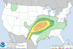
View attachment 9830Enhanced risk of storms for tomorrow, sig hail, sig winds, 5% of tornadoes.
They could upgrade the enhanced risk also.
According to SPC, 2021's May being the first one didn't have one EF3 in the entire month.
According to Grazulis, 1974's May also didn't have EF3 under his standard along with 2021's.
By the way, 1974 was one of the best analog year to this year before the season began along with 2011 and 2008.


