Ozonelayer
Member
Something about Friday that I've noticed is that the HRRR shows a round of semi-discrete supercells in the early morning. It appears that these could also have significant tornado potential from the helicity tracks.
Follow along with the video below to see how to install our site as a web app on your home screen.
Note: This feature may not be available in some browsers.
Thats also true. I wonder if they'll pull that with Friday.def remember, for 4/2, models had a very linuar mode and spc outright said, "ya no thats a whole lotta bull"
Couldn’t agree more. It’s fine to use STP to see what kind of environment may be in place, regardless of models, but it can be sky high with zero convection and it’s just a moot point.From a forecaster:
I BEG of yall to not just use STP/VTP/Simulated reflectivity.
VTP doesn't take in account convective inhabitation, STP differs platform to platform (different formulas!!), and simulated reflectivity isnt accurate most of the time. Just use Sim-ref as a reference point; PLEASE look at the background environment!!
Not even Broyles himself uses Sim-ref. So remember that with this risk please
All those parameters are indeed quite useful, and can be very helpful to get an idea of things, but like anything else, their utility decreases rapidly as you're looking for more and more specific details or the setup you're looking at is more complex or niche than usual. They're not useful without taking into account their biases, environmental factors, including geography, seasonality and obs. That said, they can be a good starting point for people to start understanding more about convective dynamics and what overlaps of different factors and parameters can contribute to tornadogenesis. Same logic applies to soundings - they're super useful but you have to pay attention to their products and items in context. Not arguing with anyone, just making sure everyone understands that, like all tools, composite parameters are useful in-context and have their uses.Couldn’t agree more. It’s fine to use STP to see what kind of environment may be in place, regardless of models, but it can be sky high with zero convection and it’s just a moot point.
Agreed. One thing that really caught my eye from Broyles’ video was him using the QPF from the ECMWF to see if open warm sector convection would develop on 4/2. There are so many tools and different nuances and biases to take account of when looking into a setup.All those parameters are indeed quite useful, and can be very helpful to get an idea of things, but like anything else, their utility decreases rapidly as you're looking for more and more specific details or the setup you're looking at is more complex or niche than usual. They're not useful without taking into account their biases, environmental factors, including geography, seasonality and obs. That said, they can be a good starting point for people to start understanding more about convective dynamics and what overlaps of different factors and parameters can contribute to tornadogenesis. Same logic applies to soundings - they're super useful but you have to pay attention to their products and items in context. Not arguing with anyone, just making sure everyone understands that, like all tools, composite parameters are useful in-context and have their uses.
I use it for the gen area of svr wx, not intensity, I feel thats how it should be used contrasted to, "look at da stppp"Couldn’t agree more. It’s fine to use STP to see what kind of environment may be in place, regardless of models, but it can be sky high with zero convection and it’s just a moot point.

Not that I recall, and I doubt either of these will. I could see a moderate tomorrow for wind and some tornados. Trey really wasn’t that high on either of these setups in his latest video as well.Has a forecast ever gone directly from an ENH to a HIGH? I'm not even sure if that's possible.

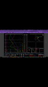
HREF has a fairly good track record - no point in taking it at gospel, but for it to pop a 30% is definitely worth noting. Tracks pretty well with the center of the SPC's ENH for tomorrow.View attachment 41611
SPC HREF guidance pulling a 30% contour for tomorrow. Reminder this is not produced by actual human forecasts but an automated computer product based on the environment and HREF member's storm tracks. But it's often a good indicator of a higher end day. Wouldn't be surprised to see the next D2 go 15% for tornadoes (or 45% for wind as others mentioned).
I Guess the HRRR just really hates Chicago.