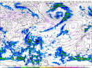
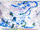
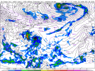
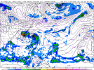
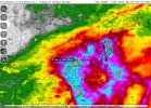
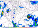
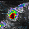
GFS still refuses to believe 94L is even a thing, so it will be interesting to see if the euro is just stuck on a nonsense solution or if it's just too complex for the GFS.It’s hard for the models to resolve such a thing. Heck, in my 5 years watching the basin I don’t think I’ve see such a complex fujiwara issue.
Navigation
Install the app
How to install the app on iOS
Follow along with the video below to see how to install our site as a web app on your home screen.
Note: This feature may not be available in some browsers.
More options
-
Welcome to TalkWeather! We see you lurking around TalkWeather! Take the extra step and join us today to view attachments, see less ads and maybe even join the discussion. CLICK TO JOIN TALKWEATHER
You are using an out of date browser. It may not display this or other websites correctly.
You should upgrade or use an alternative browser.
You should upgrade or use an alternative browser.
Potential Tropical Cyclone Nine and Hurricane Humberto
- Thread starter wx_guy
- Start date
GFS has been sleeping this year tbh. There was one year, I think it was 2020 (found out through archives on Storm2K) that the GFS would keep not having a storm in its runs until the storm was already there and NAMED.GFS still refuses to believe 94L is even a thing, so it will be interesting to see if the euro is just stuck on a nonsense solution or if it's just too complex for the GFS.
- Thread starter
- #23
wx_guy
Member
- Messages
- 1,193
- Reaction score
- 4,277
- Location
- United States
- HAM Callsign
- KO4ZGH
- Special Affiliations
- SKYWARN® Volunteer
- ARRL Member
Yeah, definitely excited to see how this "binary interaction" (term that the NHC used in its 5 PM advisory of Humberto) plays out! It's such a rare thing to happen that the models struggle inherently with it. I think so close to land, there's every chance in the world that nothing major happens as far as land goes...and every chance in the world that entropy wins out. Sometimes, chaos IS the answer.
- Thread starter
- #24
wx_guy
Member
- Messages
- 1,193
- Reaction score
- 4,277
- Location
- United States
- HAM Callsign
- KO4ZGH
- Special Affiliations
- SKYWARN® Volunteer
- ARRL Member
On a related note, I mentioned the Fujiwhara effect to some colleagues at work today and I definitely felt like I was talking to them about B-rated cringe sci-fi movies about "The Category TEN!!" or "Tornadocane Carnage!!!" or some such with the whole "one storm eats the other" or "merge into one giant storm" shtick...I mean, it IS weird, right? Right??? lol
I'm wondering. Invest 94L could make a run at the Gulf especially if it's slow to develop. Even if Invest 94L doesn't do that, we are gonna get something to develop in the Gulf next month.
This is just such a weird setup to me tbh, but hasn’t 2025 been weird the whole season up to now?0z Euro landfalls Imelda in the Carolinas before Humberto absorbs her moisture.
View attachment 46658
0z GFS now fully on board with the two systems, Humberto absorbs Imelda just off the coast.
View attachment 46659
You know the hurricane season is weird when the AZORES of all places ( a place that doesn’t commonly get TCs) is the first land area to be put under a hurricane warning out of the whole season.
Also, seeing some of these hurricane models converging more to the fact that Humberto may reach category 4 to even borderline 5 intensity, and Imelda reaching higher intensities than previously predicted, is nothing short of eyebrow raising to me. If they both become majors, every single hurricane thus far would have been a major, which is pretty insane.This is just such a weird setup to me tbh, but hasn’t 2025 been weird the whole season up to now?
You know the hurricane season is weird when the AZORES of all places ( a place that doesn’t commonly get TCs) is the first land area to be put under a hurricane warning out of the whole season.
Also, seeing some of these hurricane models converging more to the fact that Humberto may reach category 4 to even borderline 5 intensity, and Imelda reaching higher intensities than previously predicted, is nothing short of eyebrow raising to me. If they both become majors, every single hurricane thus far would have been a major, which is pretty insane.
I would not be surprised. Nothing to stop them but each other. Plenty of heat in the ocean.
NOAA CoastWatch and AOML Ocean Observations Viewer
Ocean Observing System, Atlantic Hurricane Field Program, global satellite data, insitu data, ships, buoys and regional data in the Gulf of America, Caribbean, and North Atlantic
But what’s eyebrow raising to me is how close together they would be, and if they both became MHs, it would shatter the previous record of closest MHs to each other in the Atlantic (currently the record is Irma and Jose in 2017). It feels like something you would see in a hypo season, but it’s very real.Also, seeing some of these hurricane models converging more to the fact that Humberto may reach category 4 to even borderline 5 intensity, and Imelda reaching higher intensities than previously predicted, is nothing short of eyebrow raising to me. If they both become majors, every single hurricane thus far would have been a major, which is pretty insane.
And the fact that they could take similar tracks (abit 94L would potentially go inland unlike Humberto) is also crazy.
2025 definitely seems to be making a legendary comeback from a highly unusually dead first half of September (last time we went from August 23 to at least September 17 without another named storm developing after August 23 was in 1992)
One thing I keep noticing is that the models aren't strengthening Imelda much as it is off the coast of S Florida, with strengthening after it gets north of Melbourne. I'm not understanding what they are seeing that will keep Imelda weaker until then. That's bathwater.
N0mz
Member
Should we have a thread for 94L as it is likely to landfall?
I'm good with wherever we discuss it. Maybe a combined thread for Humberto/Imelda since they may interact? Maybe best to keep here and wait and see for now.Should we have a thread for 94L as it is likely to landfall?
(I archive weather images in folders based on name, and for my organization I have Humberto and Imelda folders under one called "Twins" where I'm going to save interaction images. )

