• Welcome to TalkWeather!
    We see you lurking around TalkWeather! Take the extra step and join us today to view attachments, see less ads and maybe even join the discussion.
    CLICK TO JOIN TALKWEATHER

Tropical Storm Nicole

WesL

"Bill, I'm talkin' imminent rueage"
Administrator
Moderator
Sustaining Member
Messages
3,423
Reaction score
2,777
Location
Fayetteville, AR
Special Affiliations
  1. SKYWARN® Volunteer
BULLETIN
Subtropical Storm Nicole Intermediate Advisory Number 1A
NWS National Hurricane Center Miami FL AL172022
800 AM AST Mon Nov 07 2022

...NOAA HURRICANE HUNTERS INVESTIGATING SUBTROPICAL STORM NICOLE...
...PROLONGED PERIOD OF HAZARDOUS WEATHER EXPECTED OVER THE
NORTHWESTERN BAHAMAS, FLORIDA, AND THE SOUTHEASTERN COAST OF THE
UNITED STATES THIS WEEK...


SUMMARY OF 800 AM AST...1200 UTC...INFORMATION
----------------------------------------------
LOCATION...25.9N 69.1W
ABOUT 520 MI...835 KM E OF THE NORTHWESTERN BAHAMAS
MAXIMUM SUSTAINED WINDS...45 MPH...75 KM/H
PRESENT MOVEMENT...NNW OR 330 DEGREES AT 14 MPH...22 KM/H
MINIMUM CENTRAL PRESSURE...1002 MB...29.58 INCHES


WATCHES AND WARNINGS
--------------------
CHANGES WITH THIS ADVISORY:

None.

SUMMARY OF WATCHES AND WARNINGS IN EFFECT:

A Tropical Storm Watch is in effect for...
* Northwestern Bahamas

A Tropical Storm Watch means that tropical storm conditions are
possible within the watch area, generally within 48 hours.

Interests in the central Bahamas, Florida, and along the
southeastern coast of the United States should monitor the progress
of Nicole. Additional watches will likely be required later today.

For storm information specific to your area, please monitor
products issued by your national meteorological service.


DISCUSSION AND OUTLOOK
----------------------
At 800 AM AST (1200 UTC), the center of Subtropical Storm Nicole was
located by NOAA Hurricane Hunters near latitude 25.9 North,
longitude 69.1 West. Nicole is moving toward the north-northwest
near 14 mph (22 km/h). A turn toward the northwest with a decrease
in forward speed is expected later today. A westward or
west-southwestward motion is forecast Tuesday through early
Thursday. On the forecast track, the center of Nicole will approach
the northwestern Bahamas on Tuesday, move near or over those islands
on Wednesday, and approach the east coast of Florida by Wednesday
night.

Maximum sustained winds are near 45 mph (75 km/h) with higher
gusts. Gradual strengthening is forecast during the next few days,
and Nicole could be near or at hurricane intensity by Wednesday or
Wednesday night while it is moving near the northwestern Bahamas.

Winds of 40 mph or greater extend outward up to 275 miles (445 km)
to the east of the center.

The estimated minimum central pressure recently measured by the NOAA
Hurricane Hunters is 1002 mb (29.58 inches).
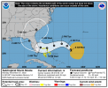
1667831022302.png
 

South AL Wx

Member
Meteorologist
Messages
366
Reaction score
492
Location
Wetumpka, AL
Special Affiliations
  1. SKYWARN® Volunteer
A Hurricane Watch has been issued for portions of the Florida East Coast:

...NICOLE REMAINS A SUBTROPICAL STORM AS IT BEGINS TO TURN
NORTHWESTWARD...
...HURRICANE AND STORM SURGE WATCHES ISSUED FOR THE EAST FLORIDA
COAST...


SUMMARY OF 1100 AM AST...1500 UTC...INFORMATION
-----------------------------------------------
LOCATION...26.3N 69.6W
ABOUT 495 MI...795 KM E OF THE NORTHWESTERN BAHAMAS
MAXIMUM SUSTAINED WINDS...45 MPH...75 KM/H
PRESENT MOVEMENT...NW OR 320 DEGREES AT 9 MPH...15 KM/H
MINIMUM CENTRAL PRESSURE...1002 MB...29.59 INCHES


WATCHES AND WARNINGS
--------------------
CHANGES WITH THIS ADVISORY:

A Hurricane Watch has been issued for the east coast of Florida
from the Volusia/Brevard County Line to Hallandale Beach and for
Lake Okeechobee.

A Storm Surge Watch has been issued for the east coast of Georgia
and east coast of Florida from Altamaha Sound southward to
Hallandale Beach.

The government of the Bahamas has changed the Tropical Storm Watch
to a Hurricane Watch for the northwestern Bahamas.

A Tropical Storm Watch has been issued for Altamaha Sound, Georgia
southward to Volusia/Brevard County Line and south of Hallandale
Beach to north of Ocean Reef.

SUMMARY OF WATCHES AND WARNINGS IN EFFECT:

A Hurricane Watch is in effect for...
* Northwestern Bahamas
* East Coast of Florida from the Volusia/Brevard County Line to
Hallandale Beach
* Lake Okeechobee

A Storm Surge Watch is in effect for...
* Altamaha Sound to Hallandale Beach

A Tropical Storm Watch is in effect for...
* Altamaha Sound southward to Volusia Brevard County Line
* Hallandale Beach to north of Ocean Reef

1667835118432.png
 
  • Thread starter
  • Admin
  • #4

WesL

"Bill, I'm talkin' imminent rueage"
Administrator
Moderator
Sustaining Member
Messages
3,423
Reaction score
2,777
Location
Fayetteville, AR
Special Affiliations
  1. SKYWARN® Volunteer
000
WTNT32 KNHC 071747
TCPAT2

BULLETIN
Subtropical Storm Nicole Intermediate Advisory Number 2A
NWS National Hurricane Center Miami FL AL172022
200 PM AST Mon Nov 07 2022

...LARGE NICOLE MOVING NORTHWESTWARD WITH NO CHANGE IN STRENGTH...


SUMMARY OF 200 PM AST...1800 UTC...INFORMATION
----------------------------------------------
LOCATION...26.4N 70.1W
ABOUT 465 MI...750 KM E OF THE NORTHWESTERN BAHAMAS
MAXIMUM SUSTAINED WINDS...45 MPH...75 KM/H
PRESENT MOVEMENT...NW OR 315 DEGREES AT 9 MPH...15 KM/H
MINIMUM CENTRAL PRESSURE...1001 MB...29.56 INCHES


WATCHES AND WARNINGS
--------------------
CHANGES WITH THIS ADVISORY:

None

SUMMARY OF WATCHES AND WARNINGS IN EFFECT:

A Hurricane Watch is in effect for...
* Northwestern Bahamas
* East Coast of Florida from the Volusia/Brevard County Line to
Hallandale Beach
* Lake Okeechobee

A Storm Surge Watch is in effect for...
* Altamaha Sound to Hallandale Beach

A Tropical Storm Watch is in effect for...
* Altamaha Sound southward to the Volusia/Brevard County Line
* Hallandale Beach to north of Ocean Reef

A Tropical Storm Watch means that tropical storm conditions are
possible within the watch area, generally within 48 hours.

A Hurricane Watch means that hurricane conditions are possible
within the watch area. A watch is typically issued 48 hours
before the anticipated first occurrence of tropical-storm-force
winds, conditions that make outside preparations difficult or
dangerous.

Interests in the central Bahamas, the remainder of Florida, and
along the southeastern coast of the United States should monitor
the progress of Nicole. Additional watches or warnings will likely
be required later today or tonight.

DISCUSSION AND OUTLOOK
----------------------
At 200 PM AST (1800 UTC), the center of Subtropical Storm Nicole was
located near latitude 26.4 North, longitude 70.1 West. The storm
is moving toward the northwest near 9 mph (15 km/h). A slower
northwestward motion is expected later this afternoon through
tonight. A turn toward the west or west-southwest is then forecast
to begin by Tuesday night and that motion should continue through
early Thursday. On the forecast track, the center of Nicole will
approach the northwestern Bahamas on Tuesday and Tuesday night,
move near or over those islands on Wednesday, and approach the east
coast of Florida Wednesday night.

Maximum sustained winds are near 45 mph (75 km/h) with higher
gusts. Gradual strengthening is forecast during the next few days,
and Nicole is forecast to be at or near hurricane intensity by
Wednesday or Wednesday night while it is moving near or over the
northwestern Bahamas.

Winds of 40 mph extend outward up to 275 miles (445 km) from the
center.

The estimated minimum central pressure is 1001 mb (29.56 inches).
 
  • Thread starter
  • Admin
  • #5

WesL

"Bill, I'm talkin' imminent rueage"
Administrator
Moderator
Sustaining Member
Messages
3,423
Reaction score
2,777
Location
Fayetteville, AR
Special Affiliations
  1. SKYWARN® Volunteer
Not promising for flood risk -
1667856948068.png
 
  • Thread starter
  • Admin
  • #6

WesL

"Bill, I'm talkin' imminent rueage"
Administrator
Moderator
Sustaining Member
Messages
3,423
Reaction score
2,777
Location
Fayetteville, AR
Special Affiliations
  1. SKYWARN® Volunteer
BULLETIN
Subtropical Storm Nicole Advisory Number 3
NWS National Hurricane Center Miami FL AL172022
400 PM EST Mon Nov 07 2022

...NICOLE FORECAST TO STRENGTHEN TUESDAY NIGHT AND WEDNESDAY...
...HURRICANE WARNING ISSUED FOR PORTIONS OF THE NORTHWESTERN
BAHAMAS...


SUMMARY OF 400 PM EST...2100 UTC...INFORMATION
----------------------------------------------
LOCATION...26.6N 70.6W
ABOUT 435 MI...705 KM ENE OF THE NORTHWESTERN BAHAMAS
MAXIMUM SUSTAINED WINDS...45 MPH...75 KM/H
PRESENT MOVEMENT...NW OR 310 DEGREES AT 9 MPH...15 KM/H
MINIMUM CENTRAL PRESSURE...1000 MB...29.53 INCHES


WATCHES AND WARNINGS
--------------------
CHANGES WITH THIS ADVISORY:

The government of the Bahamas has issued a Hurricane Warning for
the northwestern Bahamas, including the Abacos, Berry Islands,
Bimini, and Grand Bahama Island. A Tropical Storm Warning has been
issued for Andros Island, New Providence, and Eleuthera.

The Storm Surge Watch has been extended southward along the St.
Johns River south to East Palatka.
 
  • Thread starter
  • Admin
  • #7

WesL

"Bill, I'm talkin' imminent rueage"
Administrator
Moderator
Sustaining Member
Messages
3,423
Reaction score
2,777
Location
Fayetteville, AR
Special Affiliations
  1. SKYWARN® Volunteer
BULLETIN
Subtropical Storm Nicole Intermediate Advisory Number 5A
NWS National Hurricane Center Miami FL AL172022
700 AM EST Tue Nov 08 2022

...NICOLE BEGINNING TO STRENGTHEN...
...EXPECTED TO TURN WESTWARD OR WEST-SOUTHWESTWARD TODAY...


SUMMARY OF 700 AM EST...1200 UTC...INFORMATION
----------------------------------------------
LOCATION...27.7N 72.0W
ABOUT 385 MI...615 KM ENE OF THE NORTHWESTERN BAHAMAS
MAXIMUM SUSTAINED WINDS...50 MPH...80 KM/H
PRESENT MOVEMENT...WNW OR 300 DEGREES AT 8 MPH...13 KM/H
MINIMUM CENTRAL PRESSURE...992 MB...29.29 INCHES


WATCHES AND WARNINGS
--------------------
CHANGES WITH THIS ADVISORY:

None

SUMMARY OF WATCHES AND WARNINGS IN EFFECT:

A Hurricane Warning is in effect for...
* The Abacos, Berry Islands, Bimini, and Grand Bahama Island in the
northwestern Bahamas

A Tropical Storm Warning is in effect for...
* Andros Island, New Providence, and Eleuthera in the northwestern
Bahamas
* Hallandale Beach Florida to Altamaha Sound Georgia
* Lake Okeechobee

A Storm Surge Warning is in effect for...
* North Palm Beach Florida to Altamaha Sound Georgia
* Mouth of the St. Johns River to Georgetown Florida

A Hurricane Watch is in effect for...
* Hallandale Beach to the Volusia/Brevard County Line Florida
* Lake Okeechobee

A Storm Surge Watch is in effect for...
* South of North Palm Beach to Hallandale Beach Florida

A Tropical Storm Watch is in effect for...
* South of Hallandale Beach to north of Ocean Reef Florida
* North of Bonita Beach to the Ochlockonee River Florida
 

Taylor Campbell

Moderator
Moderator
PerryW Project Supporter
Messages
2,202
Reaction score
2,394
Location
Wedowee, AL
Special Affiliations
  1. SKYWARN® Volunteer
Nicole is no longer sub tropical. Weather models did a great job picking up on this storm (especially the GFS/NAVY/CMC). A wild November weather phenomenon to have a weather pattern like late September. We don’t get to experience this too often.
 
Last edited:
  • Thread starter
  • Admin
  • #9

WesL

"Bill, I'm talkin' imminent rueage"
Administrator
Moderator
Sustaining Member
Messages
3,423
Reaction score
2,777
Location
Fayetteville, AR
Special Affiliations
  1. SKYWARN® Volunteer
BULLETIN
Tropical Storm Nicole Advisory Number 6
NWS National Hurricane Center Miami FL AL172022
1000 AM EST Tue Nov 08 2022

...HURRICANE WARNING ISSUED FOR PORTIONS OF THE EAST COAST OF
FLORIDA...


SUMMARY OF 1000 AM EST...1500 UTC...INFORMATION
-----------------------------------------------
LOCATION...27.8N 72.7W
ABOUT 350 MI...560 KM NE OF THE NORTHWESTERN BAHAMAS
ABOUT 460 MI...740 KM E OF WEST PALM BEACH FLORIDA
MAXIMUM SUSTAINED WINDS...50 MPH...85 KM/H
PRESENT MOVEMENT...W OR 280 DEGREES AT 9 MPH...15 KM/H
MINIMUM CENTRAL PRESSURE...994 MB...29.36 INCHES


WATCHES AND WARNINGS
--------------------
CHANGES WITH THIS ADVISORY:

A Hurricane Warning has been issued from Boca Raton to the
Flagler/Volusia County Line. A Hurricane Watch has been issued from
the Flagler/Volusia County Line to Ponte Vedra Beach. A Tropical
Storm Watch has been issued from Altamaha Sound to the Savannah
River.

A Storm Surge Watch has been issued from Altamaha Sound Georgia to
the Savannah River and from Anclote River Florida to Suwannee River
Florida.
 

Sawmaster

Member
Messages
663
Reaction score
954
Location
Marietta SC
Special Affiliations
  1. SKYWARN® Volunteer
Nicole is now expected to be tropical storm strength when crossing upstate SC where I'm at now. Shouldn't be a problem here but might in the mountains beyond.

Phil
 

WesL

"Bill, I'm talkin' imminent rueage"
Administrator
Moderator
Sustaining Member
Messages
3,423
Reaction score
2,777
Location
Fayetteville, AR
Special Affiliations
  1. SKYWARN® Volunteer
Inching closer to land and hurricane status

BULLETIN
Tropical Storm Nicole Advisory Number 10
NWS National Hurricane Center Miami FL AL172022
1000 AM EST Wed Nov 09 2022

...CENTER OF NICOLE APPROACHING GREAT ABACO ISLAND IN THE
NORTHWESTERN BAHAMAS...
...NEW STORM SURGE WARNING ISSUED...


SUMMARY OF 1000 AM EST...1500 UTC...INFORMATION
-----------------------------------------------
LOCATION...26.5N 76.7W
ABOUT 25 MI...40 KM ENE OF GREAT ABACO ISLAND
ABOUT 210 MI...340 KM E OF WEST PALM BEACH FLORIDA
MAXIMUM SUSTAINED WINDS...70 MPH...110 KM/H
PRESENT MOVEMENT...W OR 265 DEGREES AT 12 MPH...19 KM/H
MINIMUM CENTRAL PRESSURE...986 MB...29.12 INCHES


WATCHES AND WARNINGS
--------------------
CHANGES WITH THIS ADVISORY:

A Storm Surge Warning has been issued from the Anclote River Florida
to Ochlockonee River Florida.

The government of the Bahamas has changed the Hurricane Warning for
Bimini to a Tropical Storm Warning. The government of the Bahamas
has discontinued the Tropical Storm Warning for Andros Island, New
Providence, and Eleuthera.
 

WesL

"Bill, I'm talkin' imminent rueage"
Administrator
Moderator
Sustaining Member
Messages
3,423
Reaction score
2,777
Location
Fayetteville, AR
Special Affiliations
  1. SKYWARN® Volunteer
Looks like NASA is delaying the SLS launch due to Nicole and have made the decision to leave the rocket on the pad.


WesL

"Bill, I'm talkin' imminent rueage"
Administrator
Moderator
Sustaining Member
Messages
3,423
Reaction score
2,777
Location
Fayetteville, AR
Special Affiliations
  1. SKYWARN® Volunteer
Seeing some damage is Daytona Beach ahead of Nicole's arrival


BULLETIN
Tropical Storm Nicole Advisory Number 11
NWS National Hurricane Center Miami FL AL172022
400 PM EST Wed Nov 09 2022

...NICOLE BRINGING A DANGEROUS STORM SURGE AND STRONG WINDS TO
GRAND BAHAMA ISLAND...


SUMMARY OF 400 PM EST...2100 UTC...INFORMATION
----------------------------------------------
LOCATION...26.5N 77.9W
ABOUT 55 MI...90 KM E OF FREEPORT GRAND BAHAMA ISLAND
ABOUT 135 MI...220 KM E OF WEST PALM BEACH FLORIDA
MAXIMUM SUSTAINED WINDS...70 MPH...110 KM/H
PRESENT MOVEMENT...W OR 270 DEGREES AT 13 MPH...20 KM/H
MINIMUM CENTRAL PRESSURE...985 MB...29.09 INCHES


WATCHES AND WARNINGS
--------------------
CHANGES WITH THIS ADVISORY:

None
 

Taylor Campbell

Moderator
Moderator
PerryW Project Supporter
Messages
2,202
Reaction score
2,394
Location
Wedowee, AL
Special Affiliations
  1. SKYWARN® Volunteer
Nicole is now a hurricane. The HRRR model forecast elevated tornado odds with system.

AC9484-C9-F8-BF-4-B0-A-9-F2-D-2-F967636-BE79.png


6BA3D6D9-F070-4951-B057-9833848D280B.png
 

WesL

"Bill, I'm talkin' imminent rueage"
Administrator
Moderator
Sustaining Member
Messages
3,423
Reaction score
2,777
Location
Fayetteville, AR
Special Affiliations
  1. SKYWARN® Volunteer
BULLETIN
Tropical Storm Nicole Intermediate Advisory Number 13A
NWS National Hurricane Center Miami FL AL172022
700 AM EST Thu Nov 10 2022

...NICOLE NOW CENTERED OVER CENTRAL FLORIDA...
...STRONG WINDS, DANGEROUS STORM SURGE AND WAVES, AND HEAVY RAINS
CONTINUE OVER A LARGE AREA...


SUMMARY OF 700 AM EST...1200 UTC...INFORMATION
----------------------------------------------
LOCATION...28.1N 81.6W
ABOUT 30 MI...50 KM SW OF ORLANDO FLORIDA
ABOUT 55 MI...90 KM E OF TAMPA FLORIDA
MAXIMUM SUSTAINED WINDS...60 MPH...100 KM/H
PRESENT MOVEMENT...WNW OR 295 DEGREES AT 14 MPH...22 KM/H
MINIMUM CENTRAL PRESSURE...984 MB...29.06 INCHES


WATCHES AND WARNINGS
--------------------
CHANGES WITH THIS ADVISORY:

The Tropical Storm Warning has been discontinued for the Florida
east coast south of Jupiter.
 

WesL

"Bill, I'm talkin' imminent rueage"
Administrator
Moderator
Sustaining Member
Messages
3,423
Reaction score
2,777
Location
Fayetteville, AR
Special Affiliations
  1. SKYWARN® Volunteer
BULLETIN
Tropical Storm Nicole Advisory Number 15
NWS National Hurricane Center Miami FL AL172022
400 PM EST Thu Nov 10 2022

...CENTER OF NICOLE STRADDLING THE COAST OF THE FLORIDA BIG BEND
REGION...
...POTENTIAL CONTINUES FOR STORM SURGE, STRONG WINDS, AND HEAVY
RAINS...


SUMMARY OF 400 PM EST...2100 UTC...INFORMATION
----------------------------------------------
LOCATION...29.4N 83.2W
ABOUT 95 MI...155 KM SE OF TALLAHASSEE FLORIDA
ABOUT 105 MI...170 KM NNW OF TAMPA FLORIDA
MAXIMUM SUSTAINED WINDS...45 MPH...75 KM/H
PRESENT MOVEMENT...NW OR 315 DEGREES AT 15 MPH...24 KM/H
MINIMUM CENTRAL PRESSURE...990 MB...29.24 INCHES


WATCHES AND WARNINGS
--------------------
CHANGES WITH THIS ADVISORY:

The Tropical Storm Warning has been discontinued along the Florida
east coast south of the Flagler/Volusia county line, and along the
coasts of Georgia and South Carolina north of Altamaha Sound,
Georgia.

The Tropical Storm Warning for the Florida west coast has been
discontinued south of Aripeka.

The Storm Surge Warning has been discontinued for the Florida east
coast south of the Flagler/Volusia County Line.

The Storm Surge Watch has been discontinued from the South Santee
River South Carolina to the Altamaha Sound Georgia and from the
Ochlockonee River to Indian Pass Florida.
 
Back
Top