• Welcome to TalkWeather!
    We see you lurking around TalkWeather! Take the extra step and join us today to view attachments, see less ads and maybe even join the discussion.
    CLICK TO JOIN TALKWEATHER

Modernization of radar imagery prior to modern dual pol

UncleJuJu98

Member
100,000th Post
Messages
7,273
Reaction score
16,218
Location
Birmingham
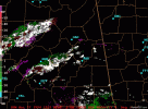
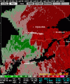
So I've been mulling and sitting on this idea for about a year or two. Discussed it with @ColdFront and @WeathermanLeprechaun. I thought of this cool idea or a project of modernizing dual pol radar imagery prior to its latest modernization in the early 2010s.

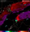
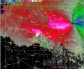
And I have used AI to try and recreate the oak Grove f5. If anybody wants to try it or create some template to modernize.
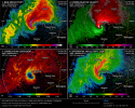
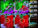
file_00000000a2a4720c810faa84b54a17d2.pngsrm_0159_bmx.jpg
 
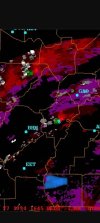
Im going to try and plug in this velocity couplet from the f4 on palm Sunday here in Alabama. Later when the refresh allows me. goshen_srm.gif
 
This video includes both simulated reflectivity and velocities of fictional tornadoes, perhaps something similar can be done, but modeled off of exisitng radar data of previous events.
 
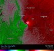
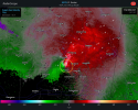
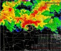
This is chatgpt best try at the ragland f4 from the 1994 palm Sunday outbreak in Alabama. It's getting closer but no cigar.

Screenshot_2026-07-09-12-54-24-52_96b26121e545231a3c569311a54cda96.jpgScreenshot_2026-07-09-12-45-26-85_40deb401b9ffe8e1df2f1cc5ba480b12.jpg
 
I dont think a perfect recreation of any velocity couplet prior to modern radar will be possible but I think it could get close enough. For a general idea of how it would look on modern day.
 
Back
Top