• Welcome to TalkWeather!
    We see you lurking around TalkWeather! Take the extra step and join us today to view attachments, see less ads and maybe even join the discussion.
    CLICK TO JOIN TALKWEATHER

Archive March 18-20th, 2018 Severe Weather

90/80 probs for tornadoes on the PDS watch!:

Tornadoes
Probability of 2 or more tornadoes

High (90%)

Probability of 1 or more strong (F2-F5) tornadoes
High (80%)

Wind
Probability of 10 or more severe wind events
Mod (50%)

Probability of 1 or more wind events > 65 knots
Low (20%)

Hail
Probability of 10 or more severe hail events
High (70%)

Probability of 1 or more hailstones > 2 inches
High (70%)

Combined Severe Hail/Wind
Probability of 6 or more combined severe hail/wind events
High (90%)
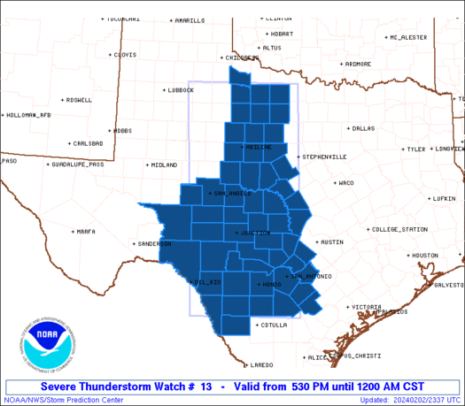
ww0013_overview_wou.gif
 
top]
000
FXUS64 KBMX 192005
AFDBMX

Area Forecast Discussion
National Weather Service Birmingham AL
305 PM CDT Mon Mar 19 2018

.UPDATE...
MESOSCALE UPDATE.

&&

.DISCUSSION...

Confidence has increased in the potential for explosive supercell
thunderstorm development late this afternoon into tonight
especially along and north of a line from Tuscaloosa to Calera to
Wedowee. A dangerous environment will also be in place south of
this line, but initiation of storms and storm coverage is
questionable.

Currently, surface winds have veered to the southwest across most
of the area following the passage of a warm front. Normally this
would yield lower dewpoints and overall moisture quality, but this
does not appear to be the case. Dewpoints are holding in the mid
to upper 60s upstream across MS. Moisture quality should not be an
issue as this event progresses.

This event will hinge on evolution of the surface to 850mb wind
fields in response to the approaching upper-level trough. We are
already seeing this response across the northern half of MS where
winds are south to southeast near Tupelo and Columbus. Hi-res
models appear to be getting a better handle on the mesoscale
features and are slowly trending more aggressive with surface
pressure troughing and backing of winds in the 23-03z time frame.
HRRR guidance suggests the potential for 0-1km shear to exceed
40kts. This amount of shear combined with SBCAPE of 2000-3000 J/kg,
supports a risk for a few long-track tornadoes. A violent tornado
cannot be ruled out.
The best chance of these enhanced ingredients
coming together for long-track tornadoes appears to be from I-65
eastward and as far south as Shelby, Talladega, Clay, and Randolph
counties.

Balloon launches are planned for 330 PM, 6 PM, and 730 PM to sample
critical changes in the low-level wind environment.

87/Grantham

Newbie question...are NWS Offices able to launch balloons at their discretion? Can't recall so many off cycle launches....Plains or otherwise;
 
Hello Guests! Take a moment and register and join the discussion!
Did so just now and encourage others to register - this is an excellent board 24/7/365. Used to live in Northport and always dreaded times like this - take care everyone. am now in Oregon and will probably only post if there's an earthquake or volcano event up here.
 
URGENT - IMMEDIATE BROADCAST REQUESTED
Tornado Watch Number 13
NWS Storm Prediction Center Norman OK
325 PM CDT Mon Mar 19 2018

The NWS Storm Prediction Center has issued a

* Tornado Watch for portions of
Northern and central Alabama
Northeast Mississippi
Southern Tennessee

* Effective this Monday afternoon and evening from 325 PM until
1100 PM CDT.

...THIS IS A PARTICULARLY DANGEROUS SITUATION...

* Primary threats include...
Several tornadoes and a few intense tornadoes likely
Scattered large hail and isolated very large hail events to 3
inches in diameter likely
Scattered damaging wind gusts to 70 mph possible

SUMMARY...Several severe storms will develop along a cold front
through this evening producing strong tornadoes, very large hail,
and damaging winds.

The tornado watch area is approximately along and 95 statute miles
north and south of a line from 15 miles south of Tupelo MS to 45
miles northeast of Gadsden AL. For a complete depiction of the watch
see the associated watch outline update (WOUS64 KWNS WOU3).

PRECAUTIONARY/PREPAREDNESS ACTIONS...

REMEMBER...A Tornado Watch means conditions are favorable for
tornadoes and severe thunderstorms in and close to the watch
area. Persons in these areas should be on the lookout for
threatening weather conditions and listen for later statements
and possible warnings.
 
I live in Meridianville also. Forgot to put that on my post.


Sent from my iPhone using Tapatalk
Spotted it in your member info. I tweeted out the link to your pics to NWS HUN
 
Yikes - this is the kind of thing you never want to see. I hope everyone is taking these warnings seriously and putting together a plan now. PDS watches are no joke.
 
Storm SE of Anniston wants to rotate, not entering a great environment, but some slightly higher shear than where it was if I read the Mesoanalysis right.
 
Well it will depend on how far north the instability goes... The PDS watch cuts off at coffee county and I am in Warren county
 
Did so just now and encourage others to register - this is an excellent board 24/7/365. Used to live in Northport and always dreaded times like this - take care everyone. am now in Oregon and will probably only post if there's an earthquake or volcano event up here.

Welcome to the forum!
 
STP OF 15 on Fayette Walker County line. Over 11 into Northern Jefferson and Blount Co. HRRR seems to think the threat is a little more SW than before. But again, don't get married to the HRRR and make sure it initializes correctly.

But 15? I wouldn't want to be anywhere near that.
 
Back
Top