
Bevo
Member
Not to be outdone, there are some additional Tornado Watches in place, currently for parts of Nebraska, Iowa, Missouri, Illinois, Kentucky, and Indiana.


Happy first day of spring, everybody!
URGENT - IMMEDIATE BROADCAST REQUESTED
Tornado Watch Number 57
NWS Storm Prediction Center Norman OK
330 PM CDT Thu Mar 19 2020
The NWS Storm Prediction Center has issued a
* Tornado Watch for portions of
southern Iowa
northern Missouri
southeast Nebraska
* Effective this Thursday afternoon and evening from 330 PM until
1100 PM CDT.
* Primary threats include...
A few tornadoes possible
Scattered large hail and isolated very large hail events to 2
inches in diameter likely
Scattered damaging wind gusts to 70 mph possible
SUMMARY...Storms including a few supercells are expected to continue
developing this afternoon into the evening, posing a risk for large
hail, tornadoes and damaging wind.
The tornado watch area is approximately along and 120 statute miles
east and west of a line from 35 miles north northeast of Des Moines
IA to 10 miles east southeast of Falls City NE. For a complete
depiction of the watch see the associated watch outline update
(WOUS64 KWNS WOU7).
PRECAUTIONARY/PREPAREDNESS ACTIONS...
REMEMBER...A Tornado Watch means conditions are favorable for
tornadoes and severe thunderstorms in and close to the watch
area. Persons in these areas should be on the lookout for
threatening weather conditions and listen for later statements
and possible warnings.
&&
OTHER WATCH INFORMATION...CONTINUE...WW 56...
AVIATION...Tornadoes and a few severe thunderstorms with hail
surface and aloft to 2 inches. Extreme turbulence and surface wind
gusts to 60 knots. A few cumulonimbi with maximum tops to 500. Mean
storm motion vector 24035.
...Dial
URGENT - IMMEDIATE BROADCAST REQUESTED
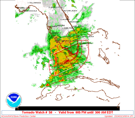
Tornado Watch Number 58
NWS Storm Prediction Center Norman OK
405 PM CDT Thu Mar 19 2020
The NWS Storm Prediction Center has issued a
* Tornado Watch for portions of
southern Illinois
southern Indiana
western and central Kentucky
southeast Missouri
* Effective this Thursday afternoon and evening from 405 PM until
1100 PM CDT.
* Primary threats include...
A few tornadoes possible
Scattered damaging wind gusts to 70 mph likely
Isolated large hail events to 1.5 inches in diameter possible
SUMMARY...Thunderstorms including a few supercells and bowing
segments will continue developing and advancing eastward through the
Ohio Valley this afternoon into the evening. Some of the storms will
pose a threat for tornadoes, damaging wind and large hail.
The tornado watch area is approximately along and 95 statute miles
east and west of a line from 55 miles northwest of Louisville KY to
40 miles south southwest of Paducah KY. For a complete depiction of
the watch see the associated watch outline update (WOUS64 KWNS
WOU8).
PRECAUTIONARY/PREPAREDNESS ACTIONS...
REMEMBER...A Tornado Watch means conditions are favorable for
tornadoes and severe thunderstorms in and close to the watch
area. Persons in these areas should be on the lookout for
threatening weather conditions and listen for later statements
and possible warnings.
&&
OTHER WATCH INFORMATION...CONTINUE...WW 56...WW 57...
AVIATION...Tornadoes and a few severe thunderstorms with hail
surface and aloft to 1.5 inches. Extreme turbulence and surface wind
gusts to 60 knots. A few cumulonimbi with maximum tops to 500. Mean
storm motion vector 25035.
Happy first day of spring, everybody!