• Welcome to TalkWeather!
    We see you lurking around TalkWeather! Take the extra step and join us today to view attachments, see less ads and maybe even join the discussion.
    CLICK TO JOIN TALKWEATHER
Logo 468x120

Hurricane Grace

WesL

"Bill, I'm talkin' imminent rueage"
Staff member
Administrator
Moderator
Sustaining Member
Messages
3,344
Reaction score
2,614
Location
Fayetteville, AR
Special Affiliations
  1. SKYWARN® Volunteer
Helloooooooo Grace


1629005753782.png

BULLETIN
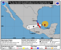
Tropical Storm Grace Advisory Number 7
NWS National Hurricane Center Miami FL AL072021
1100 PM AST Sat Aug 14 2021

...POORLY ORGANIZED GRACE NOW MOVING A BIT SLOWER...
...HEAVY RAINFALL ACROSS THE LESSER AND GREATER ANTILLES REMAINS A
PRIMARY THREAT OVER THE NEXT FEW DAYS...


SUMMARY OF 1100 PM AST...0300 UTC...INFORMATION
-----------------------------------------------
LOCATION...16.8N 62.4W
ABOUT 170 MI...275 KM ESE OF ST. CROIX
ABOUT 265 MI...430 KM ESE OF SAN JUAN PUERTO RICO
MAXIMUM SUSTAINED WINDS...40 MPH...65 KM/H
PRESENT MOVEMENT...WNW OR 285 DEGREES AT 20 MPH...31 KM/H
MINIMUM CENTRAL PRESSURE...1010 MB...29.83 INCHES
 
  • Thread starter
  • Admin
  • #2

WesL

"Bill, I'm talkin' imminent rueage"
Staff member
Administrator
Moderator
Sustaining Member
Messages
3,344
Reaction score
2,614
Location
Fayetteville, AR
Special Affiliations
  1. SKYWARN® Volunteer
Looking like a Gulf of Mexico double shot...


1629048510358.png

BULLETIN
Tropical Storm Fred Advisory Number 24
NWS National Hurricane Center Miami FL AL062021
1100 AM EDT Sun Aug 15 2021

...FRED AGAIN A TROPICAL STORM OVER THE EASTERN GULF OF MEXICO...


SUMMARY OF 1100 AM EDT...1500 UTC...INFORMATION
-----------------------------------------------
LOCATION...26.1N 84.9W
ABOUT 195 MI...320 KM SW OF TAMPA FLORIDA
ABOUT 335 MI...540 KM SSE OF PENSACOLA FLORIDA
MAXIMUM SUSTAINED WINDS...40 MPH...65 KM/H
PRESENT MOVEMENT...NNW OR 330 DEGREES AT 12 MPH...19 KM/H
MINIMUM CENTRAL PRESSURE...1008 MB...29.77 INCHES
 

Mike S

Administrator
Staff member
Administrator
Moderator
PerryW Project Supporter
Messages
1,991
Reaction score
1,118
Location
Meridianville, Al
Special Affiliations
  1. SKYWARN® Volunteer
Grace looks to be headed towards the Texas/Mexico border, but along the way she is going to bring a lot of rain to Haiti amongst other places. The last place that needs it.
 
  • Thread starter
  • Admin
  • #4

WesL

"Bill, I'm talkin' imminent rueage"
Staff member
Administrator
Moderator
Sustaining Member
Messages
3,344
Reaction score
2,614
Location
Fayetteville, AR
Special Affiliations
  1. SKYWARN® Volunteer
Adios Grace. I hate to see it going into Cozmel. They have had a rough go with COVID and lack of a tourist season for over a year. A hurricane is the last thing they need.

BULLETIN
Tropical Storm Grace Intermediate Advisory Number 18A
NWS National Hurricane Center Miami FL AL072021
800 PM EDT Tue Aug 17 2021

...NOAA AND AIR FORCE RECONNAISSANCE AIRCRAFT FIND THE CENTER OF
GRACE JUST WEST OF JAMAICA...
...HEAVY RAINFALL AND FLASH FLOOD THREAT CONTINUES IN JAMAICA...


SUMMARY OF 800 PM EDT...0000 UTC...INFORMATION
----------------------------------------------
LOCATION...18.3N 78.6W
ABOUT 50 MI...80 KM W OF MONTEGO BAY JAMAICA
ABOUT 185 MI...295 KM ESE OF GRAND CAYMAN
MAXIMUM SUSTAINED WINDS...60 MPH...95 KM/H
PRESENT MOVEMENT...W OR 280 DEGREES AT 15 MPH...24 KM/H
MINIMUM CENTRAL PRESSURE...1002 MB...29.59 INCHES


1629254761174.png
 

Mike S

Administrator
Staff member
Administrator
Moderator
PerryW Project Supporter
Messages
1,991
Reaction score
1,118
Location
Meridianville, Al
Special Affiliations
  1. SKYWARN® Volunteer
Hurricane Grace Tropical Cyclone Update
NWS National Hurricane Center Miami FL AL072021
450 AM CDT Thu Aug 19 2021

...GRACE MAKES LANDFALL ALONG THE EASTERN YUCATAN PENINSULA
OF MEXICO NEAR TULUM...

Satellite images and radar data from Belize indicate that Hurricane
Grace made landfall along the eastern Yucatan Peninsula around 445
AM CDT...0945 UTC...just south of Tulum, Mexico.

A Weatherflow station at Xcaret Park near Playa del Carmen, Mexico,
recently measured a sustained wind of 60 mph (97 km/h) and a gust
to 85 mph (137 km/h). Another Weatherflow station located at
Cancun, Mexico, recently measured a sustained wind of 59 mph (95
km/h) and a gust to 80 mph (129 km/h), while the Weatherflow site
located at Puerto Morelos, Mexico, recently measured a sustained
wind of 51 mph (83 km/h) a gust to 70 mph (113 km/h). On Cozumel, a
sustained wind of 41 mph (66 km/h) and a gust to 68 mph (109 km/h)
was observed at the Cozumel Lighthouse.

Landfall on the Yucatan
 

Mike S

Administrator
Staff member
Administrator
Moderator
PerryW Project Supporter
Messages
1,991
Reaction score
1,118
Location
Meridianville, Al
Special Affiliations
  1. SKYWARN® Volunteer
Grace is now a hurricane and will make a run at Cat 2 before landfall tonight.

At 700 AM CDT (1200 UTC), the center of Hurricane Grace was located
near latitude 20.6 North, longitude 93.7 West. Grace is moving
toward the west near 15 mph (24 km/h). A westward to
west-southwestward motion at a slightly slower forward speed is
expected during the next day or two. On the forecast track, the
center of Grace is forecast to move across the southwestern Gulf of
Mexico today, and then make landfall along the coast of mainland
Mexico this evening or tonight.

Data from the Air Force Hurricane Hunters indicate that maximum
sustained winds have increased to near 85 mph (140 km/h) with higher
gusts. More strengthening is likely until Grace makes landfall.
After landfall, Grace should weaken rapidly as it moves into the
mountains of central Mexico.
 

Attachments

  • 120516_5day_cone_no_line_and_wind.png
    120516_5day_cone_no_line_and_wind.png
    73 KB · Views: 0
  • Thread starter
  • Admin
  • #8

WesL

"Bill, I'm talkin' imminent rueage"
Staff member
Administrator
Moderator
Sustaining Member
Messages
3,344
Reaction score
2,614
Location
Fayetteville, AR
Special Affiliations
  1. SKYWARN® Volunteer
Holding as a solid Cat 1. Hoping those in Grace's path are prepared.

BULLETIN
Hurricane Grace Intermediate Advisory Number 29A
NWS National Hurricane Center Miami FL AL072021
100 PM CDT Fri Aug 20 2021

...GRACE STRENGTHENS A LITTLE MORE...
...EXPECTED TO MAKE LANDFALL ALONG EASTERN MAINLAND MEXICO
TONIGHT...


SUMMARY OF 100 PM CDT...1800 UTC...INFORMATION
----------------------------------------------
LOCATION...20.6N 94.5W
ABOUT 145 MI...230 KM NE OF VERACRUZ MEXICO
ABOUT 185 MI...300 KM E OF TUXPAN MEXICO
MAXIMUM SUSTAINED WINDS...90 MPH...150 KM/H
PRESENT MOVEMENT...W OR 265 DEGREES AT 10 MPH...17 KM/H
MINIMUM CENTRAL PRESSURE...979 MB...28.91 INCHES
 

warneagle

Member
Messages
3,729
Reaction score
3,208
Location
Arlington, VA
Special Affiliations
  1. SKYWARN® Volunteer
Grace is rapidly intensifying and might be close to or at major hurricane strength. SFMR winds >100 kts on latest recon pass.
 

bjdeming

Member
Sustaining Member
Messages
1,512
Reaction score
1,231
Location
Corvallis, Oregon
Very rough translation: As incredible as it seems, Category 1 Hurricane Grace is crossing the center of Mexico (including Mexico City and environs) and is forecast to become a tropical storm later.


Taylor Campbell

Moderator
Moderator
PerryW Project Supporter
Messages
2,102
Reaction score
2,189
Location
Wedowee, AL
Special Affiliations
  1. SKYWARN® Volunteer
This was looking like it would make landfall as a major Hurricane on that area when it was well east in the Caribbean and continued to look that way as it moved west.
 
Last edited:
Back
Top