• Welcome to TalkWeather!
    We see you lurking around TalkWeather! Take the extra step and join us today to view attachments, see less ads and maybe even join the discussion.
    CLICK TO JOIN TALKWEATHER
Logo 468x120

Severe WX April 7 - 9, 2020 Severe Weather Threat

Taylor Campbell

Moderator
Moderator
PerryW Project Supporter
Messages
2,102
Reaction score
2,189
Location
Wedowee, AL
Special Affiliations
  1. SKYWARN® Volunteer
A thread for the severe weather Tuesday-Thursday.
 

Timhsv

Member
Messages
410
Reaction score
689
Location
Meridianville, AL.
Special Affiliations
  1. SKYWARN® Volunteer
1586239974782.png

.Mid MS Valley into portions of the OH/TN Valleys...
The primary severe threat is expected to develop near or after 00Z
along the southeastward moving cold front as it advances into
portions of the OH/TN/Mid MS Valleys. Steep midlevel lapse rates
atop increasing low-level moisture will result in moderate
destabilization spreading as far northeast as the mid MS Valley,
with at least weak destabilization spreading into portions of the OH
Valley ahead of the front. Increasing deep-layer flow/shear into the
evening will support organized convection along the front. With
deep-layer shear vectors oriented at least somewhat orthogonal to
the frontal boundary, an initial discrete or semi-discrete mode is
possible, with a corresponding risk of large hail (potentially
significant) and damaging wind, and perhaps a couple of tornadoes in
areas where more substantial low-level moisture return can occur.
Some upscale growth is possible Wednesday night, at which point
damaging wind would likely become the primary threat.

The magnitude and coverage of the severe threat, and also the
northeastern extent of the threat, will be highly dependent on the
amount of moistening and destabilization that can occur ahead of the
front by Wednesday evening, and considerable spread remains
regarding these details in the model guidance. A corridor of higher
severe probabilities may eventually be needed in future outlooks
once there is greater confidence in the magnitude of destabilization
across this region.
 

warneagle

Member
Messages
3,729
Reaction score
3,208
Location
Arlington, VA
Special Affiliations
  1. SKYWARN® Volunteer
Small ENH area in southern Michigan/northern OH with an even smaller 5% TOR.
 
  • Thread starter
  • Moderator
  • #4

Taylor Campbell

Moderator
Moderator
PerryW Project Supporter
Messages
2,102
Reaction score
2,189
Location
Wedowee, AL
Special Affiliations
  1. SKYWARN® Volunteer
I suspect we will see a enhanced risk tomorrow just like today. It's been the look for days.
 

xJownage

Member
Messages
570
Reaction score
604
Location
Jacksonville, Florida
01e85e19566c7745be01f3144eaa9884.jpg


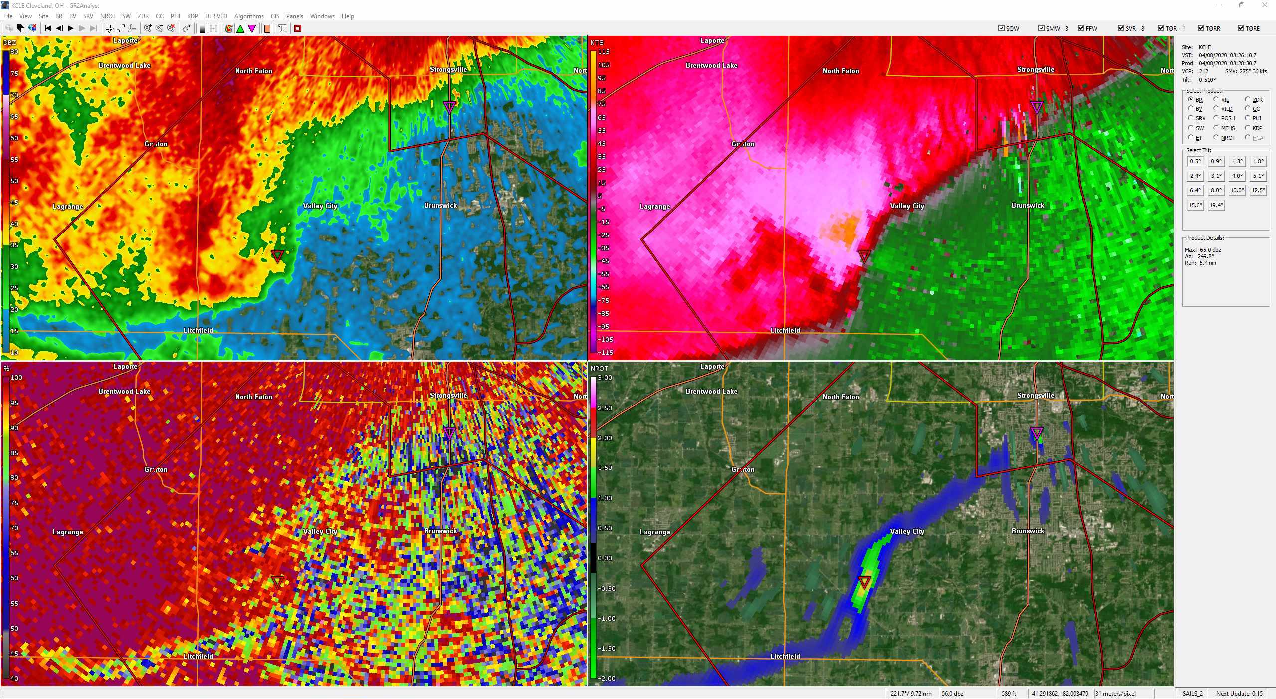
This is a very dangerous embedded supercell in a very populated area. Very prominent rotation on the last few scans.
 
Last edited:

Kory

Member
Messages
4,928
Reaction score
2,119
Location
Tuscaloosa, Alabama
Looks like we’ll have some individual cells that will fire off along 20/59 corridor this afternoon that will pose a hail threat. Then, a possible widespread damaging wind event from TN/KY into North MS/AL this evening and overnight.
 
Messages
452
Reaction score
380
Location
Canton, GA
Looks like we’ll have some individual cells that will fire off along 20/59 corridor this afternoon that will pose a hail threat. Then, a possible widespread damaging wind event from TN/KY into North MS/AL this evening and overnight.
I think the hail threat could ramp up overnight. Tons of CAPE, steep L57, good 0-6km bulk shear, etc.
 

Kory

Member
Messages
4,928
Reaction score
2,119
Location
Tuscaloosa, Alabama
Once we get convergence into a convective complex that races southeast, the hail threat will go down. Damaging wind threat will increase then.
 

WesL

"Bill, I'm talkin' imminent rueage"
Staff member
Administrator
Moderator
Sustaining Member
Messages
3,344
Reaction score
2,614
Location
Fayetteville, AR
Special Affiliations
  1. SKYWARN® Volunteer
 

bwalk

Member
Messages
597
Reaction score
291
Location
Prattville, Al
Meridian also probably getting some hail. This should move into W. Alabama shortly.
Edit: I think NorthGaWeather was referring to this in his message.

1586379437209.png
 
Last edited:
Back
Top