
Navigation
Install the app
How to install the app on iOS
Follow along with the video below to see how to install our site as a web app on your home screen.
Note: This feature may not be available in some browsers.
More options
-
Welcome to TalkWeather! We see you lurking around TalkWeather! Take the extra step and join us today to view attachments, see less ads and maybe even join the discussion. CLICK TO JOIN TALKWEATHER
You are using an out of date browser. It may not display this or other websites correctly.
You should upgrade or use an alternative browser.
You should upgrade or use an alternative browser.
Severe Weather 2026
- Thread starter KevinH
- Start date
Ozonelayer
Member
Upgraded to observed

Kds86z
Member
Kds86z
Member
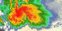
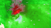
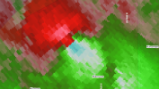
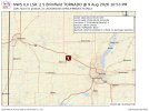
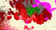
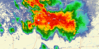
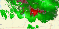
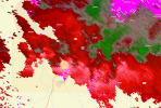
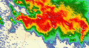
Got some familiar town names popping up from June 11..Bizarre Illinois storm continues south, think this is the same one that produced the one east of Streator. 1st image is a less contaminated scan from KILX.
TORNADO WARNING FOR...
NORTHEASTERN LIVINGSTON COUNTY IN CENTRAL ILLINOIS...
SOUTHWESTERN KANKAKEE COUNTY IN NORTHEASTERN ILLINOIS...
NORTH CENTRAL FORD COUNTY IN EAST CENTRAL ILLINOIS...
* UNTIL 115 AM CDT.
* AT 1239 AM CDT, SEVERE THUNDERSTORMS CAPABLE OF PRODUCING A
TORNADO WAS LOCATED NEAR DWIGHT, MOVING EAST AT 30 MPH.
HAZARD...TORNADO.

WeathermanLeprechaun
Member
Got this one wrong due to models overestimating a surface inversion at play. In the end, many mergers led to an quite eventful, classic, deviant whatever event in N IL. As for the very impressive VROT, no way to know if that was vio or not

warneagle
Member
man, Illinois really can't catch a break this year, can it?

CheeselandSkies
Member
If only it was all 4 hours earlier. HRRR pretty well nailed the timing for a change.
I'm pretty sure the northern storms ended up cooling themselves off with their own precip, sorta like how Effingham ended up materializing.Got this one wrong due to models overestimating a surface inversion at play. In the end, many mergers led to an quite eventful, classic, deviant whatever event in N IL. As for the very impressive VROT, no way to know if that was vio or not
Additionally, I think there may have been two significant tornadoes yesterday: 1 near Amboy that was large but on the lower end (only assuming it could've been sig based on velo), and the other deviant one which we'll have to see whatever happened to the farmhouses.
WeathermanLeprechaun
Member
Not really. Cells just matured rapidly beforehand the inversion and it was a classic high CIN high shear say that worked. Mergers absolutely aided it though yesI'm pretty sure the northern storms ended up cooling themselves off with their own precip, sorta like how Effingham ended up materializing.
Additionally, I think there may have been two significant tornadoes yesterday: 1 near Amboy that was large but on the lower end (only assuming it could've been sig based on velo), and the other deviant one which we'll have to see whatever happened to the farmhouses.
CheeselandSkies
Member
12Z HRRR and NAMnest both became rather interesting for this evening from the state line into Chicagoland.
Maybe what I thought might happen (in daylight) yesterday, will happen today.
Maybe what I thought might happen (in daylight) yesterday, will happen today.
WeathermanLeprechaun
Member
Yeah, given extreme low level stretching, any mature supercell in N IL today could be pretty interesting.
WeathermanLeprechaun
Member
Train was derailed..

/s
On a serious note, this does qualify for significant damage from that high VROT tornado last night. We will see the rating of such