• Welcome to TalkWeather!
    We see you lurking around TalkWeather! Take the extra step and join us today to view attachments, see less ads and maybe even join the discussion.
    CLICK TO JOIN TALKWEATHER

Severe Weather 2025

1754254834148.png
conditions are good for hybrid tornadoes if a cell latches on a boundary in this area from now to 5 hours.

1754254917015.png
3 cells are moving in that area. keep a eye out for photogenic tornadoes in this spot.

sounding is quite similar to the Wellfleet hybrid tornado , however with
lower LCL (1.1 km instead of 2.7 km)
higher 3cape (124 instead of 42)
slightly lower MLCAPE. (3090 instead of 4124)
 
View attachment 45626
2 of them are supercells with rotation.
View attachment 45627
surface vorticity is there.
only thing left is for the 2 cells to have non fast moving non cold boundary's and instead have more warm slower boundaries.
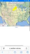
Eastern cell is now radar indicated tornado warned.


136
WFUS53 KGLD 032143
TORGLD
KSC063-032215-
/O.NEW.KGLD.TO.W.0032.250803T2143Z-250803T2215Z/

BULLETIN - EAS ACTIVATION REQUESTED
Tornado Warning
National Weather Service Goodland KS
443 PM CDT Sun Aug 3 2025

The National Weather Service in Goodland has issued a

* Tornado Warning for...
Northwestern Gove County in west central Kansas...

* Until 515 PM CDT.

* At 443 PM CDT, a severe thunderstorm capable of producing a tornado
was located 7 miles south of Grinnell, moving southwest at 20 mph.

HAZARD...Tornado and baseball size hail.

SOURCE...Radar indicated rotation.

IMPACT...Flying debris will be dangerous to those caught without
shelter. Mobile homes will be damaged or destroyed.
Damage to roofs, windows, and vehicles will occur. Tree
damage is likely.

* This tornadic thunderstorm will remain over mainly rural areas of
northwestern Gove County.

PRECAUTIONARY/PREPAREDNESS ACTIONS...

TAKE COVER NOW! Move to a basement or an interior room on the lowest
floor of a sturdy building. Avoid windows. If you are outdoors, in a
mobile home, or in a vehicle, move to the closest substantial shelter
and protect yourself from flying debris.

&&

LAT...LON 3908 10066 3904 10053 3886 10064 3892 10080
TIME...MOT...LOC 2143Z 031DEG 17KT 3902 10064

TORNADO...RADAR INDICATED
MAX HAIL SIZE...2.75 IN
 
Back
Top