- Moderator
- #21
Who is bringing the marshmallows?
S'mores!!
Follow along with the video below to see how to install our site as a web app on your home screen.
Note: This feature may not be available in some browsers.
Who is bringing the marshmallows?


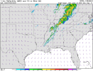
Machine learning model from CSU is hitting Friday pretty hard.

I noticed that on the Euro in that timeframe, but that was also in the face of decent 3-hour sfc pressure falls, as the low is deepening, and it's not occluded. All those things point toward winds that should be backing, and we know from experience that none of the models ever have as much of an isallobaric response as they should until the last minute, and sometimes not even then.I would like to see more southerly surface winds in the warm sector than some of the newest guidance is suggesting, as the current progs are lacking a bit on hodograph size/curvature especially in the 18-21z window.
Well said. Always love your analysis.View attachment 10796
Alright, so let's talk a minute...
The reasons cited in the outlook mainly revolve around the positive tilt nature of the trough. It is mentioned that the positive tilt is helping promote flow aloft parallel to the front which would undercut thunderstorms along the front. Here's the thing... that front is still WAY west at the time that we're watching. We are concerned with open warm sector development in the WAA regime along the broad low-level jet axis. This is not one of those meridional positive tilt troughs where the deep-layer flow is sharply southerly and the low-level jet is confined to areas immediately along the front. When those situations happen, most of the warm sector is actually east of the low-level jet, where there is low-level divergence. In this case, the low-level jet is well out ahead of the surface front, and the broad zone of WAA helps promote large scale ascent, even if subtle, well ahead of the front they are talking about. In addition to that, there are significant height falls that overspread the warm sector through the afternoon, evening, overnight, and predawn well ahead of the front. This is another source for large scale ascent. We will also have east AR, north MS, west/middle TN/KY, and north AL getting into the right rear quadrant of the 500mb jet streak associated with that lead disturbance. There are some signals there may actually be a double barrel upper jet, similar to Super Tuesday 2008, with a secondary mid-level jet streak over these areas. Those things would promote upper-level divergence, which is yet more subtle large scale ascent. Are those mechanisms strong? No. But in an open warm sector in Dixie Alley where the capping is weak, and the boundary layer moisture is rich and substantially deeper than what you see in the Plains, you wouldn't want strong lift in a situation like this... otherwise you're either going to have a linear storm mode or a messy and grungy mode. Once you add those large scale ascent mechanisms together, and especially account for surface pressure falls and prefrontal confluence bands in the warm sector, there are mechanisms to get robust discrete convective development deep into the warm sector. Last night's Euro and today's Euro actually show a signal for discrete storms in north central MS to west/middle TN as early as 5-6pm, and a strong signal for long-track discrete storms coming out of north Mississippi and southwest Tennessee, across north Alabama and Middle TN as early as 8-11pm with time. That is well ahead of the main round of activity that begins moving into north AL and middle TN after midnight, which may also be supercells or QLCS with embedded supercells, with deep-layer vectors still a bit more veered prior to 12z. Once you get toward the daybreak hours and after, as the main trough axis is stepping out toward the area, the low-level winds are veering with time, the deep-layer vectors are more parallel to the line, and the trough is shearing itself, and dynamics are pulling away with time.
We have to get beyond conceptual models and actually have an understanding of how previous events have happened, instead of just assuming every significant event in the past was a negative tilt trough without ever going back to look at what the setups looked like. Most of the "classic" rules like that were born from the Fawbush-Miller days of the 40s and early 50s. There are many events that don't fit that conceptual model. The thing about those rules... they were originally born from the Tinker 1948 tornadoes in March of that year. The problem is, if you pay attention to the descriptions of the conditions leading up to the tornadoes... with reports of a wall of clouds stretching from one end of the horizon to the other... not only are rules based on an area which has stronger capping most times and NEEDs stronger lift, but those descriptions make it sound like those may have been QLCS tornadoes, or at least supercells embedded within a QLCS. The descriptions sound like there was a big horizon-stretching shelf cloud immediately before the tornadoes. Conceptual models and anecdotal ideas can only take us so far in forecasting. Severe weather has to be an ingredients-based forecast approach. Most of the time we see a setup in Dixie that looks like that classic Fawbush-Miller conceptual model, we end up with either a solid line of storms or a grungy, messy warm sector. Let's look at how actual events have happened in the past and adjust our conceptual models accordingly. Those events happened the way they did for a reason.
To be clear, when I mentioned that date earlier, I was only pointing out that some guidance has a double barrel jet streak similar to what that evening had and was talking about how that was a source of lift. I'm not calling for anything like that or making a comparison for expectations.Thanks for the analysis, Fred. You're a smart guy and certainly know more about this stuff than me. At the same time though I'm still not sure what to make of this upcoming event, and no my uncertainty is not because of the trough. I probably shouldn't be too quick to dismiss any possibilities and part of that is certainly me just being pessimistic because of how many events this year have failed to materialize. It may very well be another Super Tuesday '08 or if this year's current trend continues it may be another complete bust.
I am still surprised the SPC hasn't introduced 15% probabilities based on what some of the models are showing. I fear we are going back to a "pre-Plainfield" era of stringent forecasting.
Yeah I get what you were saying. Being exposed to sites like YouTube for so long got me used to seeing wannabe mets getting super riled up and acting like there will 100% be another 4/27/11 in December. People see one parameter that is similar to a past event and just go crazy. Trying to steer clear of sites like YouTube now especially given what the comment section has devolved into over the years.To be clear, when I mentioned that date earlier, I was only pointing out that some guidance has a double barrel jet streak similar to what that evening had and was talking about how that was a source of lift. I'm not calling for anything like that or making a comparison for expectations.