Kds86z
Member
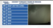
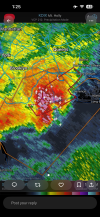
I just told myself in my head, I bet Indiana will do it today..now Warned
Follow along with the video below to see how to install our site as a web app on your home screen.
Note: This feature may not be available in some browsers.


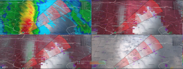
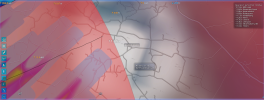
Is there a link where we can order/download it? If so, please share it here for the rest of us!For those looking for new weather software, I highly recommend the new WSV3. Still work in progress with adding stuff, but it's worth it. I have RadarScope, RadarOmega, GRlevelx 2 Analyst, GRlevelx 3, WeatherFront, Baron Threat Net, and WSV3. Out of all these, WSV3 updates the fastest. You can never have too many backups.


for download: https://wsv3.com/download.htmlIs there a link where we can order/download it? If so, please share it here for the rest of us!

Yes. Sorry about that. Here you go: https://wsv3.com/2027/Is there a link where we can order/download it? If so, please share it here for the rest of us!


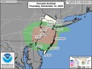
Didn't expect a tornado threat in my backyard today, lol. SPC upgraded to 5% and watch possible in the next hour or so.

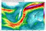
I'm just referring to the small trough that crosses the Rockies in the majority of the models at about ~140 hours, then lifts north afterwards. That wave might help bring up some moisture for any storm system that comes in behind it, the latter of which being closer to what that post is talking about.is this what your refering to slenker