

To add to the climatology here, the Milton event taking place over the Florida Peninsula also made it a vastly different scenario geographically, where you had a very strong storm that was still offshore bringing embedded supercells ashore in an environment with mid-to-upper-70s dews. Just a very different situation in pretty much every aspect. That said, I definitely still see a tornado threat, but not betting on anything particularly potent outside of the immediate coast. Also, model solutions are changing run-to-run, so I feel like it's still way too uncertain to start zeroing in on the caliber and nature of tornado threat.The thing is that the more I am looking at model data, I am looking drastically less convinced of a long duration inland tor event here and even more skeptical of anything significant. Time for a "debunking hype" writeup instead.
I'm beginning to see that social media is being a bit too influenced by Milton comparisons when in reality, it's not a good comparison. Look at how pinched this warm sector is after it makes landfall via the GFS (I know but there see other models suggesting this general warm sector size too.)
Navigation
Install the app
How to install the app on iOS
Follow along with the video below to see how to install our site as a web app on your home screen.
Note: This feature may not be available in some browsers.
More options
-
Welcome to TalkWeather! We see you lurking around TalkWeather! Take the extra step and join us today to view attachments, see less ads and maybe even join the discussion. CLICK TO JOIN TALKWEATHER
You are using an out of date browser. It may not display this or other websites correctly.
You should upgrade or use an alternative browser.
You should upgrade or use an alternative browser.
Severe WX Invest 92L/Hurricane Isaias Severe WX
- Thread starter N0mz
- Start date
Ozonelayer
Member
The Milton analog was also different in other ways too. Milton was, by all means, extraordinary.
With Milton, you had daytime florida instability and humidity interacting with consistant daytime heating, lot of low level shear and a great hodograph allowing for the supercells to produce strong tornadoes even in a more clustered state (Fort Myers PDS is probably the best example of this.) And the non clustered storms produced intense tornadoes (even the offshore storms had intense couplets, arguably more so than even the Fort Pierce HE EF-3)
With this one, you don't have nearly as much instability (meaning storms that, if they arent getting mergers or are being supported by height falls or forcing, will get sheared apart). The daytime heating is pretty limited too (landfall takes place in the early morning hours as of current forcast, Milton didnt make landfall until late afternoon AFTER the main portion of the tornado outbreak) and the inland portion is going to be very, very limited by the pinched warm sector. Like, anywhere from a third to half of these supercells will probably be going through 50-60 F with barely any moisture for support. The coast is really the only part as of now I would watch for sigtor potential day of landfall.
Could it change? Absolutely. 4 days out leaves 96 hours for trends to change.
With Milton, you had daytime florida instability and humidity interacting with consistant daytime heating, lot of low level shear and a great hodograph allowing for the supercells to produce strong tornadoes even in a more clustered state (Fort Myers PDS is probably the best example of this.) And the non clustered storms produced intense tornadoes (even the offshore storms had intense couplets, arguably more so than even the Fort Pierce HE EF-3)
With this one, you don't have nearly as much instability (meaning storms that, if they arent getting mergers or are being supported by height falls or forcing, will get sheared apart). The daytime heating is pretty limited too (landfall takes place in the early morning hours as of current forcast, Milton didnt make landfall until late afternoon AFTER the main portion of the tornado outbreak) and the inland portion is going to be very, very limited by the pinched warm sector. Like, anywhere from a third to half of these supercells will probably be going through 50-60 F with barely any moisture for support. The coast is really the only part as of now I would watch for sigtor potential day of landfall.
Could it change? Absolutely. 4 days out leaves 96 hours for trends to change.

jackhutwx
Member
I personally follow him, I love his photography and joke posts, he never really posts much about actual weather.Oh, no, like when he doesn't shitpost, he's solid but I think it's a pretty stupid engagement post to make. Just that's all
jackhutwx
Member
im actually getting really into tropical weather and forecasting, if theres any resources to learn more about how the tropics work vs. mainland u.s, let me know!
KevinH
Member
ShhhhhThought I'd put this out there in case this system produces a bunch of tornadoes. Georgia's highest total tornado count in 24 hours is 22.
HWRF plasters some supercells over Georgia Saturday
KevinH
Member
YESSSSSSS!!!!!!! lol
I have officially turned on email notifications for this thread lol
KevinH
Member
Leave me alone lolYou sound a bit like a certain guy on here when you say that haha, just would've given a extra grade if you said Dixie does what it wants LOL
In all seriousness, yes, but the magical trope of it being Dixie doesn't necessarily mean these issues will just be dismissed. I know instability will probably increase a little bit so my comment is absolutely subject to change but yeah
Just when the South needs to be reminded of where they live SMH
akt1985
Member
The good news for potential tornadoes is the radar used by NWS Mobile is now fixed.

Kds86z
Member
.NORTHEASTERN GULF COAST
SEVERE PROBABILITIES HAVE BEEN ADJUSTED TO ACCOUNT FOR THE LATEST
NHC FORECAST TRACK OF ISAIAS. BASED ON THE ACCELERATING NORTHWARD
MOTION OF THIS SYSTEM, EVOLVING HODOGRAPHS AND FORCING FOR ASCENT
CONDITIONALLY MOST CONDUCIVE TO SUPERCELL STRUCTURES WITH POTENTIAL
TO PRODUCE TORNADOES COULD BECOME FOCUSED WELL TO THE
NORTH-NORTHEAST OF THE CYCLONE CENTER. THIS MAY BEGIN OVERSPREADING
COASTAL AREAS BY EARLY FRIDAY EVENING, IF NOT EARLIER. EVEN AS THIS
SHIFTS NORTHWARD, WELL INLAND OF COASTAL AREAS, IT IS POSSIBLE THAT
HODOGRAPHS, AT LEAST, WILL REMAIN CONDITIONALLY SUPPORTIVE OF A
CONTINUING RISK FOR SUPERCELLS WITH TORNADOES AS FAR SOUTH AS AREAS
NEAR/WEST-NORTHWEST OF THE FLORIDA BIG BEND THROUGH DAYBREAK.
THE PRIMARY UNCERTAINTY WITH REGARD TO THE RISK FOR TORNADOES
CONCERNS A PRECEDING INFLUX OF POTENTIALLY COOL/STABLE
BOUNDARY-LAYER AIR AS FAR SOUTH AS COASTAL AREAS, WHICH MAY REMAIN
INHIBITIVE THROUGH THE PERIOD. BASED ON 07/12Z NAM (WITH A TRACK
SIMILAR, BUT PERHAPS SLOWER THAN THE OFFICIAL FORECAST TRACK)
FORECAST SOUNDINGS, LOW-LEVEL THERMODYNAMIC PROFILES DO NOT BECOME
CONDUCIVE TO AN APPRECIABLE RISK FOR TORNADOES UNTIL LATE FRIDAY
NIGHT, GENERALLY NEAR/NORTHWEST OF THE FLORIDA BIG BEND. THIS MAY
BE IN THE WAKE OF THE BETTER LARGE-SCALE FORCING FOR ASCENT.
..KERR.. 10/07/2026
SEVERE PROBABILITIES HAVE BEEN ADJUSTED TO ACCOUNT FOR THE LATEST
NHC FORECAST TRACK OF ISAIAS. BASED ON THE ACCELERATING NORTHWARD
MOTION OF THIS SYSTEM, EVOLVING HODOGRAPHS AND FORCING FOR ASCENT
CONDITIONALLY MOST CONDUCIVE TO SUPERCELL STRUCTURES WITH POTENTIAL
TO PRODUCE TORNADOES COULD BECOME FOCUSED WELL TO THE
NORTH-NORTHEAST OF THE CYCLONE CENTER. THIS MAY BEGIN OVERSPREADING
COASTAL AREAS BY EARLY FRIDAY EVENING, IF NOT EARLIER. EVEN AS THIS
SHIFTS NORTHWARD, WELL INLAND OF COASTAL AREAS, IT IS POSSIBLE THAT
HODOGRAPHS, AT LEAST, WILL REMAIN CONDITIONALLY SUPPORTIVE OF A
CONTINUING RISK FOR SUPERCELLS WITH TORNADOES AS FAR SOUTH AS AREAS
NEAR/WEST-NORTHWEST OF THE FLORIDA BIG BEND THROUGH DAYBREAK.
THE PRIMARY UNCERTAINTY WITH REGARD TO THE RISK FOR TORNADOES
CONCERNS A PRECEDING INFLUX OF POTENTIALLY COOL/STABLE
BOUNDARY-LAYER AIR AS FAR SOUTH AS COASTAL AREAS, WHICH MAY REMAIN
INHIBITIVE THROUGH THE PERIOD. BASED ON 07/12Z NAM (WITH A TRACK
SIMILAR, BUT PERHAPS SLOWER THAN THE OFFICIAL FORECAST TRACK)
FORECAST SOUNDINGS, LOW-LEVEL THERMODYNAMIC PROFILES DO NOT BECOME
CONDUCIVE TO AN APPRECIABLE RISK FOR TORNADOES UNTIL LATE FRIDAY
NIGHT, GENERALLY NEAR/NORTHWEST OF THE FLORIDA BIG BEND. THIS MAY
BE IN THE WAKE OF THE BETTER LARGE-SCALE FORCING FOR ASCENT.
..KERR.. 10/07/2026

CheeselandSkies
Member
.NORTHEASTERN GULF COAST
SEVERE PROBABILITIES HAVE BEEN ADJUSTED TO ACCOUNT FOR THE LATEST
NHC FORECAST TRACK OF ISAIAS. BASED ON THE ACCELERATING NORTHWARD
MOTION OF THIS SYSTEM, EVOLVING HODOGRAPHS AND FORCING FOR ASCENT
CONDITIONALLY MOST CONDUCIVE TO SUPERCELL STRUCTURES WITH POTENTIAL
TO PRODUCE TORNADOES COULD BECOME FOCUSED WELL TO THE
NORTH-NORTHEAST OF THE CYCLONE CENTER. THIS MAY BEGIN OVERSPREADING
COASTAL AREAS BY EARLY FRIDAY EVENING, IF NOT EARLIER. EVEN AS THIS
SHIFTS NORTHWARD, WELL INLAND OF COASTAL AREAS, IT IS POSSIBLE THAT
HODOGRAPHS, AT LEAST, WILL REMAIN CONDITIONALLY SUPPORTIVE OF A
CONTINUING RISK FOR SUPERCELLS WITH TORNADOES AS FAR SOUTH AS AREAS
NEAR/WEST-NORTHWEST OF THE FLORIDA BIG BEND THROUGH DAYBREAK.
THE PRIMARY UNCERTAINTY WITH REGARD TO THE RISK FOR TORNADOES
CONCERNS A PRECEDING INFLUX OF POTENTIALLY COOL/STABLE
BOUNDARY-LAYER AIR AS FAR SOUTH AS COASTAL AREAS, WHICH MAY REMAIN
INHIBITIVE THROUGH THE PERIOD. BASED ON 07/12Z NAM (WITH A TRACK
SIMILAR, BUT PERHAPS SLOWER THAN THE OFFICIAL FORECAST TRACK)
FORECAST SOUNDINGS, LOW-LEVEL THERMODYNAMIC PROFILES DO NOT BECOME
CONDUCIVE TO AN APPRECIABLE RISK FOR TORNADOES UNTIL LATE FRIDAY
NIGHT, GENERALLY NEAR/NORTHWEST OF THE FLORIDA BIG BEND. THIS MAY
BE IN THE WAKE OF THE BETTER LARGE-SCALE FORCING FOR ASCENT.
..KERR.. 10/07/2026
It's interesting how SPC put in a 15% all-hazards contour for Day 3 in order to drive a slight risk, even though the tornado-driven slight risk for Day 2 is only at 5% and the other hazards are sub-5%. It appears the CIG system didn't give them a good way around stuff like this.

I’m wondering if we will see a 10% area introduced. Maybe for Friday along the panhandle
Tbf, if they set that up to establish a 15% tornado risk, it'd still end up being an Enhanced Risk, even with a CIG1 contour. That said, would be surprised if they did that on their first D2, given the uncertainties.It's interesting how SPC put in a 15% all-hazards contour for Day 3 in order to drive a slight risk, even though the tornado-driven slight risk for Day 2 is only at 5% and the other hazards are sub-5%. It appears the CIG system didn't give them a good way around stuff like this.
akt1985
Member
Right now the SPC thinks most of the tornado potential will be east of I-65 on Saturday.
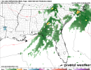
Obviously it's NAM at end-of-run, but seems like an interesting scenario Sunday. Ironically, feels a bit like our lower-end traditional events in that it may end up being a time-sensitive setup that will depend on the right intersection of ingredients over a fairly small area. Right now, seems like parts of Georgia are the prime spot Sunday, but obviously the best dynamics from Isaiah as it likely becomes extra-tropical and shoots northward. Deep moisture will likely be in place, but as is almost always the case, models are probably underestimating the strength of the Lower Apps CAD wedge. At the same time, the wedge could provide a point of focus for activity, especially with probable training of storms. Definitely seems like something worth watching for Georgia folks, but still plenty of questions. Could also have some activity across the Carolinas, with GFS, for example, favoring that area for supercell potential Sunday, though that region has a tendency to underperform compared to forecast (and then, every once in a while, way overperform).
FFC's AFD for the event.
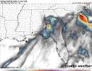
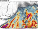
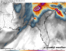
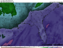
FFC's AFD for the event.
.LONG TERM...
(Friday night through Wednesday)
Issued at 239 AM EDT Thu Oct 8 2026
The focus of the long-term period will be Hurricane Isaias and its
potential impacts on the forecast area. The latest forecast cone
from NHC progs landfall somewhere between the Mississippi coast and
western portion of the Florida Panhandle. This positions north and
central Georgia on the eastern side of the center of Isaias, where
strong winds, flooding rain, and tornadoes will all be on the table.
Wind Threat: High pressure will remain in place on Friday, having
built in over the Appalachians on Thursday and been reinforced with
cold air damming (the "wedge"). A tightening pressure gradient is
expected at the surface across Georgia as Isaias moves northward and
pushes up against the high pressure area. Due to this tightened
gradient, the area of strong winds is forecast to be larger on the
east side of Isaias. As a result, at least some period of sustained
winds of 15-25 mph and gusts of 25-35 mph can be expected across
north and central Georgia. Additionally, a developing upper-level
low will be moving eastward across the Southeast Friday into
Saturday. This will likely accelerate the extra-tropical transition
(ET) of Isaias and may bring potential for an initial increase in
winds in the immediate hours after Isaias has begun its ET. There is
also the potential for the development of a "sting jet" -- an
acceleration of descending air that brings extreme localized winds.
Some form of wind-related Watch issuance is very likely in the next
24 hours or so.
Flooding Rain Threat: Given strong tropical moisture advection as
Isaias moves inland, widespread rainfall is expected early Saturday
morning through early Sunday morning. The convective rainbands from
Isaias will be where the most efficient rainfall will be focused.
That said, it is futile to try to pin down where exactly the
heaviest rain will occur, so residents anywhere in Georgia should
prepare for the possibility of localized flash flooding and/or river
flooding, should they find themselves under persistent rainbands.
Our current forecast has widespread 2 to 3 inches through the
weekend, backed by most of the ensemble guidance. Would not be
surprised to see hi-res guidance painting bullseyes/swaths of
greater amounts over the coming days as they try to resolve the
rainbands.
Tornado Threat: The conceptual model of tropical storms and
hurricanes holds that the front right quadrant of these systems have
the greatest potential for tornadoes. Given that the center of
Isaias will very likely track to the west of Georgia, tornadoes will
be a possibility across parts of the forecast area -- especially
along the wedge boundary and outside of the cooler, stable wedge
airmass.
Ozonelayer
Member
12z HRRR comes in with what looks a decent caliber tornadic event in northern Florida
It follows the eastward shift fairly well, with 70s dewpoints and warm temperatures coiniding with a lesser amount of dry air entrainment. The shear isnt as maximized but its still there, and the hodograph shape is good.
(Northern Florida):
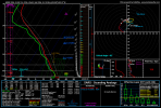
Further towards the coast, theres a more significant threat for tornadoes as the supercells move ashore.
It follows the eastward shift fairly well, with 70s dewpoints and warm temperatures coiniding with a lesser amount of dry air entrainment. The shear isnt as maximized but its still there, and the hodograph shape is good.
(Northern Florida):
Further towards the coast, theres a more significant threat for tornadoes as the supercells move ashore.
tennessee storm chaser
Member
- Messages
- 1,909
- Reaction score
- 4,371
- Location
- jackson tennessee
- Special Affiliations
- SKYWARN® Volunteer
This little event seems to me be more of southern Georgia and north Florida threat ….For tornadoes
Last edited:
Kds86z
Member
jackhutwx
Member
Kds86z
Member
akt1985
Member
This might be related to Isaias, but there is a Marginal Risk out this afternoon for west-central Florida.