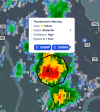
The 18z HRRR continues to support thinking of a potentially tornadic MCV (it's the same one that's driven the 5% today BTW but didn't verify due to major cloud cover.) in the Mid-Atlantic. Intense 0-1km SRW of 40 kts, with strong low level shear + stretching could lead to chaotic mini supercells eque to 6/5/24.
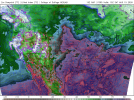
However, this isn't the only day of interest. Tuesday has shown up on ML guidance as a big time severe weather day for Iowa in particular. A strong jet streak of 50+ kts overlaps a highly unstable warm sector and may drive a significant damaging wind/tornado event in the area with ML guidance strongly suggesting both in the mix. Profiles already suggesting long lived MCS potential in the cards and the vertical velocity product on the GFS seems to suggests clusters with potentially a isolated supercell ahead of those clusters. But, of course, it's early days so we will not know storm mode for a bit, a mixed mode is the most prominent on models at the moment but that could switch.
When I say significant damaging wind/tornado event, i do not mean significant tornadoes. Moreso significant damaging wind but the tornado threat exists to a extent and derecho events like surprising with tornadoes a lot.