• Welcome to TalkWeather!
    We see you lurking around TalkWeather! Take the extra step and join us today to view attachments, see less ads and maybe even join the discussion.
    CLICK TO JOIN TALKWEATHER

Severe WX Severe Weather Threat June 19-28

That dry slot and warm nose aloft at 500mb always seems to be a common feature in these setups. Sometimes they don't work and other times they do. Will have to see.

(from yearly thread)

14Z HRRR now introduces a nice southeastward-moving supercell with stout UH from Iowa into Green Counties, WI. Might turn out a bit like the "Independence Day Mothership" of 2022 (the chase where I pulled in behind Vince Waelti and Brandon Copic's Radar Omega/Ryan Hall Y'all-wrapped vehicles).

070422_02_2048.jpg

070422_06_2048.jpg
 
Day 2: possible tornado upgrade to come

WITH STORM MOTIONS LIKELY TO BE ALONG-BOUNDARY. THERE REMAINS STRONG SIGNAL THAT A 40-50 KT SOUTHWESTERLY LOW-LEVEL JET WILL INCREASE INTO THE EVENING ACROSS OKLAHOMA INTO SOUTHERN KANSAS. THIS IN COMBINATION WITH FAVORABLE ALONG BOUNDARY STORM MOTIONS WILL SUPPORT
POTENTIAL FOR TORNADOES, A FEW OF WHICH COULD BE STRONG. THE MAIN
UNCERTAINTY REMAINS IN THE EXACT PLACEMENT OF THE BOUNDARY RELATIVE TO THE MORE FAVORABLE CORRIDOR OF INSTABILITY/LOW-LEVEL JET AXIS. THE 5% TORNADO AREA WAS SHIFTED SOUTHWARD WITH THIS UPDATE TO ACCOUNT FOR RECENT TRENDS. IT IS POSSIBLE THAT IF MORE CONFIDENCE IN THE PLACEMENT OF THESE FEATURES OCCURS, HIGHER PROBABILITIES MAY BE NEEDED. FOR NOW, CONFIDENCE REMAINS MODERATE IN SUPERCELLS
DEVELOPING WITH POTENTIAL FOR LARGE TO VERY LARGE HAIL AND DAMAGING WIND.
 

Attachments

  • IMG_0373.jpeg
    IMG_0373.jpeg
    176.4 KB · Views: 4


AT 611 PM MDT, A CONFIRMED TORNADO WAS LOCATED NEAR PROCTOR, OR 20
MILES NORTHEAST OF STERLING, MOVING SOUTHEAST AT 20 MPH.

HAZARD...DAMAGING TORNADO AND BASEBALL SIZE HAIL.

SOURCE...LAW ENFORCEMENT CONFIRMED TORNADO.

IMPACT...FLYING DEBRIS WILL BE DANGEROUS TO THOSE C
 
Additional surveys happening today:

View attachment 53904

HUN only found straight line wind damage. They're back out again today checking the Francisco area at the Alabama/Tennessee border. That would have been upstream from the New Market tornadoes. It'll be interesting to see what they surveyors find there.
 
NEAR THE SURFACE BOUNDARY
ACROSS SOUTHERN KS/NORTHERN OK THROUGH THE AFTERNOON AND EVENING AS
A SOUTHERLY LOW-LEVEL JET STRENGTHENS. ELONGATED/CURVED HODOGRAPHS
SUGGEST A THREAT FOR A FEW TORNADOES WILL EXIST, ESPECIALLY WITH ANY
THUNDERSTORMS THAT CAN REMAIN AT LEAST SEMI-DISCRETE. AND GIVEN THE
ENHANCED EFFECTIVE SRH NEAR THE BOUNDARY, A STRONG TORNADO APPEARS
POSSIBLE IF A SUPERCELL MODE CAN BE MAINTAINED.
 

Has the 5% hatched taken over for the 10% hatched for the "Strong tornado" mention? I did notice the SPC mentioned "strong tornado may occur." in their most recent write-up. Guessing that must mean the 10% hatched is now more of the mention of "Violent tornadoes, and or multiple strong tornadoes.
 
Has the 5% hatched taken over for the 10% hatched for the "Strong tornado" mention? I did notice the SPC mentioned "strong tornado may occur." in their most recent write-up. Guessing that must mean the 10% hatched is now more of the mention of "Violent tornadoes, and or multiple strong tornadoes.
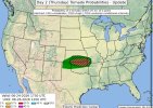
Not taken over no. Buts it’s the lowest probability.
 
Back
Top