Severe Weather Statement
National Weather Service Jackson MS
805 PM CDT Wed May 6 2026
MSC065-077-085-070200-
/O.CON.KJAN.TO.W.0037.000000T0000Z-260507T0200Z/
Lincoln MS-Lawrence MS-Jefferson Davis MS-
805 PM CDT Wed May 6 2026
...TORNADO EMERGENCY FOR Monticello, Silver Creek...
...A TORNADO WARNING REMAINS IN EFFECT UNTIL 900 PM CDT FOR
NORTHEASTERN LINCOLN...LAWRENCE AND WESTERN JEFFERSON DAVIS
COUNTIES...
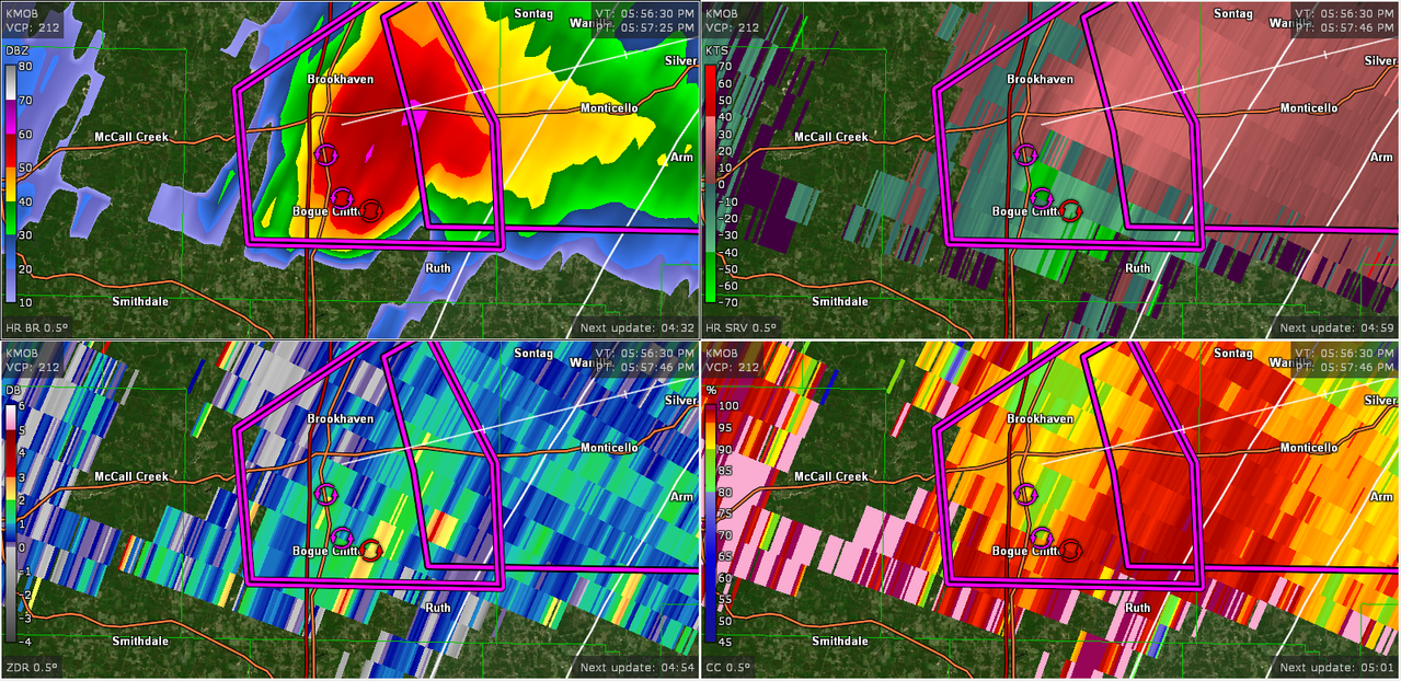
At 804 PM CDT, a confirmed large and destructive tornado was located
near Enterprise, or near Brookhaven, moving east at 35 mph.
TORNADO EMERGENCY for Monticello, Silver Creek. This is a
PARTICULARLY DANGEROUS SITUATION. TAKE COVER NOW!
HAZARD...Deadly tornado.
SOURCE...Radar confirmed tornado.
IMPACT...You are in a life-threatening situation. Flying debris may
be deadly to those caught without shelter. Mobile homes
will be destroyed. Considerable damage to homes,
businesses, and vehicles is likely and complete destruction
is possible.
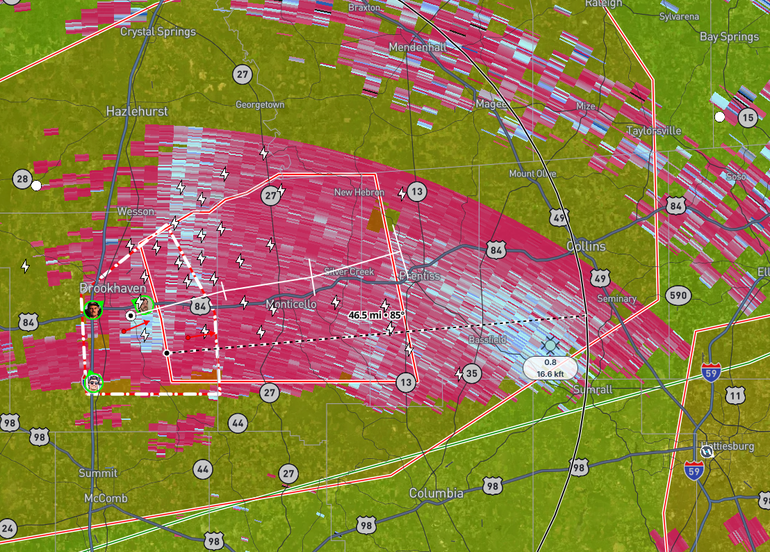
The tornado will be near...
East Lincoln around 810 PM CDT.
Sontag around 815 PM CDT.
Monticello and Wanilla around 820 PM CDT.
Silver Creek around 830 PM CDT.
Oma around 835 PM CDT.
New Hebron around 840 PM CDT.
PRECAUTIONARY/PREPAREDNESS ACTIONS...
To repeat, a large, extremely dangerous, and potentially deadly
tornado is on the ground. To protect your life, TAKE COVER NOW! Move
to an interior room on the lowest floor of a sturdy building. Avoid
windows. If in a mobile home, a vehicle or outdoors, move to the
closest substantial shelter and protect yourself from flying debris.
&&
LAT...LON 3153 9035 3165 9039 3170 9029 3170 9026
3172 9023 3173 9019 3176 9013 3176 8995
3143 8987 3143 9033
TIME...MOT...LOC 0104Z 248DEG 29KT 3153 9037
TORNADO...OBSERVED
TORNADO DAMAGE THREAT...CATASTROPHIC
MAX HAIL SIZE...<.75 IN