
slenker
Member
Cell near Hickman KY may be one to watch, not super impressive looking but it is rotating
EDIT: nah, it’s completely cooked.
EDIT: nah, it’s completely cooked.
Last edited:
Follow along with the video below to see how to install our site as a web app on your home screen.
Note: This feature may not be available in some browsers.
Agreed. Tomorrow we’ll know for sure but my gut says what we saw over Batesville was a failed cycle rather than a touchdown.Thankfully I think the Arkansas storm got damaged by convection behind it so unless it goes more discrete again it probably won't produce another strong tornado.
Can't MCS have classic supercells embedded in them? Don't think the tornado threat is gone even if it's quiet right now.Batesville, AR storm was undercut by the main line/front. Storms further in northeast AR are outflow dominant. Maybe something can spin up along the leading edge west of Dyersburg, TN. Storms in central TN are anemic being on the eastern edge of the moisture/instability plume. The line across OH/IN continues a downward trend, especially as it catches the swath of showers and storms that developed out ahead of it. Not a lot going for the event as of now...
Yes they canCan't MCS have classic supercells embedded in them? Don't think the tornado threat is gone even if it's quiet right now.
Finally TOR warned, but not observed... then again, this is NWS Memphis we're dealing with. No surprise.Not as big now, was bigger. Now finally warned.
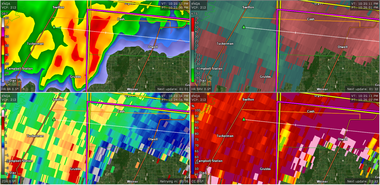
Ah yes good old Memphis nws..Finally TOR warned, but not observed... then again, this is NWS Memphis we're dealing with. No surprise.
edit: finally upgraded to observed just as I posted this