• Welcome to TalkWeather!
    We see you lurking around TalkWeather! Take the extra step and join us today to view attachments, see less ads and maybe even join the discussion.
    CLICK TO JOIN TALKWEATHER

Severe Weather 3-25

Kds86z

Member
Messages
10,225
Reaction score
24,329
Location
Pennsylvania


Upgrade to enhanced risk. Yet again the hotspot so far this year…

SUPERCELL WIND PROFILES ARE EVIDENT IN FORECAST SOUNDINGS, WITH
ENLARGED/FAVORABLY CURVED LOW-LEVEL HODOGRAPHS ALONG THE FRONT AND
45+ KT EFFECTIVE SHEAR MAGNITUDES. GIVEN STRONG DEEP-LAYER FLOW,
HODOGRAPHS ALSO ARE ELONGATED/STRAIGHT. SUPERCELLS PRODUCING LARGE
TO VERY LARGE HAIL (GREATER THAN 2+ INCH) ARE POSSIBLE, EVEN WITH
POTENTIALLY ELEVATED CONVECTION TO THE COOL SIDE OF THE BOUNDARY. IF
ANY SUPERCELL CAN STAY TO THE WARM SIDE OF THE SURFACE FRONT AND
MAINTAIN SURFACE-BASED STATUS, A TORNADO RISK IS ALSO POSSIBLE
(POSSIBLY STRONG TORNADOES). WITH TIME, CONVECTION IS EXPECTED TO
DEVELOP INTO A LINE OR BOWING SEGMENTS GIVEN ORIENTATION OF
DEEP-SHEAR VECTORS TO THE SURFACE BOUNDARY. GIVEN STRENGTH OF
850-700 MB FLOW AND STEEP LAPSE RATES, DAMAGING WINDS GUSTS ARE
POSSIBLE.

Mod can you pin? Thanks @MichelleH
 
The question as a whole I believe and what could be holding them back from issuing a 10% is how long the storms become isolated before gelling into a line.
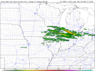
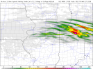
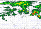
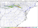
True; model output has the line behind the storms catching up in NW Ohio.
 
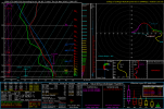
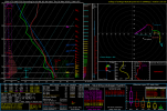
Sounding west of Mansfield, OH:
1774463465806.png
1/3/2000 had an F3 in Owensboro, KY, while 9/20/2000 featured the Xenia, OH F4.
 
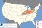
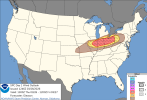
day1otlk_1300.pngday1probotlk_1300_torn.pngday1probotlk_1300_hail.pngday1probotlk_1300_wind.png
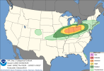
...THERE IS AN ENHANCED RISK OF SEVERE THUNDERSTORMS ACROSS PARTS OF
THE MIDWEST/OHIO VALLEY...

...SUMMARY...
Scattered severe thunderstorms are expected this afternoon and
evening across parts of the Midwest and Ohio Valley. Large to very
large hail, a few tornadoes, and severe/damaging winds all appear
likely.

...Mid Mississippi Valley into the Midwest/Ohio Valley...
Upper ridging will remain suppressed over the Southwest and southern
Plains today as rather strong westerly mid/upper-level jets
overspread the Upper Midwest/Great Lakes. A weak mid-level shortwave
trough that has encouraged occasional lighting flashes with
convection across the NE Panhandle earlier this morning will
approach the mid MS Valley/Midwest by late this afternoon. A cold
front is forecast to move southward through the day across
IL/IN/southern Lower MI/OH as a weak surface reflection develops
eastward into central PA through this evening. A partially
modified/shallow Gulf airmass will stream northward ahead of this
front, with surface dewpoints generally expected to remain in the
mid 50s to no more than low 60s.

Current expectations are for thunderstorms to quickly develop along
the length of the front from central IL eastward into IN, southern
Lower MI, and northern OH by 19-22Z as diurnal heating erodes
lingering convective inhibition. Even though low-level moisture
should remain fairly shallow/limited ahead of the front, a narrow
corridor of 1000-1500 J/kg of MLCAPE (locally stronger possible) is
forecast to be present by mid to late afternoon given sufficient
daytime heating and steepening mid-level lapse rates. Strong flow of
50-60+ kt in the 700-500 mb layer and related deep-layer shear of
similar magnitude will support organized updrafts and supercells
with this initial development. Large to very large hail (2+ inches
in diameter possible) should occur as long as a supercell mode can
be maintained.

A fairly quick transition to more linear structures appears likely
given the frontal forcing, with an increasing threat for scattered
to numerous severe/damaging winds as one or more clusters spreads
east-southeastward across much of the OH Valley into western/central
PA through the late afternoon and evening. Given the forecast
strength of the low to mid-level flow, isolated gusts of 75+ mph may
occur. There is a threat for a few tornadoes as well with both
supercells and embedded mesocirculations within the linear clusters,
although a well-mixed boundary layer should increase LCLs this
afternoon as surface temperatures generally warm into the 70s and
80s. Some guidance suggests a locally greater threat for tornadoes
(perhaps a couple strong) may exist across parts of northern/central
IN/OH with any supercells that can be maintained along/ahead of the
cold front, as low-level shear should be greater across these areas
in association with a 35-50 kt west-southwesterly low-level jet.
However, confidence in this scenario occurring was too low to
include higher tornado probabilities with this update.

Farther west across the mid MS Valley (MO into eastern KS), there is
lower confidence in warm sector thunderstorm development this
afternoon and evening due to the presence of a stronger cap.
However, elevated convection may occur along/behind the cold front
this evening, with strong deep-layer shear and sufficient MUCAPE
conditionally supporting supercells with mainly a threat for large
hail. Have made only minor changes to the Slight Risk across this
area based on latest guidance trends.
 
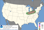
View attachment 52292View attachment 52293View attachment 52294View attachment 52295
...THERE IS AN ENHANCED RISK OF SEVERE THUNDERSTORMS ACROSS PARTS OF
THE MIDWEST/OHIO VALLEY...

...SUMMARY...
Scattered severe thunderstorms are expected this afternoon and
evening across parts of the Midwest and Ohio Valley. Large to very
large hail, a few tornadoes, and severe/damaging winds all appear
likely.

...Mid Mississippi Valley into the Midwest/Ohio Valley...
Upper ridging will remain suppressed over the Southwest and southern
Plains today as rather strong westerly mid/upper-level jets
overspread the Upper Midwest/Great Lakes. A weak mid-level shortwave
trough that has encouraged occasional lighting flashes with
convection across the NE Panhandle earlier this morning will
approach the mid MS Valley/Midwest by late this afternoon. A cold
front is forecast to move southward through the day across
IL/IN/southern Lower MI/OH as a weak surface reflection develops
eastward into central PA through this evening. A partially
modified/shallow Gulf airmass will stream northward ahead of this
front, with surface dewpoints generally expected to remain in the
mid 50s to no more than low 60s.

Current expectations are for thunderstorms to quickly develop along
the length of the front from central IL eastward into IN, southern
Lower MI, and northern OH by 19-22Z as diurnal heating erodes
lingering convective inhibition. Even though low-level moisture
should remain fairly shallow/limited ahead of the front, a narrow
corridor of 1000-1500 J/kg of MLCAPE (locally stronger possible) is
forecast to be present by mid to late afternoon given sufficient
daytime heating and steepening mid-level lapse rates. Strong flow of
50-60+ kt in the 700-500 mb layer and related deep-layer shear of
similar magnitude will support organized updrafts and supercells
with this initial development. Large to very large hail (2+ inches
in diameter possible) should occur as long as a supercell mode can
be maintained.

A fairly quick transition to more linear structures appears likely
given the frontal forcing, with an increasing threat for scattered
to numerous severe/damaging winds as one or more clusters spreads
east-southeastward across much of the OH Valley into western/central
PA through the late afternoon and evening. Given the forecast
strength of the low to mid-level flow, isolated gusts of 75+ mph may
occur. There is a threat for a few tornadoes as well with both
supercells and embedded mesocirculations within the linear clusters,
although a well-mixed boundary layer should increase LCLs this
afternoon as surface temperatures generally warm into the 70s and
80s. Some guidance suggests a locally greater threat for tornadoes
(perhaps a couple strong) may exist across parts of northern/central
IN/OH with any supercells that can be maintained along/ahead of the
cold front, as low-level shear should be greater across these areas
in association with a 35-50 kt west-southwesterly low-level jet.
However, confidence in this scenario occurring was too low to
include higher tornado probabilities with this update.

Farther west across the mid MS Valley (MO into eastern KS), there is
lower confidence in warm sector thunderstorm development this
afternoon and evening due to the presence of a stronger cap.
However, elevated convection may occur along/behind the cold front
this evening, with strong deep-layer shear and sufficient MUCAPE
conditionally supporting supercells with mainly a threat for large
hail. Have made only minor changes to the Slight Risk across this
area based on latest guidance trends.
looks like they pushed the enhanced risk a bit south, which is fair because i didnt really see anything for parts of northern/northeastern illinois other than a small hail risk when storms start to fire off.
 
Back
Top