• Welcome to TalkWeather!
    We see you lurking around TalkWeather! Take the extra step and join us today to view attachments, see less ads and maybe even join the discussion.
    CLICK TO JOIN TALKWEATHER

Severe Weather Threat June 15-23

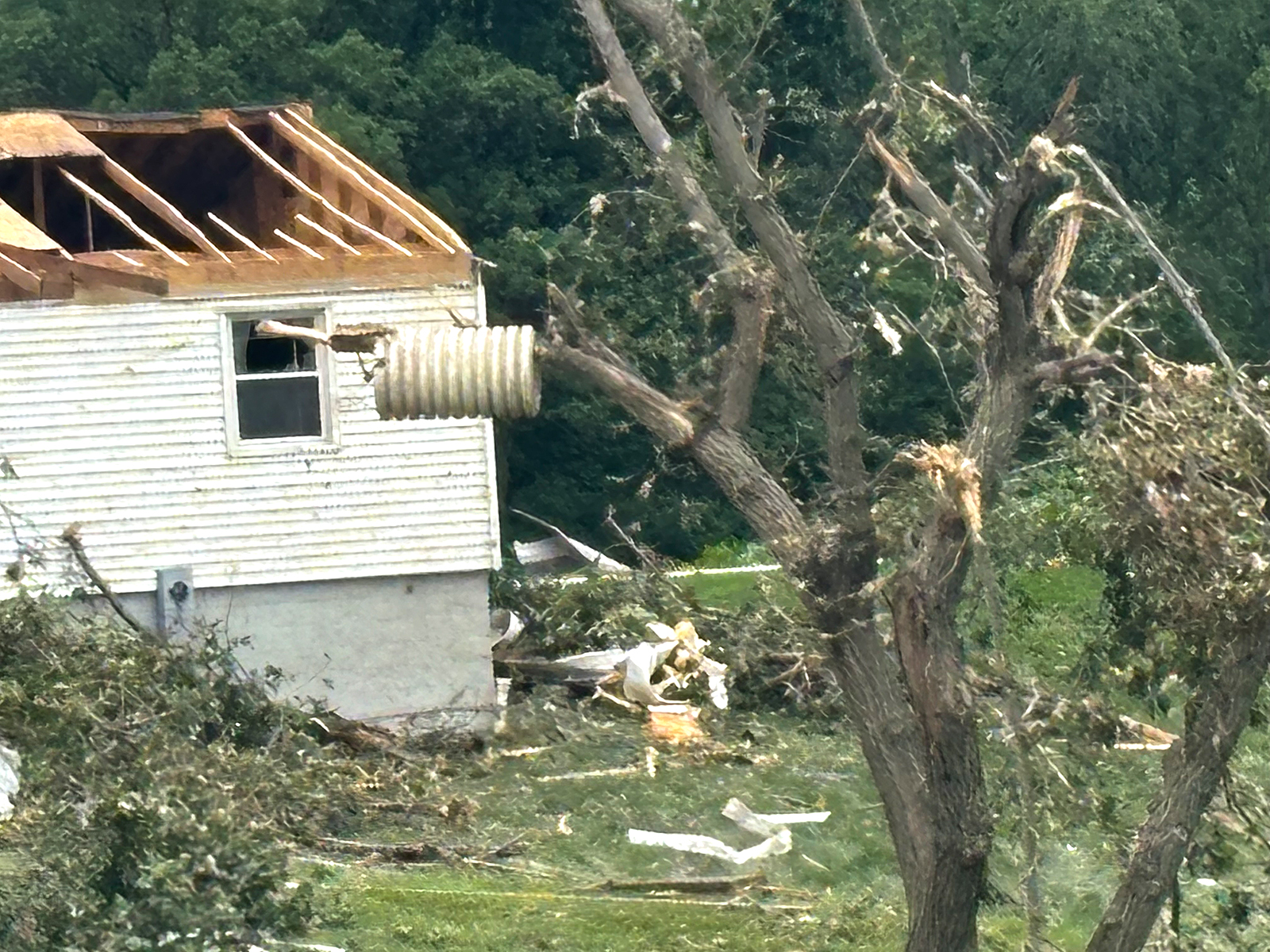
Last EF3 tornado in North Dakota was August 27th, 2016, but I hadn't realized it had been 15 years since the last EF4 in North Dakota which was on June 17th, 2010. You actually had 2 EF4 tornadoes that day.

That day is pretty much the gold standard of events for the northern Plains/upper Midwest crowd (on a par with Pilger four years later, although no individual storm went quite that nuts, there were far more tornadic storms overall). Unfortunately for me it occurred a few years before I had the financial resources and free time to chase outside of local spotting events. May 30, 2022 teased that level of potential several days out and I had it and the next day off, but it soon became pretty clear from CAM solutions that it had devolved into an excessively forced, linear mess and I sat it out with no regrets.


Well, the moderate was for wind...and ironically it looks like the derecho decreased sharply in intensity shortly after entering the western edge of the moderate risk area (although I have heard there was some significant damage in northern MN that may not yet be reflected on this map). I think 10 hatched for tornado was pretty solid given the conditional nature of the supercell potential in eastern ND.
 
Well, the moderate was for wind...and ironically it looks like the derecho decreased in intensity shortly after entering the western edge of the moderate risk area. I think 10 hatched for tornado was pretty solid given the conditional nature of the supercell potential in eastern ND.
Oh absolutely agree @CheeselandSkies. SPC did phenomenal.
 
Well, the moderate was for wind...and ironically it looks like the derecho decreased sharply in intensity shortly after entering the western edge of the moderate risk area (although I have heard there was some significant damage in northern MN that may not yet be reflected on this map). I think 10 hatched for tornado was pretty solid given the conditional nature of the supercell potential in eastern ND.
Threat was too conditional for mdt tornado. 10% hatched was the right balance. Yeah broyles/hart for that first day 1. @CheeselandSkies
 
I feel like this could end up to be a Greensburg supercell situation, where we get multiple EF3 rated tornadoes from the same supercell.
It is needing to be noted that it’s possible that two tornadoes impacted the property in that video.

The first enderlin tornado occluded near it and then a second tornado spun up from the west and smashed into it on an easterly track.
 
I feel like this could end up to be a Greensburg supercell situation, where we get multiple EF3 rated tornadoes from the same supercell.
Curb Your Enthusiasm Bingo GIF by Jason Clarke
 
Back
Top