Navigation
Install the app
How to install the app on iOS
Follow along with the video below to see how to install our site as a web app on your home screen.
Note: This feature may not be available in some browsers.
More options
-
Welcome to TalkWeather! We see you lurking around TalkWeather! Take the extra step and join us today to view attachments, see less ads and maybe even join the discussion. CLICK TO JOIN TALKWEATHER
You are using an out of date browser. It may not display this or other websites correctly.
You should upgrade or use an alternative browser.
You should upgrade or use an alternative browser.
Severe Weather Threat May 17-19, 2025
- Thread starter Brice W
- Start date
There's only the one storm, but who knows what else could come from the west..
Also going until 5 AM. Guessing the SPC believes more cells are going to fire up
Someone's very, very late. It has hail with it and is a slow mover but yeah
Lol if that would have been earlier it could have been bad for the DFW metro.
This guy needs to re-examine his priorities.
CheeselandSkies
Member
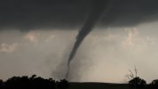
Got in late last night and before going to bed loaded the 4K camcorder video from Sunday at Arnett onto my computer.
These are just some raw frame snaps. The timelapse from the GoPro clipped to my side window is gonna be unreal. It caught nearly the entire life cycle from birth until it moved offscreen (just a minute or two before roping out), with the spectacular storm structure above.
When I posted them on Stormtrack I said "This is my Rozel." Then I realized it was 12 years later to the same date!


Central Ohio Wx
Member
CheeselandSkies
Member
Nice, Andy!
Forgot to mention, there was another tornado after this one appeared to end; after I (and a hundred or more other chasers) had packed up and started going north on US 283 back toward the junction with 60. Not 100% sure if it was a new tornado or a reintensification of the original one, but the condensation funnel dipped down a few more times for about 3-4 minutes before completely roping out, looking north across 60 from 283.
I managed to botch all my camcorder video of this phase (focus was off); but the entire sequence was captured on my front-facing dashboard GoPro.


Last edited:
Nice, Andy!
Forgot to mention, there was another tornado after this one appeared to end; after I (and a hundred or more other chasers) had packed up and started going north on US 283 back toward the junction with 60. Not 100% sure if it was a new tornado or a reintensification of the original one, but the condensation funnel dipped down a few more times for about 3-4 minutes before completely roping out, looking north across 60 from 283.
I managed to botch all my camcorder video of this phase (focus was off); but the entire sequence was captured on my front-facing dashboard GoPro.
View attachment 42722View attachment 42723View attachment 42724

You must've been very close to me for these shots.
CheeselandSkies
Member
Nice! If you saw a black Highlander with WI plates, that was me.
Amazing shots! The third and fourth shots are particularly beautiful. Love the close ups too.Got in late last night and before going to bed loaded the 4K camcorder video from Sunday at Arnett onto my computer.
These are just some raw frame snaps. The timelapse from the GoPro clipped to my side window is gonna be unreal. It caught nearly the entire life cycle from birth until it moved offscreen (just a minute or two before roping out), with the spectacular storm structure above.
When I posted them on Stormtrack I said "This is my Rozel." Then I realized it was 12 years later to the same date!
View attachment 42689View attachment 42690View attachment 42691View attachment 42692View attachment 42693View attachment 42694View attachment 42695View attachment 42696
Look at all that dust. What a photogenic tornado. Can't imagine how it felt seeing it in person. absolute skyscraper!
tornado examiner
Member
Casually one of the most violent plains tornadoes we’ve seen since matador.
Western_KS_Wx
Member
Earlier this morning I went and photographed some incredible damage to vegetation along this road 3 miles south of Grinnell, Kansas. The tornado left virtually not a blade of grass standing in the ditch on either side of the road, and in some locations scoured the ground to where there was just dirt behind. The centerline of the tornado was made remarkably visible as well in the soil as it crossed the road. I also noticed an old corn field to the south had essentially all dead corn stalks removed and several sizeable gouges in the soil from intense vortices. Some of these cornstalks were speared into the side of the ditch like lawndarts. This was the most intense scouring I was able to find along the path.


Holy hell.Earlier this morning I went and photographed some incredible damage to vegetation along this road 3 miles south of Grinnell, Kansas. The tornado left virtually not a blade of grass standing in the ditch on either side of the road, and in some locations scoured the ground to where there was just dirt behind. The centerline of the tornado was made remarkably visible as well in the soil as it crossed the road. I also noticed an old corn field to the south had essentially all dead corn stalks removed and several sizeable gouges in the soil from intense vortices. Some of these cornstalks were speared into the side of the ditch like lawndarts. This was the most intense scouring I was able to find along the path.
View attachment 42798View attachment 42799View attachment 42800View attachment 42801View attachment 42802View attachment 42804View attachment 42803View attachment 42807View attachment 42806View attachment 42805
I thought I was looking at an empty farm field full of corn husks with the way the grass is clumped in some of these pics. This is seriously nuts.Earlier this morning I went and photographed some incredible damage to vegetation along this road 3 miles south of Grinnell, Kansas. The tornado left virtually not a blade of grass standing in the ditch on either side of the road, and in some locations scoured the ground to where there was just dirt behind. The centerline of the tornado was made remarkably visible as well in the soil as it crossed the road. I also noticed an old corn field to the south had essentially all dead corn stalks removed and several sizeable gouges in the soil from intense vortices. Some of these cornstalks were speared into the side of the ditch like lawndarts. This was the most intense scouring I was able to find along the path.
View attachment 42798View attachment 42799View attachment 42800View attachment 42801View attachment 42802View attachment 42804View attachment 42803View attachment 42807View attachment 42806View attachment 42805
Lake Martin EF4
Member
Oh...uh....wow......
Potentially my first EF5 pick of the year! Does Wichita take ground scouring into account for high end tornadoes like this?
Potentially my first EF5 pick of the year! Does Wichita take ground scouring into account for high end tornadoes like this?
tornado examiner
Member
No doubts at all that the plevna tornado reached EF5 intensity and would have leveled any town it hit directly.
But…will likely be finalized as an EF3…
Rip.
But…will likely be finalized as an EF3…
Rip.
Lake Martin EF4
Member
I've stated previously that I highly doubt Plevna was EF5, for similar reasons that I doubt Hollister 2024 was violent.No doubts at all that the plevna tornado reached EF5 intensity and would have leveled any town it hit directly.
You want an EF5 candidate, you're going to the Grinnell contextual damage.
Tbf, I've only seen one image of damage from Plevna that was impressive (the tree damage at some unknown location, looked like they were partially debarked). I want to see aerials of the damage, which no one has done yet.No doubts at all that the plevna tornado reached EF5 intensity and would have leveled any town it hit directly.
But…will likely be finalized as an EF3…
Rip.
The Grinnell damage above though, is pretty insane. It's definitely at least of EF4 intensity for the ground to look like that.


