
Navigation
Install the app
How to install the app on iOS
Follow along with the video below to see how to install our site as a web app on your home screen.
Note: This feature may not be available in some browsers.
More options
-
Welcome to TalkWeather! We see you lurking around TalkWeather! Take the extra step and join us today to view attachments, see less ads and maybe even join the discussion. CLICK TO JOIN TALKWEATHER
You are using an out of date browser. It may not display this or other websites correctly.
You should upgrade or use an alternative browser.
You should upgrade or use an alternative browser.
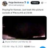
Severe Weather Threat May 17-19, 2025
- Thread starter Brice W
- Start date
When's the next day 2 come out?
warneagle
Member
Yeesh. Reminds me of Rolling Fork.Add This to the list of night time devils this year…
jiharris0220
Member
Talk about dodging a nuke.
Kds86z
Member
Central Ohio Wx
Member
Wow, that looks very similar to Greensburg 2007:Add This to the list of night time devils this year…

Update:
As of 530 AM, high-based showers and isolated storms are beginning
to develop within a mid-level moisture plume extending
northeastward from the Texas Hill Country. This trend should
continue this morning, with perhaps a couple of more robust cells
capable of small hail and gusty winds becoming established after
sunrise. The main severe weather risk is still from mid afternoon
into the evening, and will primarily be in North Texas where an
environment supportive of supercells will be in place with all
severe hazards possible. Overnight CAM guidance remains fairly
subdued in terms of convective coverage within the forecast area,
while coarser global guidance continues to support widespread
convection ahead of the dryline. Current thinking is still that
CAMs are underdone, and have gone more bullish with PoPs than most
short-term guidance would indicate given there will be strong
synoptic forcing available and a very unstable buoyant sector
ahead of the dryline. The remainder of the trends outlined below
remain valid for today`s event.
Out of the FWD office
Kds86z
Member
Wow, that looks very similar to Greensburg 2007:
View attachment 42510
And this was the final wedge of a few from the storm.
Kds86z
Member
…. 
Kds86z
Member
To put into perspective how unusual (but not unprecedented) the 10% SIG TOR hatch is for North MS/Mid-South during the month of May, the last time we had a 10% SIG TOR hatch or greater equivalent was on May 25th, 2011 and again on May 2nd, 2010.
AJS
Member
Talk about dodging a nuke.
That’s luck at its finest right there. Curious to see the overall path of the tornado.
Kds86z
Member
TornadoFan
Member
Kds86z
Member
Haha we did it at the same time. great minds think alike
DanLarsen34
Member
It seems like multiple high profile chasers were frustrated with the early portion of the event and either called it or were ready to when then the Greensburg cell initiated and became surface based.
Brad Arnold mentioned on stream last night that he booked a hotel in OKC for that reason only to end up on the southern KS cell until it died. Reed and his team called it early as well
jiharris0220
Member
Speaking of which.It seems like multiple high profile chasers were frustrated with the early portion of the event and either called it or were ready to when then the Greensburg cell initiated and became surface based.
Brad Arnold mentioned on stream last night that he booked a hotel in OKC for that reason only to end up on the southern KS cell until it died. Reed and his team called it early as well