• Welcome to TalkWeather!
    We see you lurking around TalkWeather! Take the extra step and join us today to view attachments, see less ads and maybe even join the discussion.
    CLICK TO JOIN TALKWEATHER

Severe Weather Threat 4/28-4/30

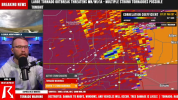
The SPC has been on a tear nailing these events, and I see why they went with the outlook they did, but these sort of Atmospheric Anti-Climax forecasts are just a part of it.

It’s probably recency bias, and nothing climatological, but it does seem like a theme of the past few years have been these set ups where everything just goes linear right off the bat or it’s just overcrowded with crapvection.
 
We may not be done. Central and northeastern Iowa is an area to watch into the overnight. Remember, this event had a major overnight feature to it. We're talking into the early morning hours. We're far from done I believe.
Fortunately no, the dry line will be already half way across the state by 1am, and even then instability will be far too low for anything substantial.

Also, directional shear will do nothing but increase as the associated low departs and will orientate the surface winds even further northeast.
 
This has to be the least active moderate risk day we’ve had in quite a while.
And considering the potential for what could've happened today, it's likely for the best that this was how things ultimately ended up playing out.
 
This has to be the least active moderate risk day we’ve had in quite a while.
It’s ironic, but the yesterday actually had far higher ceilings than today ever had.

Yesterday only had a strong inversion and nebulous forcing holding back full scale tornado outbreak from occurring, and obviously the convection that managed to overcome the inversion produced multiple significant tornadoes.

Meanwhile today had both failure modes (although not quite as substantial) plus the directional shear and parallel jet streak/PBL wind orientation, and even a weaker LLJ.

The violent tornado parameter today peaked the lowest out of the past two days.
 
Last edited:
Honestly if I were chasing this day would have my attention over Monday, very impressive parameters if storms can get going. I was also suprised the SPC doesnt even have an outline.

View attachment 40266

Lots of time to change but as of now I am not super impressed with Monday... SW surface winds, sw to ne dryline orientation and SW upper level flow screams messy storm mode and lower low level shear to me
not to toot my own horn but this ended up being a really good call. I’m not one to armchair QB the SPC bc I think they have some of the hardest jobs in the world but I think the only thing I would disagree with was the day 3 moderate and the sig tor language with so many evident failure modes.
 
Back
Top