
notsoencrypted
Member
Accidentally posted this is Severe Weather 2025 earlier.
If you want to see a textbook example of an overreliance on models, just look at our most popular local weather station here in Iowa this morning. Completely underselling the threat. This is the same station that was focusing on a different storm as a tornado entered Greenfield last year. I hope this doesn't make people overly complacent.
Oof. That's rough to see.
 Thankfully it looks like KEYC in Mankato, which covers a decent bit of northern IA, is taking it seriously:
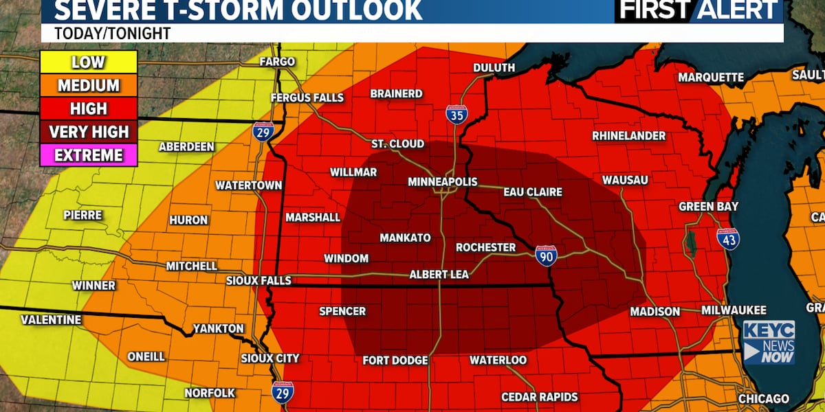
Dangerous storms, tornadoes possible today
Today could be a very dangerous severe weather day, especially for central and southern Minnesota and northern Iowa. Conditions are right for thunderstorms that could produce strong, violent tornadoes, 70 to 80 mph wind gusts and hail the size of golf balls or larger.
 www.keyc.com


