• Welcome to TalkWeather!
    We see you lurking around TalkWeather! Take the extra step and join us today to view attachments, see less ads and maybe even join the discussion.
    CLICK TO JOIN TALKWEATHER

Severe WX April 1-2 (overnight) Severe Weather Event

What caught us off guard though was the increased activity after dark in MS/TN.
It doesn't really surprise me that much. LCLs had already substantially lowered, instability still remained quite potent in that region, and the LLJ likely suddenly spiked a second time around then. Environment was still fairly untapped because of the lack of properly organized convection that moved through the area.
 
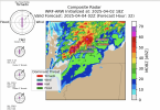
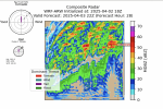
Phew, after a very long HIGH risk day yesterday, we move on to today and Friday which are ENH days currently. Here's the latest run of my WRF-ARW model. It's at 2 km high-resolution, so more detailed than the HRRR and can resolve explicit convection a bit easier than HRRR, and it's centered on Memphis, TN and about a 200-ish mile wide area around it. (It looks like the threat area in the latest outlook has shifted a bit west, but I ran the model overnight while sleeping.)

I'll focus on the Composite radar and the Threat Potential Overlay. As you've seen before, the storm profiles are off to the left.

It looks to be mostly random showers and a few thunderstorms until 22Z (5 PM) tonight, where a medium tornado threat manifests.

1743684702337.png


Fast forward to 0z (7 PM CDT). A hail and isolated tornado threat continues.


1743684911171.png


Now at 02z (9 PM CDT).


1743684993537.png


At midnight tonight, flooding looks to be the primary concern.Things largely die off in intensity until Friday later.

1743685071755.png


Action begins picking up between 3 PM and 4PM on Friday, with a tornado threat:

1743685283948.png


At 8 PM on Friday, Limited threats exist in SE Missouri.

1743685334495.png


At 9 PM Friday, a hail and tornado threat continues in S Missouri and N Arkansas.

1743685467348.png


At 2 AM, there's weak tornado potential moving into Arkansas proper. Pretty potent squall line coming through.

1743685566222.png


By 5 AM Saturday morning, the squall line has agonizingly not move very much.

1743685639372.png


My Threat Overlay algorithm mainly focuses on 3-hour rainfall totals to estimate the risk of Flash Flooding, so it's largely undergoing the Flood threat here. Case in point, here's the *additional* rainfall that is forecast on the model over the next 72 hours, on top of what has already fallen. Remember this is at 2 km resolution, so it's able to resolve convective storms with pretty high accuracy. The orange areas are locations *in the next 72 hours* it forecasts 10 + inches. The light red are locations it forecasts 15+ inches. And the dark red are locations it forecasts 20+ inches! Insane! This is going to be a major problem, especially in Arkansas.


1743686022749.png


Overall, the threat for the next 72 hours (at least through mid-day on Saturday) looks to be an order of magnitude less than what we saw yesterday/last night. Definitely much less potential, I feel. Saturday evening/night will have to be a future model run, but the flood threat looks to be the primary concern, along with isolated tornadoes (some of which could be strong).
 
Broyles deserves a gosh darn medal of honor for that forecast or whatever medal he can get. He was pretty much spot on with the high risk placement from the very start. Absolutely brilliant forecast, I really want to personally ask him what his thought process was during that forecast because I don't think anyone could've come close to nailing that in the way he did.
Once again, I will not tolerate any future Broyles slander. Dude clearly knows what he's doing, contrary to historical popular belief.
 
Once again, I will not tolerate any future Broyles slander. Dude clearly knows what he's doing, contrary to historical popular belief.
From what I've seen, he doesn't care about the floor or the ceiling too much. He bases his forecasts on the most probable outcome, which is bold, but for an extremely smart man like Broyles, it seems to work often.
 
I just caught up on everything that went down after i went to bed...man, these are some awful sights. Especially for Selmer, Slayden and Grand Junction. My prayers go out to all of those impacted by last night's horrible storms
 
Wow. When I saw 20 extra pages from when I went to bed to this morning I knew the outbreak must have continued.

I need to eat a big plate of crow because honestly I was pretty vocal in asking what in the hell the SPC and Broyles was seeing exactly to upgrade yesterday to a high risk. Well, that’s why Broyles and the SPC are the best in the world and I’m just some hobbyist on the internet with an opinion that was very wrong on yesterday.

It seems like so many of the town names we’ve heard over the years got mentioned last night. Holly Springs, Selmer, all of Arkansas. Just an absolute historic outbreak
 
Back
Top