• Welcome to TalkWeather!
    We see you lurking around TalkWeather! Take the extra step and join us today to view attachments, see less ads and maybe even join the discussion.
    CLICK TO JOIN TALKWEATHER

Severe WX Severe Weather Threat 3/14-3/16

Surprised the D3 moderate isn't further north yet as well, and I'm sure it'll be expanded, but the general public loses sight of the fact that a D3 enhanced hatch is absolutely nothing to be complacent in any way about, either; as has been discussed in this thread, many of our worst tornadoes have been well outside the highest risk areas
 
Surprised the D3 moderate isn't further north yet as well, and I'm sure it'll be expanded, but the general public loses sight of the fact that a D3 enhanced hatch is absolutely nothing to be complacent in any way about, either; as has been discussed in this thread, many of our worst tornadoes have been well outside the highest risk areas
And most of our High Risk days here actually didn't go Moderate until some point on the Day 2, and at least a couple... November 10, 2002 being one, jumped straight from Day 2 SLGT to Day 1 HIGH.
 
Surprised the D3 moderate isn't further north yet as well, and I'm sure it'll be expanded, but the general public loses sight of the fact that a D3 enhanced hatch is absolutely nothing to be complacent in any way about, either; as has been discussed in this thread, many of our worst tornadoes have been well outside the highest risk areas
You may want to go back a few pages to understand the moderate was most likely placed too far to the south. Fred commented on exactly this topic
 
And most of our High Risk days here actually didn't go Moderate until some point on the Day 2, and at least a couple... November 10, 2002 being one, jumped straight from Day 2 SLGT to Day 1 HIGH.
then one has 5/3/99 where ya go "eh meh event to holy crap vio tor day heres a high" prob one of the wildest d1 upgrades ever ngl

than and prob august 10th 2020 going slt to a moderate
 
I am new to the board, and am very amateur in my meteorological knowledge. As someone who lives on the central Georgia/Alabama border, what is the main reason why these things seem to die off at the border in general? Obviously there are examples where it breaks through, there have been 8-9 confirmed tornadoes in Troup County in the last 15 years, but it seems as if they fade quickly. Is it the Florida peninsula inhibiting moisture return, or a mix of things? Thanks, really enjoying the discussion on this one and we are still getting prepared as this one looks like it wont fade as quickly as others.
There are a number of reasons why this can occur. Moisture issues (source region quality issues or the warm sector getting pinched with eastward extent), upper level support lifting, and even cold air damming. But even with those issues, we've seen a lot of severe weather. We'll take Cherokee County, which is squarely in North Central Georgia for example. They have had 17 confirmed tornadoes since 2000, most due to discrete or embedded supercells.
 
I will preface what I'm about to say with the fact that I am in no way in any shape, form, or fashion whatsoever calling for a 2011 repeat or close to it. Now, to my actual message lol... Since the 2011 outbreak when Ray Charles saw that coming days in advance, we've seen upgrades to the RAP, the HRRR, the GFS, and the Euro change parameterizations and other things that may help them score better on the verification stats for something like 500mb heights, but it's been a significant detriment to their ability to handle the reality of things like cap strength, convective initiation and coverage, boundary layer moisture vs mixing, low-level wind response to pressure and height falls, and all these other things that are life and death critical to accurate severe weather forecasting. I honestly feel like if we were hypothetically handed another 4/27/2011 down to a minute by minute, mile by mile carbon copy of it, none of the models would handle it correctly until 24 hours and less, some not even at 00-01 hr, and it's very possible that some of your most well-respected mets that saw 2011 for what it was days in advance wouldn't be able to do the same with confidence with today's current state of model framework.
I feel like the flip side of this is that 2011 is such a hallowed date that even if every forecast model spit out parameters equal to that date ahead of time everyone would be reluctant to compare it, and understandably! I feel confident that the next Super Outbreak will only be determined in retrospect.
 
I will preface what I'm about to say with the fact that I am in no way in any shape, form, or fashion whatsoever calling for a 2011 repeat or close to it. Now, to my actual message lol... Since the 2011 outbreak when Ray Charles saw that coming days in advance, we've seen upgrades to the RAP, the HRRR, the GFS, and the Euro change parameterizations and other things that may help them score better on the verification stats for something like 500mb heights, but it's been a significant detriment to their ability to handle the reality of things like cap strength, convective initiation and coverage, boundary layer moisture vs mixing, low-level wind response to pressure and height falls, and all these other things that are life and death critical to accurate severe weather forecasting. I honestly feel like if we were hypothetically handed another 4/27/2011 down to a minute by minute, mile by mile carbon copy of it, none of the models would handle it correctly until 24 hours and less, some not even at 00-01 hr, and it's very possible that some of your most well-respected mets that saw 2011 for what it was days in advance wouldn't be able to do the same with confidence with today's current state of model framework.
Not Ray Charles "catching the stray" lol-- in all seriousness, I guess that may explain some of the, mmm, conservatism in the D2/3 outlooks from this morning, at least when it comes to the MDT for central AL to not be more north? Really, I guess you're getting at the fact that we need more Ray Charleses who've lived the setups v. those who rely on, albeit very good modeling and data collection programs? That's a concerning point you've made because in my very finite wisdom, better tech = better forecasts, but better tech also leads to overreliance on the same?
 
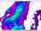
12Z HRW-FV3 in full on supercell printer mode over the lower MS Valley-Mid South for Friday evening-overnight. Would be very dangerous, however it also wants to convect quite early on Saturday over MS/AL, which verbatim would put some limitations on how far north the warm sector can destabilize.
“try and find a non-convectively contaminated sounding on the HRW-FV3 challenge ”(IMPOSSIBLE)
 
I feel like the flip side of this is that 2011 is such a hallowed date that even if every forecast model spit out parameters equal to that date ahead of time everyone would be reluctant to compare it, and understandably! I feel confident that the next Super Outbreak will only be determined in retrospect.

I mean...a lot of the forecast soundings for the Plains on 5/20/19 had instability and shear parameters similar to 4/27, which is why a high risk was put out, and the wording was hit so hard, and look what a little unforeseen thermodynamic fly in the ointment (everyone's favorite term) did to that day.

That's why I don't really buy into the high risk hype anymore. The upgrade at 1630Z on 3/31/23 didn't change my thinking at all. Thought it was gonna be an active and dangerous day regardless.
 
Hate that the "nightmare" scenario of violent tornadoes after dark looks likely. I've been pushing everyone I know to purchase weather radios all week, and I'm hoping I made a difference.
Good on ya. Recommending the same thing for my folks. Yeah, this could be a very dangerous night for Georgia.
 
OK, enough. I think at this point we all realize that SPC will not be issuing a high risk today for D3. Can we stop talking about it and save posts for information about the actual threat? Once this event starts popping off Friday, if you post something blatantly off topic for this thread (and I see it) it will be removed and you will get a warning. If you do it again, you will be removed. @Mike S , is that ok with you? This is too dangerous a threat for bickering imo, and as such, I think a one warning rule should apply during the event.

I know this goes against my "overmoderation" viewpoint, but over the next 72 hours, let's make an effort to stay on point.

Post data
Opine
Ask questions
Give answers

On topic.

If an argument starts brewing, take it to PM. Or start a thread on the subject. Or use carrier pigeons. ANYWHERE but here.
 
12Z HRW-FV3 in full on supercell printer mode over the lower MS Valley-Mid South for Friday evening-overnight. Would be very dangerous, however it also wants to convect quite early on Saturday over MS/AL, which verbatim would put some limitations on how far north the warm sector can destabilize.
The LLJ would be in place quite early though.
 
Back
Top