• Welcome to TalkWeather!
    We see you lurking around TalkWeather! Take the extra step and join us today to view attachments, see less ads and maybe even join the discussion.
    CLICK TO JOIN TALKWEATHER

Severe WX Severe Weather Threat 3/14-3/16

Don't forget, SPC now (since last August) does the 1930Z regularly scheduled Day 3 update. Should be out in an hour or so, although of course for most of you all eyes are on Saturday. I'm still trying to cling to hopium of a decent Iowa or northern Illinois chase setup for Friday although that's looked less likely for a couple of days now.
 
I mean the overall mid-level synoptic pattern with placement of main and secondary lows is decently similar to 4/27, but there is a lot more going into it than just the 500mb pattern (and 4/27 being in late April had vastly better thermos lol) - people shouldn't compare the two just because of that

Every severe event got compared to the Super Outbreak til 4/27 so we'll probably keep having the 4/27 comparisons every setup until another outbreak eclipses it
Better thermals, but also later in the season. Weather it's an analog or not doesnt make that much difference as the environment before is very different along with seasonal differences. For example, 4/27 had incredibly high shear for late April in Alabama, while the shear Saturday very high, its not as uncommon in mid March.
 
Two very different approaches as evidenced by video titles in my YouTube "Subscriptions" feed just now:

Trey (Convective Chronicles): "Forecast Discussion - March 12, 2025 - Significant Severe Weather Likely This Weekend"

Reed: "LIVE EMERGENCY UPDATE ON TORNADO OUTBREAK THREAT FRIDAY-SATURDAY"
 
I kind of wish people wouldn't use the phrase "generational outbreak." I get that it emphasizes the rarity of those events, but it can give the false impression that since we just had one 14 years ago, there won't be another one for 2-3 more decades. The date of the last "generational outbreak" has no bearing on when the next one occurs. The next one could be this year or it could be 100 years from now.
 
Don't forget, SPC now (since last August) does the 1930Z regularly scheduled Day 3 update. Should be out in an hour or so, although of course for most of you all eyes are on Saturday. I'm still trying to cling to hopium of a decent Iowa or northern Illinois chase setup for Friday although that's looked less likely for a couple of days now.
Friday looks concerning too in my view. MDT definitely possible.
 
Two very different approaches as evidenced by video titles in my YouTube "Subscriptions" feed just now:

Trey (Convective Chronicles): "Forecast Discussion - March 12, 2025 - Significant Severe Weather Likely This Weekend"

Reed: "LIVE EMERGENCY UPDATE ON TORNADO OUTBREAK THREAT FRIDAY-SATURDAY"
You gotta hand it to Reed, though, he’s very smart and good at predicting tornadoes. He’s yucky but still haha
 
Please correct me if I’m wrong here, while caps are not necessarily good, it can spare some areas right? When and where the cap breaks is where all hell breaks loose though.
Amateur here, but the cap is essentially an elevated layer of stable air that prevents thunderstorm development (putting a lid on it). As the air below the cap warms up and destablizes then yes, it can break through the cap and turn into explosive convection. If the atmosphere below the cap doesn’t sufficently warm up or or destablize then it could fail to break through leading to no thunderstorm development.

Meteorologist and experts feel free to hold me honest.
 
The morning of April 27th, we were trying to respond to a structure fire to help a neighboring FD.
Then the early morning line hit us, knocking my turnout gear off the catwalk of our engine ( the gear and the bag it was in weighs about 50 lbs ) it bounced it like a ball across a field.

We came to a stop. Blinding rain and wind. We carry a 1,000 gallons of water and our engine was rocking like a sailboat at sea.

Luckily a car behind us saw the bag blow off and picked it up for me.
We couldn't get to the fire. Trees were blocking Every single road to it.
 
Last edited:
Amateur here, but the cap is essentially an elevated layer of stable air that prevents thunderstorm development (putting a lid on it). As the air below the cap warms up and destablizes then yes, it can break through the cap and turn into explosive convection. If the atmosphere below the cap doesn’t sufficently warm up or or destablize then it could fail to break through leading to no thunderstorm development.

Meteorologist and experts feel free to hold me honest.
Basically yes, but the cap can be broken by other means than just daytime heating. Cooling aloft can help, also a low level feature such as a front or boundary can break the cap.
 
Amateur here, but the cap is essentially an elevated layer of stable air that prevents thunderstorm development (putting a lid on it). As the air below the cap warms up and destablizes then yes, it can break through the cap and turn into explosive convection. If the atmosphere below the cap doesn’t sufficently warm up or or destablize then it could fail to break through leading to no thunderstorm development.

Meteorologist and experts feel free to hold me honest.
Basically yes, but the cap can be broken by other means than just dautine heating. Cooling aloft can help, also a low level feature such as a front or boundary can break the cap.
I'm ready to say that we're looking at a major tornado outbreak IF the current model depictions persist.
Matt we all appreciate you guys. I know the current environment for yall isn't the easiest and I am sure this weekend will bring additional challenges. I am afraid you are right.
 
Last edited:
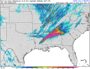
Trey mentioned it in his video, and it's closely related to our other thermo profiles Saturday, but I really don't like that we will likely be having favorable LRs over a large area on Saturday.
1741805987045.png
 
Back
Top