
- Thread starter
- #101
Navigation
Install the app
How to install the app on iOS
Follow along with the video below to see how to install our site as a web app on your home screen.
Note: This feature may not be available in some browsers.
More options
-
Welcome to TalkWeather! We see you lurking around TalkWeather! Take the extra step and join us today to view attachments, see less ads and maybe even join the discussion. CLICK TO JOIN TALKWEATHER
You are using an out of date browser. It may not display this or other websites correctly.
You should upgrade or use an alternative browser.
You should upgrade or use an alternative browser.
2024 Global Tropical Cyclone Discussion
- Thread starter Atlantic
- Start date
- Thread starter
- #102

- Thread starter
- #103


- Thread starter
- #104
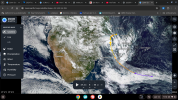
Back on track, here is that frontal-origin system:

The National Hurricane Center has not noticed this system yet. I imagine if they did, they would pull the Marginal Subtropical Systems policy like the did with the 01L/Unnamed from 2023 and give it a low chance for development.
The National Hurricane Center has not noticed this system yet. I imagine if they did, they would pull the Marginal Subtropical Systems policy like the did with the 01L/Unnamed from 2023 and give it a low chance for development.
- Thread starter
- #105

- Thread starter
- #106
That frontal origin system reach’s its best look on December 21st.
Here’s an image of it:

And compare it to the Eastern ATL low on April 21st this year;

The convection seems to be better with the system in December, and I wouldn’t be surprised to see it designated a Tropical Storm or Subtropical Storm in reanalysis.
Here’s an image of it:
And compare it to the Eastern ATL low on April 21st this year;
The convection seems to be better with the system in December, and I wouldn’t be surprised to see it designated a Tropical Storm or Subtropical Storm in reanalysis.
- Thread starter
- #107
- Thread starter
- #108

- Thread starter
- #109
Since Invests 92S and 94S are still active, I will continue talking about them here as they were designated in 2024.
94S looks to try to pull a Freddy and track all the way to Madagascar and get obliterated, while 92S could try to become a weak TC briefly while moving ENE initially.
94S looks to try to pull a Freddy and track all the way to Madagascar and get obliterated, while 92S could try to become a weak TC briefly while moving ENE initially.
- Thread starter
- #110
Found out Zoom Earth added another South Atlantic storm track today.
Here are the one I knew about before, in chronological order by year;
Hurricane Catarina


And the new track, Subtropical Storm Yakecan from 2022:

Second photo and third photo both say 50Q, but they had actual names.
First 50Q and second photo is Tropical Storm Anita of 2010.
Second 50Q and third picture is Subtropical Storm Arani of 2011.
Here are the one I knew about before, in chronological order by year;
Hurricane Catarina
And the new track, Subtropical Storm Yakecan from 2022:
Second photo and third photo both say 50Q, but they had actual names.
First 50Q and second photo is Tropical Storm Anita of 2010.
Second 50Q and third picture is Subtropical Storm Arani of 2011.
- Thread starter
- #111
Invest 94S, which was designated on December 29th, 2024, was upgraded to Moderate Tropical Storm Dikeledi, the last 2024 disturbance to become a tropical cyclone, and the first TC of 2025 on top of that.
Here is a video of Dikeledi’s journey from being Invest 94S the entire time and being Tropical Low 08U in the Australian Region to becoming a Freddy-wannabe by crossing the entire Southern Indian Ocean as a disturbance to becoming a TC on approach to Madagascar:
(iPhone video unavailable, cannot figure out upload)
- Thread starter
- #112
- Thread starter
- #113
Dikeledi is currently in the Mozambique Channel, and is likely to reintensify into a Category 2-equivelent Tropical Cyclone as it rounds the high pressure ridge in place to the west.
Attachments
- Thread starter
- #114
Intense Tropical Cyclone Dikeledi's journey is at honorable end as of now according to the JTWC. Dikeledi carried 2024 as the final system to be designated as an Invest in 2024, but it also became a TC in 2025.
Dikeledi was first noted by the BoM in the Australian Region as a tropical low (Tropical Low 08U) on December 28th, 2024. The JTWC designated it as Invest 94S late on December 29th, 2024. The system moved generally westwards over several days and eventually crossed 90E and the BoM handed responsilblity of 08U\94S to Meteo-France. Meteo-France initally noted it as an area of disturbed weather on January 7th. Then they upgraded it to Area of Disturbed Weather 05 later on that day. On January 8th the JTWC upped the 24-48 hour chances to high while Meteo-France upgraded it to Tropical Depression 05. Later on on January 8th or 9th Meteo-France designated it Moderate Tropical Storm Dikeledi while the JTWC maintained a high chance invest. Dikeledi moved westwards and made landfall on January 11th in northern Madagascar as a Tropical Cyclone by Meteo-France and as a Category 2-equivent storm. It weakened to a Severe Tropical Storm over the northern Mozambique Channel but quickly regained Category 2\Tropical Cyclone status and made a secord landfall in Mozambique as a Category 2\Tropical Cyclone on January 13th. It moved a little further inland than expected and weaken to a TS\STS. It moved back out over water and slowly regained intensity while moving south-southeast. While passing south of Madagascar it gained Category 3 status by the JTWC and Intense Tropical Cyclone by Meteo-France on January 15th. Dikeledi was according to Meteo-France the furthest south a storm reached Intense Tropical Cyclone status on record, beating out Intense Tropical Cyclone Anggrek (An Australian Region storm that crossed 90E) The peak hed for 6-12 hours as Dikeledi was moving into cooler waters and higher wind shear. Dikeledi began weakening and continued to weaken though January 16th and fell to TS status on January 17th. The storm turned post-tropical\extratropical by 3PM EST on January 17th.

Dikeledi at peak intensity early on January 15th as a Category 3 storm.
Dikeledi was first noted by the BoM in the Australian Region as a tropical low (Tropical Low 08U) on December 28th, 2024. The JTWC designated it as Invest 94S late on December 29th, 2024. The system moved generally westwards over several days and eventually crossed 90E and the BoM handed responsilblity of 08U\94S to Meteo-France. Meteo-France initally noted it as an area of disturbed weather on January 7th. Then they upgraded it to Area of Disturbed Weather 05 later on that day. On January 8th the JTWC upped the 24-48 hour chances to high while Meteo-France upgraded it to Tropical Depression 05. Later on on January 8th or 9th Meteo-France designated it Moderate Tropical Storm Dikeledi while the JTWC maintained a high chance invest. Dikeledi moved westwards and made landfall on January 11th in northern Madagascar as a Tropical Cyclone by Meteo-France and as a Category 2-equivent storm. It weakened to a Severe Tropical Storm over the northern Mozambique Channel but quickly regained Category 2\Tropical Cyclone status and made a secord landfall in Mozambique as a Category 2\Tropical Cyclone on January 13th. It moved a little further inland than expected and weaken to a TS\STS. It moved back out over water and slowly regained intensity while moving south-southeast. While passing south of Madagascar it gained Category 3 status by the JTWC and Intense Tropical Cyclone by Meteo-France on January 15th. Dikeledi was according to Meteo-France the furthest south a storm reached Intense Tropical Cyclone status on record, beating out Intense Tropical Cyclone Anggrek (An Australian Region storm that crossed 90E) The peak hed for 6-12 hours as Dikeledi was moving into cooler waters and higher wind shear. Dikeledi began weakening and continued to weaken though January 16th and fell to TS status on January 17th. The storm turned post-tropical\extratropical by 3PM EST on January 17th.
Dikeledi at peak intensity early on January 15th as a Category 3 storm.
IdaliaHelene
Member
- Messages
- 475
- Reaction score
- 610
- Location
- Keaton Beach
- Special Affiliations
- SKYWARN® Volunteer
- ARRL Member
report of the 57th Session of Typhoon Committee:
The Committee noted the email from United Kingdom Met Office for concern about the
name of JEBI and requested Republic of Korea to provide a replacement name.
Jebi just got retired due to the request from the UK Met Office because it means "f*uck" in Serbo-Croatian. Jebi was submitted by South Korea and means barn swallow in Korean. JFL at the met office