• Welcome to TalkWeather!
    We see you lurking around TalkWeather! Take the extra step and join us today to view attachments, see less ads and maybe even join the discussion.
    CLICK TO JOIN TALKWEATHER

Severe Weather 2024

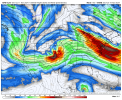
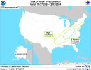
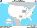
Apparently there may have been a couple possible tornadoes today in Michigan? I'm not good at telling the nuances of true TDSs from other radar artifacts so I don't know for sure looking at these screenshots. I do know the Newark one was warned for a bit.


I think we need to start discussing next week. Hearing from a few different people murmurings of a possible severe threat with a very strong cold front.
SPC is hinting at it and now the 12z GFS is too. It makes sense as well as we should be getting a significant pattern change near or during Thanksgiving week.
 

Attachments

  • gfs-deterministic-conus-z500_speed-1985200.png
    gfs-deterministic-conus-z500_speed-1985200.png
    226.4 KB · Views: 0
Not sure where exactly to put this, but EURO now goes up to 15 day or 360hrs for 0z/12z runs, 140hrs for 6z/18z.
 
Interested to see the incoming trough interacting with the tropical moisture from Sara, but currently my thinking is that Sara is going to limit the moisture advection that troughs like that usually have.

Good to see these again. Sign of a major pattern shift.
 
Thanksgiving Week looks interesting for both high wind, heavy rain/flash flooding, and severe weather potential. This time we won't have a tropical system to steal the moisture. SPC is already giving little hints.

"Low-level moisture across the CONUS
will with not return with any abundance until around Mon/D7. At that
time, models indicate a broad belt of west to southwest flow aloft
with general troughiness across the West, and rising heights
possibly over the East. Mid to upper 60s F are forecast from eastern
TX into the lower MS Valley, beneath increasing flow aloft which
could potentially yield areas of strong storms in the warm advection
regime."
 

Attachments

  • cmc-ensemble-all-avg-conus-t2m_f_anom-2557600.png
    cmc-ensemble-all-avg-conus-t2m_f_anom-2557600.png
    113.8 KB · Views: 0
  • gfs-ensemble-all-avg-conus-t2m_f_anom-2600800.png
    gfs-ensemble-all-avg-conus-t2m_f_anom-2600800.png
    117.1 KB · Views: 0
  • precip_probhazards_d8_14_contours.png
    precip_probhazards_d8_14_contours.png
    325.9 KB · Views: 0
  • wind_probhazards_d8_14_contours.png
    wind_probhazards_d8_14_contours.png
    342.7 KB · Views: 0
Thanksgiving Week looks interesting for both high wind, heavy rain/flash flooding, and severe weather potential. This time we won't have a tropical system to steal the moisture. SPC is already giving little hints.
Oh, how lovely...i'm supposed to be riding to Columbus on that Thursday to spend a little over a week at my sister's house.
 
SPC eyeing the Thanksgiving timeframe for some possible severe weather, though many questions remain. For now, though, I'm enjoying the heck out of this cold weather.
Beyond this time frame, subtle differences exist regarding how
quickly the pattern may amplify, as ridging occurs over the West,
and a possible trough develops from the southern Plains into the
southeastern states. Any appreciable low-level moisture return and
destabilization would likely be tied to such a trough amplification,
which is low predictability. In short, a non-zero threat of severe
storms may develop over parts of the Gulf Coast states, Thu/D7 into
Fri/D8, as moisture increases and flow aloft remains strong.
 
Back
Top