Ledian
Member
Yikes, Sherman is about to get it
Follow along with the video below to see how to install our site as a web app on your home screen.
Note: This feature may not be available in some browsers.
Between the hail and damaging winds, surprised there's not a bunch of SVRs out there.Someone inform MEG we need a Severe Thunderstorm Warning for Monroe and Itawamba Counties

Another outflow boundary, albeit less visible, to the south of that one, moving north. They're gonna collide soon enough.Nice big outflow boundary off the Columbus site....
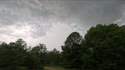
Town name is inaccurate; situation is not "all good"That's one nasty storm over Allgood.
View attachment 28575
The saga of photogenic "Plains-looking" European tornadoes continues. This one touched down near Szombathely, in Hungary today.
The NAM completely disagrees somehow, lolSome pretty intense soundings coming out of the 12z GFS for Thursday. Nearly 3000 J/kg of MUCAPE and >450 m2/s2 of effective SRH colocated with it in some parts of Iowa and southern Minnesota.
Damn, it really is 200Some pretty intense soundings coming out of the 12z GFS for Thursday. Nearly 3000 J/kg of MUCAPE and >450 m2/s2 of effective SRH colocated with it in some parts of Iowa and southern Minnesota.
2010***Damn, it really is 200