
Navigation
Install the app
How to install the app on iOS
Follow along with the video below to see how to install our site as a web app on your home screen.
Note: This feature may not be available in some browsers.
More options
-
Welcome to TalkWeather! We see you lurking around TalkWeather! Take the extra step and join us today to view attachments, see less ads and maybe even join the discussion. CLICK TO JOIN TALKWEATHER
You are using an out of date browser. It may not display this or other websites correctly.
You should upgrade or use an alternative browser.
You should upgrade or use an alternative browser.
Severe Weather Threat - June 11th-15th, 2023
- Thread starter Taylor Campbell
- Start date
- Thread starter
- Moderator
- #62
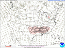
12z run of the CSU-MLP hazard prob forecast for tomorrow. Upward trend.

OHWX97
Member
The latest Day 2 Convective Outlook has increased the probability for tornadoes; 5% over much of the enhanced risk area.


Day 2 Convective Outlook
NWS Storm Prediction Center Norman OK
1230 PM CDT Tue Jun 13 2023
Valid 141200Z - 151200Z
...THERE IS AN ENHANCED RISK OF SEVERE THUNDERSTORMS FROM NORTHEAST
LA ACROSS CENTRAL MS AND AL AND INTO SOUTHWEST GA...
...SUMMARY...
Thunderstorms capable of producing all severe hazards, including
very large hail and tornadoes, are possible across much of the Lower
Mississippi Valley and Southeast States on Wednesday.
...Synopsis...
Upper pattern is forecast to feature a trough/ridge/trough pattern
within the northern stream over the northern CONUS and southern
Canada. This pattern is expected to remain largely unchanged
throughout the period, with only a modest eastward shift
anticipated. Anomalously strong mid-level flow will persist
throughout the southern stream, with 50 kt at 500-mb stretching from
the southern Plains across the Southeast and into the western
Atlantic Ocean. A series of convectively augmented shortwave troughs
are forecast to progress through this corridor of enhanced
westerlies. As such, the evolution of preceding convection will play
a large role in determining the strength and location of these
shortwaves.
Primary surface features influencing the severe potential on
Wednesday will be the convectively reinforced boundary extending
from west to east from northeast TX across the central portions of
the Southeast. Precise location of this boundary is in question,
given the likelihood its position will be modulated by thunderstorm
activity. The airmass in the vicinity of this boundary will be very
moist, with dewpoints likely in the low 70s, and warm, with
temperatures south of the boundary reaching the likely reaching the
low 90s by the early afternoon. This warm and moist air mass will
exist beneath a stout elevated mixed-layer, contributing to
strong/extreme buoyancy and the potential for severe thunderstorms.
...Northeast TX into Lower MS Valley and Southeast...
A confluence of unusually strong westerlies, steep mid-level lapse
rates, and ample low-level moisture/buoyancy will result in severe
potential across much of the Lower MS Valley and Southeast on
Wednesday. As mentioned in the synopsis, the general expectation is
for convectively reinforced boundary to extend from northeast TX
across the central portions of the Southeast. Given the overall
environmental conditions, severe thunderstorms will be possible on
both sides of this boundary.
High-resolution guidance offers varying solutions on how
thunderstorms evolve across this region, all of which are largely
dependent on how each model handles the preceding and/or early
period development. Even so, similarities within the guidance allow
for some insight towards potential convective evolution. A general
east-to-west timing is favored, with the earlier development
anticipated over southern AL and GA and the later development
anticipated during the early evening from northeast TX into the
Mid-South.
The early thunderstorms across southern AL and GA will likely trend
towards a more clustered/multicellular storm mode, but robust
updrafts capable of damaging gust and large hail are still possible.
The next round of storms is anticipated from the middle TN/northern
MS/northern AL vicinity, likely forced by a convectively augmented
shortwave trough moving through. These storms will likely be north
of the surface boundary, but environmental conditions will still be
very supportive of severe thunderstorms. Given the forcing, a more
multicellular/cluster storm mode is expected here as well. Even so,
steep mid-level lapse rates could still support the potential for
updrafts capable of very large hail. A trend towards more upscale
growth/linear organization is possible with these storms overtime,
with an attendant threat for damaging gusts as the resulting line
moves downstream.
Later afternoon/early evening storms are then forecast farther west,
from northeast TX into central MS/AL, along the outflow from earlier
storms. A more discrete mode is possible here, with supercells
capable of all severe hazards, including very large hail and
tornadoes, likely. As with other areas farther east, cold pool
amalgamation and a trend towards more linear structure is
anticipated after a few hours of a more discrete/cellular mode.
...Northern Mid-Atlantic into southern New England...
Modest air mass destabilization is expected across the region ahead
of an upper low drifting eastward/southeastward. One or more
north-south orientated convective lines are expected as ascent
attendant to this cyclone moves through. Buoyancy will be modest,
mitigated by weak lapse rates, but a few stronger gusts are possible
as these lines move northeastward.
..Mosier.. 06/13/2023

KevinH
Member
Uhm… NO!Substantial 45 corridor on SigTor ingredients on SREF for late evening Wednesday.
View attachment 20521
One possible limiting factor for tomorrow is the forecasted MCS that will move through during the early half of the day. It could choke off better instability north of it, and some runs show subsequent storms riding a boundary set up by it. That being said, atmospheric recovery is modelled to be swift tomorrow, so how much it will impact later convection remains to be seen.

- Thread starter
- Moderator
- #68
Not often you see this mPING report LOL.

billdurham
Member

billdurham
Member
This was in Mansfield, Texas last night..
Today:

THERE IS A MODERATE RISK OF SEVERE THUNDERSTORMS FROM NORTHEAST
LOUISIANA INTO CENTRAL/SOUTHERN MISSISSIPPI AND ALABAMA...AND
SOUTHWEST GEORGIA...
...SUMMARY...
Significant severe thunderstorms capable of producing all severe
hazards, including very large hail, swaths of intense wind
gusts/damage, and tornadoes, are possible across much of the Lower
Mississippi Valley vicinity and Southeast states today into tonight.
...ArkLaTex into the Southeast...
A complex forecast scenario with multiple rounds of intense severe
thunderstorms is expected to evolve today from the ArkLaTex into the
Lower MS Valley and Southeast vicinity. All severe hazards are
expected, including very large hail (some greater than 3 inches in
diameter), swaths of intense wind gusts (greater than 70 kt/80 mph),
and
tornadoes (a couple strong). As a result, a Moderate risk (level 4
of 5) has been introduced with the initial Day 1 outlook.
A series of mid/upper shortwave impulses are expected to shift east
across the Lower MS Valley and Southeast today in strong
west/southwesterly mid/upper flow. Consistency among various
forecast guidance shows at least 40-50 kt west/southwest flow
between 850-700 mb with 60+ kt at 500 mb. A plume of very steep
lapse rates will overspread the region, and 500 mb temperatures
around -10 to -11 C will be common. Forecast soundings indicate
midlevel lapse rates around 8-8.5 C/km over the region. These lapse
rates are near the 70-year period of record max according to
sounding climatology for this area of the country for this time of
year. Beneath these steep midlevel lapse rates and strong flow
aloft, a very moist airmass will be in place, with dewpoints
generally in the 68-75 F range. This will result in strong
destabilization with MLCAPE values exceeding 3000 J/kg stretching
from northeast TX through southern AL/GA/FL Panhandle vicinity.
Periods of early morning convection (prior to 12z this morning) are
expected across portions of the region. This activity may persist
through the morning into midday/early afternoon. This should result
in a convectively reinforced surface boundary oriented roughly west
to east from northern LA into central MS/AL/GA, though there is some
uncertainty in how far south this boundary will reside. Any
convection north of this boundary will be elevated, but still may
pose a risk for large hail. Near and south of the boundary, all
severe hazards are possible. Morning activity may see a relative
lull for a few hours during the afternoon as the initial shortwave
impulse shifts east and offshore the Atlantic coast before another,
stronger shortwave trough develops east across the region during the
evening.
The expectation is that multiple rounds of severe storms are
expected today into tonight. Locations may see a mix of supercells
and intense bowing segments during the day, with potential for a
derecho developing near the Lower MS Valley and shifting
east/southeast toward the central Gulf Coast vicinity during the
evening.
...North TX Vicinity...
A couple of supercells may be ongoing this morning across north
Texas. This activity will be capable of producing large to very
large hail before shifting east and weakening. Additional storms are
expected to develop during the afternoon and again pose a risk of
large hail. If trends continue, the Slight risk (level 2 of 5) may
need to be extended westward across portions of north TX.
...Northeast...
Modest air mass destabilization is expected across the region ahead
of an upper low. One or more north-south orientated bands of
convection are expected as ascent attendant to this cyclone moves
through. Instability will be modest, mitigated by weak lapse rates,
but a few stronger gusts and small hail are possible as these lines
move east/northeast through the afternoon.
Equus
Member
Wind driven interestingly enough, and a 10 hatch tornado to boot
ctopher5
Charter Member
I can’t recall a setup like this down here this time of the year. Will be an interesting day.
Sent from my iPhone using Tapatalk
Sent from my iPhone using Tapatalk
The last Moderate Risk for Mississippi in June was June 5, 2014.
KevinH
Member
Right…. I have not heard or seen the word “conditional” anywhere so we will have to wait and see how things pan outI don't think I have ever seen a Dixie setup like this so late in the year, ever. Really unusual.

ARCC
Member
I don't think I have ever seen a Dixie setup like this so late in the year, ever. Really unusual.
Fits the season we have had. Possibly the weirdest weather I’ve ever seen in May through June so far in my life.
- Moderator
- #78
Yeah, um, 10% hatched tornado risk...in Alabama...in the middle of June that's not associated with a tropical system?? What the heck is going on?
warneagle
Member
June is the new April
KevinH
Member
Dixie Alley doing whatever the hell it wants is what’s going on.Yeah, um, 10% hatched tornado risk...in Alabama...in the middle of June that's not associated with a tropical system?? What the heck is going on?
You know Dixie doesn’t follow the rules lol