Bama Ravens
Member
HRRR has the line coming through Birmingham around 6am tomorrow morning.


Severe weather ops take up a lot of time in the heat of the event, recording LSRs are generally put on low priority until the event is over.Well, it's just about completely reorganized into a squall line now.
Interesting that the SPC is still only reporting 6 tornadoes, mostly from this morning, but radar indicated rotation has suggested around 15-25 so far. I wonder why they're so far behind with the reports.
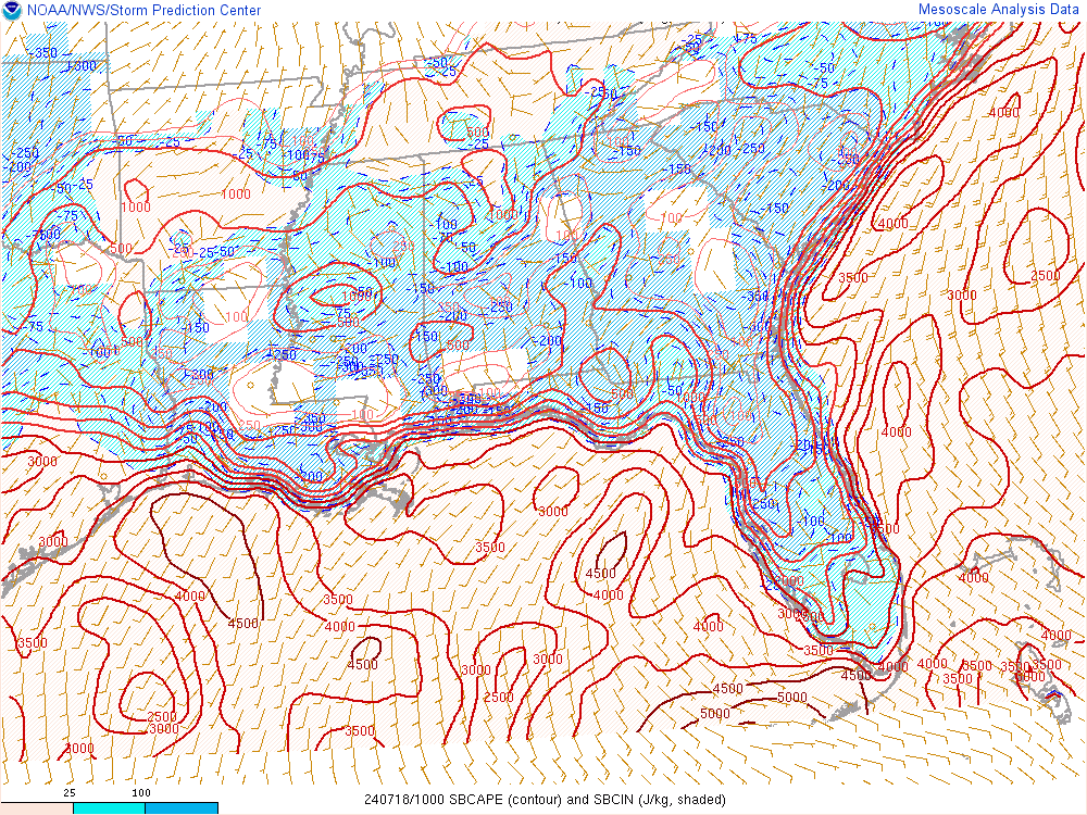
Please give a recap of their update when they finish.BMX is doing a live update on Periscope. They feel that the rain in MS is spreading eastward faster than anticipated. If it moves in, it obviously could impact the advection of higher CAPE values.
It can be replayed. I'll see if I can post a link.Please give a recap of their update when they finish.
It's actually several hours ahead of projections. Might actually allow for better thermo recovery tomorrow afternoon behind the MCS (assuming it gets out in time and doesn't stall).BMX is doing a live update on Periscope. They feel that the rain in MS is spreading eastward faster than anticipated. If it moves in, it obviously could impact the advection of higher CAPE values.
Satterwhite says that they think the steady rain behind the line will last long enough that they do not expect much redevelopment behind the line.It's actually several hours ahead of projections. Might actually allow for better thermo recovery tomorrow afternoon behind the MCS (assuming it gets out in time and doesn't stall).
If we can get better recovery behind for tomorrow, maybe some isolated severe storms tomorrow afternoon IF we can get convection to fire. These MCS's are woeful to forecast.