TuckerTerry
Member
Another shift east ... <sigh> Although good for NOLA.
Follow along with the video below to see how to install our site as a web app on your home screen.

Note: this_feature_currently_requires_accessing_site_using_safari

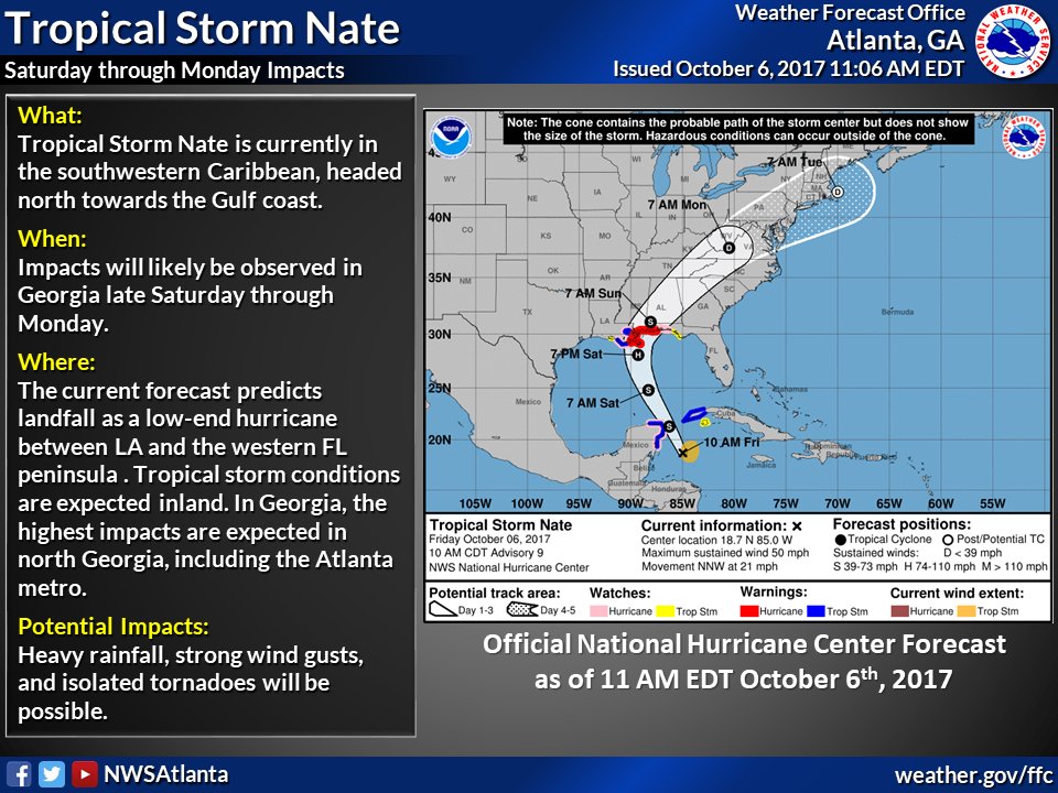
This thing is ramping up nicely. Recon keeps finding lower pressures every pass. Latest I've seen was 985, but thankfully its moving fast.
On another note, nearly all models are making landfall OUTSIDE of the cone of error around Barataria Bay/Plaquemines Parish. This looks like a huge bust for the NHC which went with hurricane models over our best globals. Seems boneheaded to me.
Keep us posted! I just activated the storm titles for those in the storm. You were the first to get one.Mid town Mobile checking in. Cloudy but otherwise pleasant. Just heard Nate is now 90 mph and moving at 26 mph. I'm looking for a model by LSU that projects storm surge that you can pull down to street level. I found it yesterday. I tried to find it this morning. I know it's not StormDat. Can anybody help? Thanks!