• Welcome to TalkWeather!
    We see you lurking around TalkWeather! Take the extra step and join us today to view attachments, see less ads and maybe even join the discussion.
    CLICK TO JOIN TALKWEATHER
Logo 468x120

The "Different" descriptions of the Tri-State Tornado 1925 through a time line

#1Skipper77

Member
Messages
2
Reaction score
7
Location
Richmond, Va
I have traveled to the different places that were hit by the Tri-State Tornado. Through my research I have made a Time Line of the "Different descriptions" of the Storm through the eyewitnesses accounts.
I also put this in the comment section as Triple Brown in the comment section of the Youtube weather channel tri-state tornado.

The various descriptions of the Tri-State Tornado
12:45 pm Eminence, Missouri - small tornado - less than 1/4 mile wide

Sam Flowers a Farmer who was released from jail for serving time for Attempted Murder was the First Victim of the TRI-State Tornado his head smashed by a falling tree.

1:00 pm Ellington, Missouri - large tornado - "A purple/blue Blackness" or "An awful commotion" plunging across the land- 1/2 -3/4 mile wide

Joe Wraith said that the Funnel itself was " Twisting and Turning simultaneously in different directions" before it got wrapped up in the fog.

1:15 pm Leadanna and Annapolis, Missouri "Smokey black fog" - over 2 miles wide "Tremendous" Speed. Leadanna and Annapolis were 2 miles apart from each other (north and south) the Tornado Struck both towns at the same time. Leadanna, Missouri did not rebuild. The Tornado swallowed Annapolis 100% and struck 25% of Leadanna simultaneously.

Beille, Missouri two massive funnels beside each other for 3.5 miles

Missouri and Illinois state lines at the Miss. River - Tumbling Black Cloud rolling like a Barrel- 1 mile wide

2:15 pm Gorham, Illinois - Pillar of Black Smoke (partially Rain wrapped)-1 mile wide

2:30 pm Murphysboro, Illinois - Black Clouds of Debris rolling on the Ground and rolling over each other- 1 mile wide

2:45 pm DeSoto, Illinois -A Churning Gray/Black Mass - Traveling at "tremendous" speed - 1.5 miles wide

Jan Bauer said it looked like a "Low Rolling Wind" and a "Gray Big Heavy Cloud" as it approached West Frankfurt.

3:10 pm West Frankfurt, Illinois - One Massive Wedge -1.5 miles wide and Two smaller funnels approaching

3:20 Eighteen, Illinois - Massive black clouds filling the whole Valley - 1/2 mile wide

Open Farm land - Wedge plus Down bursts or micro bursts made track 3 miles wide- Truncated Cone A.K.A upside down Mushroom (wider at the bottom than the top)

3:50 pm Parrish Illinois -Truncated Cone A.K.A Upside down Mushroom (wider at the bottom than the top) - 3/4 mile wide

4:00 pm Griffin, Indiana - 3 Funnels dancing around in the main Core while being covered by large debris cloud - 3/4 mile wide

4:10 pm - Open field - twisting pillar of Mud and Debris traveling at "Tremendous" speed- 1/4 mile wide Many Farms Destroyed

4:20-4:25 pm Princeton and Owensville, Indiana - A "Hideous" blackness approaching - 1/2 - 3/4 mile wide

4:30 pm - Rope Tornado dissipates

After 5pm the same SuperCell thunderstorm that give birth to the Tri-State Tornado also gave birth to an Very destructive mile wide F4 Tornado in Maukport, Indiana which borded near Kentucky.

De Soto time is exact other times maybe off by 1-2 minutes
 
Last edited:
Messages
2
Reaction score
3
Location
06082
I've been trying to come up with explanations for these descriptions. It sounds like at different times it was a microburst debris cloud, and at other times a wall cloud on the ground. What's really unusual is a good part of the path had these features. The 2011 Birmingham Tornado was a wall cloud wrapped wedge, but haven't seen a video yet of the "rolling barrel" appearance that seems like a microburst cloud. What's your opinion on these speculations of mine?
 

rolltide_130

Member
Messages
828
Reaction score
378
Location
Harvest, Alabama
Special Affiliations
I've been trying to come up with explanations for these descriptions. It sounds like at different times it was a microburst debris cloud, and at other times a wall cloud on the ground. What's really unusual is a good part of the path had these features. The 2011 Birmingham Tornado was a wall cloud wrapped wedge, but haven't seen a video yet of the "rolling barrel" appearance that seems like a microburst cloud. What's your opinion on these speculations of mine?

It's POSSIBLE (Although it's extremely hard to prove) that it was a tornado family that simply transitioned between funnels when a microburst was occurring. I don't know if anyone has done any real analysis on this however, as all we know is that there's a continuous 200+ mile swath of damage. I don't know whether or not we have any way to go in and analyze if there are some parts of the path where the damage was more consistent than that of straight line winds or not.
 

rolltide_130

Member
Messages
828
Reaction score
378
Location
Harvest, Alabama
Special Affiliations
Also, I know I'm beating a bit of a dead horse by saying this, but Hackleburg is by far our closest modern example to what the tri-state tornado may have been like in size, intensity, and appearance. Especially in this video below:


I would LOVE to be able to use some sort of computer software to artificially attempt to create an environment similar to the one that produced the Tri-State tornado and run it to see what happens, but it may be a long time before we can do that with very good accuracy.
 
Messages
2
Reaction score
3
Location
06082
Also, I know I'm beating a bit of a dead horse by saying this, but Hackleburg is by far our closest modern example to what the tri-state tornado may have been like in size, intensity, and appearance. Especially in this video below:


I would LOVE to be able to use some sort of computer software to artificially attempt to create an environment similar to the one that produced the Tri-State tornado and run it to see what happens, but it may be a long time before we can do that with very good accuracy.


Hadn't seen this vid. I agree, that's a close match visually, and the speed, path length, size and protracted f5 strength are also exceptional.

These 2 vids are worth comparing to 1925 as well. The first is the 2011 Tuscaloosa Tornado in Birmingham. The second is the 2011 Phil Campbell Tornado. The sound of the second vid turned up will send chills through you.


warneagle

Member
Messages
3,729
Reaction score
3,208
Location
Arlington, VA
Special Affiliations
  1. SKYWARN® Volunteer
100% agree about Hackleburg. I've seen several people make that comparison before and I think it's really pretty apt. I wish there were more photographic/video evidence of other similarly long-track tornadoes like Candlestick Park (caveats about it being a tornado family aside) so we could compare those as well, maybe there are some commonalities between the extremely long-track events that would shed some light on historical ones like the Tri-State.
 

#1Skipper77

Member
Messages
2
Reaction score
7
Location
Richmond, Va
I've been trying to come up with explanations for these descriptions. It sounds like at different times it was a microburst debris cloud, and at other times a wall cloud on the ground. What's really unusual is a good part of the path had these features. The 2011 Birmingham Tornado was a wall cloud wrapped wedge, but haven't seen a video yet of the "rolling barrel" appearance that seems like a microburst cloud. What's your opinion on these speculations of mine?
I believe if we look at the video shot by Bruce Boyd of the Xenia, Ohio Twister (1974) as it approached. You can clearly see multiple vortexes kick up a huge debris cloud. I think the rolling like a barrel appearance was the "massive" debris cloud as the storm approached which I believe will also explain the "Truncated Cone" appearance. Also the rolling like an "Amorphous Fog" can be explained from it in Missouri as it crossed the Mississippi River carrying all the water from rivers and ponds that it sucked up into Illinois.
Judith Cox (Gorham, Illinois) said she saw a "Great Wall of Black Smoke " while pushing "Great White Billows". The Forgotten Storm by Wallace Akins.
Rosetta Casey Adams (Gorham, Illinois) "It looked a SOLID SHEET. You could see WHITE STEAM in front of it". Death Rides the Sky by Angela Mason.

Sometimes I think it was a large and strong tornado that may have been produce by a Derecho that "SUSTAINED" it for a long time.
 

Lori

Administrator
Staff member
Administrator
Moderator
Messages
1,035
Reaction score
653
Location
Vandiver, AL
Special Affiliations
  1. SKYWARN® Volunteer
I believe if we look at the video shot by Bruce Boyd of the Xenia, Ohio Twister (1974) as it approached. You can clearly see multiple vortexes kick up a huge debris cloud. I think the rolling like a barrel appearance was the "massive" debris cloud as the storm approached which I believe will also explain the "Truncated Cone" appearance. Also the rolling like an "Amorphous Fog" can be explained from it in Missouri as it crossed the Mississippi River carrying all the water from rivers and ponds that it sucked up into Illinois.
Judith Cox (Gorham, Illinois) said she saw a "Great Wall of Black Smoke " while pushing "Great White Billows". The Forgotten Storm by Wallace Akins.
Rosetta Casey Adams (Gorham, Illinois) "It looked a SOLID SHEET. You could see WHITE STEAM in front of it". Death Rides the Sky by Angela Mason.

Sometimes I think it was a large and strong tornado that may have been produce by a Derecho that "SUSTAINED" it for a long time.
A derecho is possible...
 

Fred Gossage

Member
Meteorologist
PerryW Project Supporter
Messages
596
Reaction score
2,095
Location
Florence, AL
If that is the case, it is the only known (E)F5 tornado in recorded U.S. history to be produced by a non-cellular storm mode. Even (E)F4 cases outside of cellular/semi-cellular storm mode are very close to zero. That makes it exceedingly unlikely that it wasn't just one long-tracked supercell along the warm front just ahead of the surface low. Keeping it along the warm front and just ahead of the surface low would allow it to remain in a favorable environment for significant tornadoes for a long duration of time.
 

savid

Member
Messages
1
Reaction score
6
Location
Pennsylvania
I've been trying to come up with explanations for these descriptions. It sounds like at different times it was a microburst debris cloud, and at other times a wall cloud on the ground. What's really unusual is a good part of the path had these features. The 2011 Birmingham Tornado was a wall cloud wrapped wedge, but haven't seen a video yet of the "rolling barrel" appearance that seems like a microburst cloud. What's your opinion on these speculations of mine?
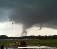
Here is a good example of exactly that, a wall cloud extending all the way to the ground. LCL on this storm must have been something insane like 75 feet. It has that "rolling barrel" appearance as well.


Ryan Heap

Member
Messages
1
Reaction score
2
Location
Ockley, Dorking
This forum really interested me as I wanted to show my own descriptions of what the Tornado looked like at Beille, Missouri and the reason why some eyewitnesses saw the double funnels. For me, I did theorize it may have taken the Dead Man Walking as it heads towards the Beille taking the similar shape to Jarrel and Cullman Tornado combined.
1693516419075.png
1693516453512.png

Here is the artist's take on the Dead Man Walking heading towards Beille from DISCORD.
1693516562817.png
 
Last edited:
Back
Top