• Welcome to TalkWeather!
    We see you lurking around TalkWeather! Take the extra step and join us today to view attachments, see less ads and maybe even join the discussion.
    CLICK TO JOIN TALKWEATHER

Severe WX Southern Severe Weather Threat: 3/9-3/10

We've had seven tornado reports thus far so I can't say today was totally a Forecasted Convective Amplification Deficiency, though many of the reports were over the Slight risk area in Arkansas. Better to have an Enhanced day that underperforms than one that kills 23 people.

The updraft helicity swaths certainly would've panned out if whatever kept these from dropping (low dew points/mixing? Certainly wasn't a problem with the shear) hadn't done so, so the forecasts weren't really off by much.
 
Mesoscale Discussion 0178
NWS Storm Prediction Center Norman OK
0720 PM CST Sat Mar 09 2019

Areas affected...Far Northeast MS...Northern AL...Middle TN

Concerning...Tornado Watch 15...16...

Valid 100120Z - 100245Z

The severe weather threat for Tornado Watch 15, 16 continues.

SUMMARY...Potential for isolated damaging wind gusts and/or a brief
tornado will continue across northeast MS, northern AL, and middle
TN for the next hour or two.

DISCUSSION...KGWX radar imagery has shown sporadic and brief
low-level rotation within the supercell now moving through southern
Lowndes county. However, latest scans have shown a trend towards
less low-level inflow/low-level organization with velocity values
decreasing and the previously observed ZDR arc losing definition.
Echo tops have also decreased over the past 30 min or so. Strongest
updraft (based on echo top) appears to be associated with the storm
in Franklin and Cobert counties in far northwest AL. Downstream air
mass from both of these storms suggests a gradual decrease in
intensity as instability wanes. Even so, given the strong low-level
shear, brief low-level organization capable of isolated wind
damaging and or a brief tornado remains possible.

Farther north, the convective line moving across middle TN has shown
modest intensification, particularly over the last 30 min or so.
Downstream thermodynamic environment is characterized by
temperatures in the 60s, dewpoints in the limited instability. Even
so, very strong low-level shear (sampled well by the 00Z BNA
sounding) could still support instances of damaging wind gusts and
perhaps a brief tornado before the line moves into cooler, more
stable air north of the warm front.
 
Perhaps due to their early occurrence, surveys are already coming in from AR and LA. Mostly short tracked EF0-1, but storm reports page notes two injuries in Arkansas in Pulaski/Lonoke counties.
 
I love having a so-called Forecasted Convective Amplification Deficiency! I love the radar wasn’t showing sky high debris on the C/C, reading gate to gate shear in high speeds and hearing radio feed of trapped people.
I’m thrilled we didn’t have posts on social media about a missing child or a missing engaged couple that are eventually found deceased!
I always pray that these ominous forecasts do not pan out!! I know you all do as well!!
But even an EF-0 can be a non-Forecasted Convective Amplification Deficiency to those that experience the fear and damage!!
 
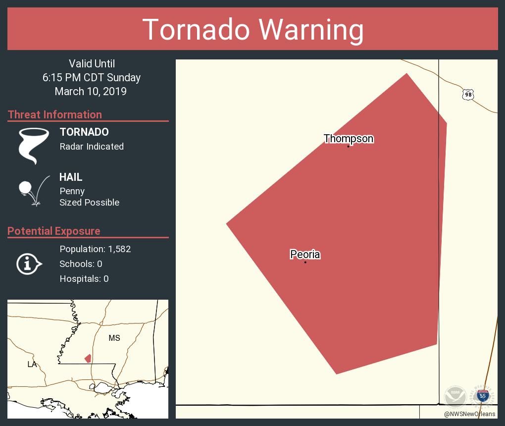
Tornado warning in southwest MS this afternoon.

D1VQtM1WwAQxNEF
 
We've had seven tornado reports thus far so I can't say today was totally a Forecasted Convective Amplification Deficiency, though many of the reports were over the Slight risk area in Arkansas. Better to have an Enhanced day that underperforms than one that kills 23 people.

The updraft helicity swaths certainly would've panned out if whatever kept these from dropping (low dew points/mixing? Certainly wasn't a problem with the shear) hadn't done so, so the forecasts weren't really off by much.

CAPE was borderline nonexistent on VSE soundings. Hackleburg CAPE was around 300 J/KG when the HRRR had them well over 1500 J/KG at the same time.

Surface thermos were, to be frank, abysmal for severe weather on Saturday looking at the post-event analysis. Why that was the case I'm not sure.. there was very little morning convection to interfere with destablization. Temperatures were fine, but dewpoints were in the upper 50s and low 60s in some areas. This one is a big mystery to me as even down into the Gulf, sfc dewpoints were really not that impressive. It wasn't just a case of them getting hung up to the south. They weren't terribly impressive period.

The sea surface temperatures in the Gulf might be something to look at. Perhaps in this case they weren't warm enough to support the amount of evaporation needed to raise the dewpoints higher than they did.
 
The sea surface temperatures in the Gulf might be something to look at. Perhaps in this case they weren't warm enough to support the amount of evaporation needed to raise the dewpoints higher than they did.
They’re well above normal. The problem was the SW low level trajectory of wind. It advected drier low level air in which mixed down.
 
Last edited:
They’re well above normal. The problem was the SW low level trajectory of wind. It advected drier low level air in which mixed down.

It seems like that's a consistent issue if memory serves. SSW to SW low level winds, unless it's a south AL setup like it was a week ago, tend to mix down dewpoints and put a damper on the threat.
 
Back
Top