05/06/26
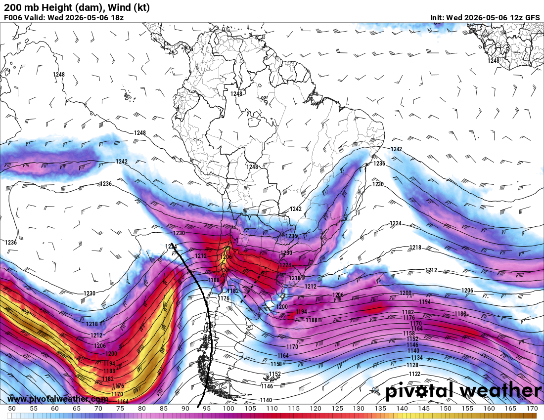
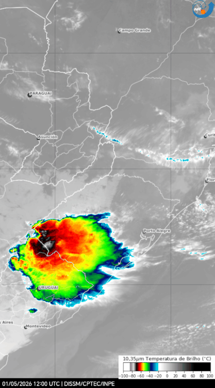
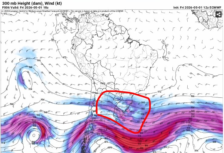
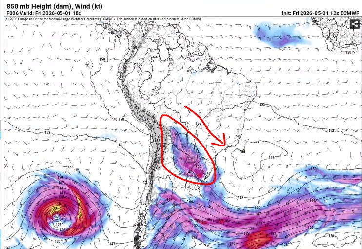
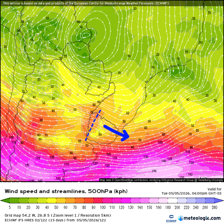
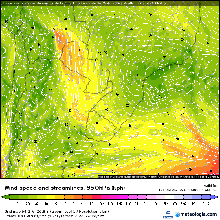
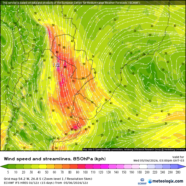
The left flank of a long-wave trough at 300–500 hPa, which had been moving across the South Pacific for days, was already crossing the Andes. Since this was a long wave, the response at lower levels would be the typical activation of the SALLJ downwind of the Andes, but this time it was much more intense and widespread, with winds of up to 90 km/h (50 kt) at 850 hPa, extending further south to central-eastern Argentina:
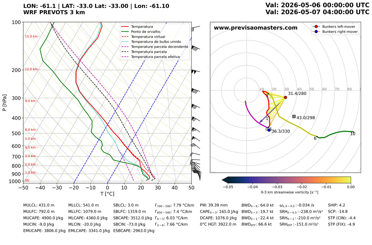
This created a highly tornadic environment for the Southern Hemisphere in the region, with strongly negative STP values that reached between -5 and -10:
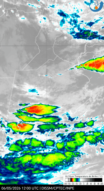
That same afternoon, a subtle short-wave trough at 500 hPa developed on the leeward side of the Andes, passing directly over that region and embedded within the main northwest-southeast flow of the primary long-wave trough:
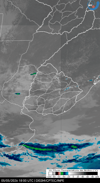
This marks the start of a series of discrete supercells across the province of Buenos Aires, bringing with them all the associated hazards, including microbursts and gorilla hail measuring ≥5 cm (≥2 in):
And, of course, tornadoes. At least one of these SCs managed to trigger a multi-vortex wedge tornado in the municipality of Las Flores, Buenos Aires:
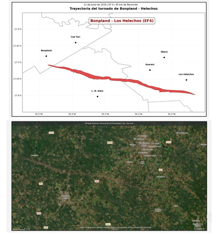
Unfortunately, no official agency has the resources or is currently conducting a serious investigation into the path of destruction and intensity of this tornado, but based on the videos and images circulating online, it is estimated to have been an F3 to F4 tornado. If the latter is confirmed, it could be the first vio-tor ≥F4 tornado recorded in Argentina since the nocturnal F4 tornado in Bonpland-Los Helechos, which struck the Argentine Panhandle on 06/12/2018.
[4/4]

 (Perhaps in another post I discussed El Niño teleconnections in South America in greater depth; they essentially act as a powerful catalyst for severe weather and tornadoes in the SESA region)...
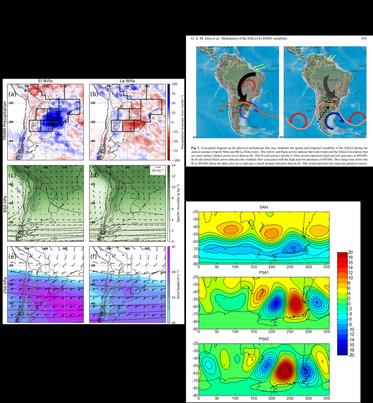
.jpg)