I found this tidbit from
here notable:
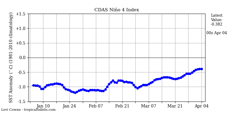
So if this is anything to go by; the second year of Niña (the spring following the year in which it develops) is the one to really watch out for (in these groupings that would be 1999, 2008 and 2011). The year in which the Niña develops can be active for severe weather, but usually not
hyperactive on the level of the second years; while the third year (in which the Niña usually decays to neutral or flips back to El Niño) usually features near-to-below average levels of activity but can still have the occasional big outbreak.
Would need a bigger sample size to draw any definitive conclusions from this, though. Would go a long ways toward explaining why just having a La Niña doesn't necessarily equate to an active tornado season, and in some cases they can be rather quiet.