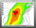
Wasn’t comparing it to that day. And I’m saying when I mean “quite sometime.” As of recently 4/27/11 is in its own tier. Not going to be that whatsoever. I’m just stating that these are soundings you’d see in textbooks. Just like your normal big risk days like 5/21/24, 3/21/21, 4/12/20 just to name a couple. These days has insane hodo’s, 4/27/11 is a day I don’t really compare in general.There isn’t a comparison. This won’t be anywhere near that day but we still may need to implore the O word.
Navigation
Install the app
How to install the app on iOS
Follow along with the video below to see how to install our site as a web app on your home screen.
Note: This feature may not be available in some browsers.
More options
-
Welcome to TalkWeather! We see you lurking around TalkWeather! Take the extra step and join us today to view attachments, see less ads and maybe even join the discussion. CLICK TO JOIN TALKWEATHER
You are using an out of date browser. It may not display this or other websites correctly.
You should upgrade or use an alternative browser.
You should upgrade or use an alternative browser.
Severe WX Severe Weather Threat 3/14-3/16
- Thread starter Bulkshear
- Start date
wx_guy
Member
- Messages
- 1,202
- Reaction score
- 4,315
- Location
- United States
- HAM Callsign
- KO4ZGH
- Special Affiliations
- SKYWARN® Volunteer
- ARRL Member
There's also a lot of people, especially in Alabama, who have real and serious pain and loss connected to that day. Experiences like that change you, and invoking their legacy often do a lot of harm and little good.That’s not really the point though.
It’s not about whether an event is of similar setup to 2011, but more so people making the comparison every single time a system comes by Dixie alley. Which does absolutely nothing but spread unnecessary fear and panic while bringing down public trust when said setup obviously doesn’t transpire.
tennessee storm chaser
Member
- Messages
- 1,614
- Reaction score
- 3,020
- Location
- jackson tennessee
- Special Affiliations
- SKYWARN® Volunteer
Impressive , if any these dew points r slightly under done , don’t want think….. A lot times more than not models won’t get good handle on this till day before or even close to an event. Like short range cam models even
you add this with the LLJ that is forecasted and a little capping. You’ve got big problems. Really hope this doesn’t come to fruition
The CAPE values are really impressive here. Upper 2,000s j/kg. Even well before the event, like @wx_guy pointed out, there's some strong instability present. It could very well give significant punch to morning storms that are leftovers from the previous night's activity.


UpperLevelLOL
Member
...maybe a stray outflow boundary kicks things off early and lowers the ceiling for the event? Dunno, trying to find potential failure modes here
Agreed. Models like these that focus on one specific aspect of an event will obviously give you something. It just won’t be entirely accurate.Impressive , if any these dew points r slightly under done , don’t want think….. A lot times more than not models won’t get good handle on this till day before or even close to a event
- Thread starter
- #849
Bulkshear
Member
Well up into the TN valley!
Another small fault could be the way the trough gets. If it has a deeper more northerly direction with it. Expect very significant weather, you have the trough not dig as much then it won’t be AS bad as forecasted. And you must know about the strange last minute capping that has happened with some of the bigger events we’ve had....maybe a stray outflow boundary kicks things off early and lowers the ceiling for the event? Dunno, trying to find potential failure modes here

Given this and the amount of moisture that is going to be getting pulled up probably at least 40knots+ you’re gonna have extreme vorticity regardless. A lot of ingredients have to come right to get the highest ceiling....maybe a stray outflow boundary kicks things off early and lowers the ceiling for the event? Dunno, trying to find potential failure modes here

me and everyone else across the Deep South at this point
I post this to lighten the mood a little
Last edited:
wx_guy
Member
- Messages
- 1,202
- Reaction score
- 4,315
- Location
- United States
- HAM Callsign
- KO4ZGH
- Special Affiliations
- SKYWARN® Volunteer
- ARRL Member
Just for people to get an idea of the caliber of event the GFS (and other models) are putting out there...
My distance algorithm I talked about a couple pages ago, I added a big that shows the Percentiles compared to all other SARS Sounding Analog events.

This is using a sounding in SE MS Saturday afternoon. Note ML LCL is better the lower it is (the lower the LCL, the less a tornado has to go to "reach" the ground.)
My distance algorithm I talked about a couple pages ago, I added a big that shows the Percentiles compared to all other SARS Sounding Analog events.

This is using a sounding in SE MS Saturday afternoon. Note ML LCL is better the lower it is (the lower the LCL, the less a tornado has to go to "reach" the ground.)
Cyclonic Paracosm
Member
CheeselandSkies
Member
I have to say, I don't know if I've ever before seen a setup quite like what is portrayed on the models for Friday-Saturday, where the negatively tilted trough essentially "reloads" the next day. Usually these setups are one-and-done east of the MS River, where you have one big (or potentially big, if not for the moisture caveats) day which would be Friday, and the following day the dynamics lift off to the northeast, far displaced from any remaining warm sector, and you are left with veered flow along a trailing front with a marginal to slight risk of severe weather at most.
For a little while, it looked like this is what might happen with this system, and with Friday's moisture issues there was some thought that this system might not amount to as much as initially feared/hyped. Certainly no longer the case at this juncture.

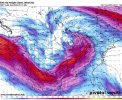
Just your casual dual midlatitude cyclones, each with a pressure normally associated with a solid Category 1 hurricane:

For a little while, it looked like this is what might happen with this system, and with Friday's moisture issues there was some thought that this system might not amount to as much as initially feared/hyped. Certainly no longer the case at this juncture.

Just your casual dual midlatitude cyclones, each with a pressure normally associated with a solid Category 1 hurricane:

NorthGaWeather
Member
So does Palm Sunday ‘94.Whenever I keep looking at soundings in Alabama on the supercell sounding analogue systems; December 16, 2000 keeps popping up.
James spann remembers that event well.
Equus
Member
Even if convective feedback is causing the secondary surface low to be a bit more intense on models than it perhaps is likely to be, the development of one altogether is kind of the piece of the puzzle where my attention is fully piqued; we already have a pretty high ceiling here, I'd like to stop building additional floors above it
warneagle
Member
And 15 November 1989. We're playing all the hits.So does Palm Sunday ‘94.
wx_guy
Member
- Messages
- 1,202
- Reaction score
- 4,315
- Location
- United States
- HAM Callsign
- KO4ZGH
- Special Affiliations
- SKYWARN® Volunteer
- ARRL Member
And please note -- > This is percentiles compared to the SARS database -- 21% of which is EF2+ tornadoes. So we are talking about an upper echelon event here.Just for people to get an idea of the caliber of event the GFS (and other models) are putting out there...
My distance algorithm I talked about a couple pages ago, I added a big that shows the Percentiles compared to all other SARS Sounding Analog events.
View attachment 35080
This is using a sounding in SE MS Saturday afternoon. Note ML LCL is better the lower it is (the lower the LCL, the less a tornado has to go to "reach" the ground.)
Cyclonic Paracosm
Member
yes, can we not add layersEven if convective feedback is causing the secondary surface low to be a bit more intense on models than it perhaps is likely to be, the development of one altogether is kind of the piece of the puzzle where my attention is fully piqued; we already have a pretty high ceiling here, I'd like to stop building additional floors above it


