
warneagle
Member
I definitely wouldn't sleep on S MN/N IA either. Some serious shear values between the Twin Cities and Des Moines.
Follow along with the video below to see how to install our site as a web app on your home screen.

Note: this_feature_currently_requires_accessing_site_using_safari

That might actually serve to mix out dew points.....Significant clearing (perhaps more than expected) showing up on visible satellite over W and C IA, SW MN, NE KS and NW MO.
Tornado on the ground headed for Oak Grove, MO.
Honestly I think this setup has everything going for it except for somewhat sub-ideal moisture trajectories due to that pesky ridge centered just off the Atlantic coast, and wind profiles a little more parallel to the cold front that I would like to see across the northern end of the threat. Still, I think the potential is there for widespread wind and hail from Iowa to Oklahoma, with 1 or 2 potentially dangerous tornadic supercells primarily over E KS or W MO. This event could approach, but probably not match or exceed, last Tuesday in magnitude. Following severe weather over the last few years, I've become a big fan of lapse rates/cold air aloft.
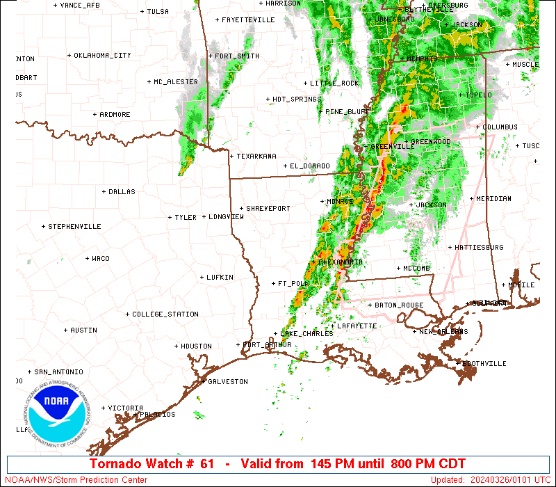
Northern AR/SW MO is about to get ugly I regret to say
Absolutely excellent forecast there. Gonna have to see how things evolve over SW MO/NW AR but you have nailed it.